The Trailhead

Jason and I decided to hit the Winds again after our adventurous hike last year through the Thorofare. That hike and planning had solidified the concept of our lightweight hiking transformation. We finally let go of the “old ways” and embraced many of the new concepts of lightweight hiking. The old heavy leather boots were gone, replaced by trail runners or “hiking shoes”. Trekking poles were being utilized, and their potential were soon realized. Every part of our kit, especially the big three, were scrutinized to the very last half ounce. Items were replaced, some items were discarded, and ultimately, the transformation was complete.

We had aspirations of hiking the full length of the Winds, South Pass to Union Pass, staying as close to the divide as possible. This would be a trip that was to have many obstacles that we could not foresee many months prior and just days before our departure. We would formulate our own “high route” complete with a glacier traverse and as a last second thought, a possible second Gannett Peak attempt. We poured over the beta we had on our proposed route. We would carry all the necessary mountaineering equipment we though we might need to ascend and descend some of the passes we planned and ultimately Gannett Peak (assuming the snow bridge would be gone), if everything aligned. This was a tall task to get our weight to where we could travel the proposed 140 mile route, and safely accomplish it.

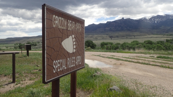
We all know what happened in March of 2020. The ‘Rona made its appearance and as of this writing, is in it’s third wave requiring a current lockdown of some services. We had our sights set on mid August, figuring the weather would be the best at this time for some continuous high country traveling. This year would also prove to be a very dry year, the driest I think I have seen the Winds. The snow patches in the high country were all but gone, the glaciers traversed were mainly solid ice and on the lower sections, braided rivulets were everywhere. Exactly one week prior to our start date, I was walking my dog, had her in a sit position on a leash as other dogs and bicycles passed. Well, the bicycle noise caused Nugget (my Boxer mix) to lunge and I heard a “pop” in my shoulder as the leash tightened. I was in denial as to what happened and assumed it would be better the next day. For three days I could not move my arm. I had about 4 days until we embarked at South Pass. Luckily, the last four days I made a miraculous recovery (at least I could use it and thought I could use trekking poles and some boulder scrambling would be ok) and felt much better about my ability to pull this off. Gannett was still a question mark at this time, as I was not sure I could self arrest with my shoulder the way it was. The day before we were to depart to Wyoming, we got information that we might have to cut our trip a day or two short. My uncle in Riverton had three lambs that needed butchering while we were up there. Seems that every butcher in that area was booked and unable to do it until fall. These were lambs that should have been processed this past spring and were large and unmanageable for my uncle. We agreed to cut it short. We scrambled (again, the day before!) looking at our days, mileage, and formulated a plan. We would have a couple really big days in there but thought we could still pull it off.

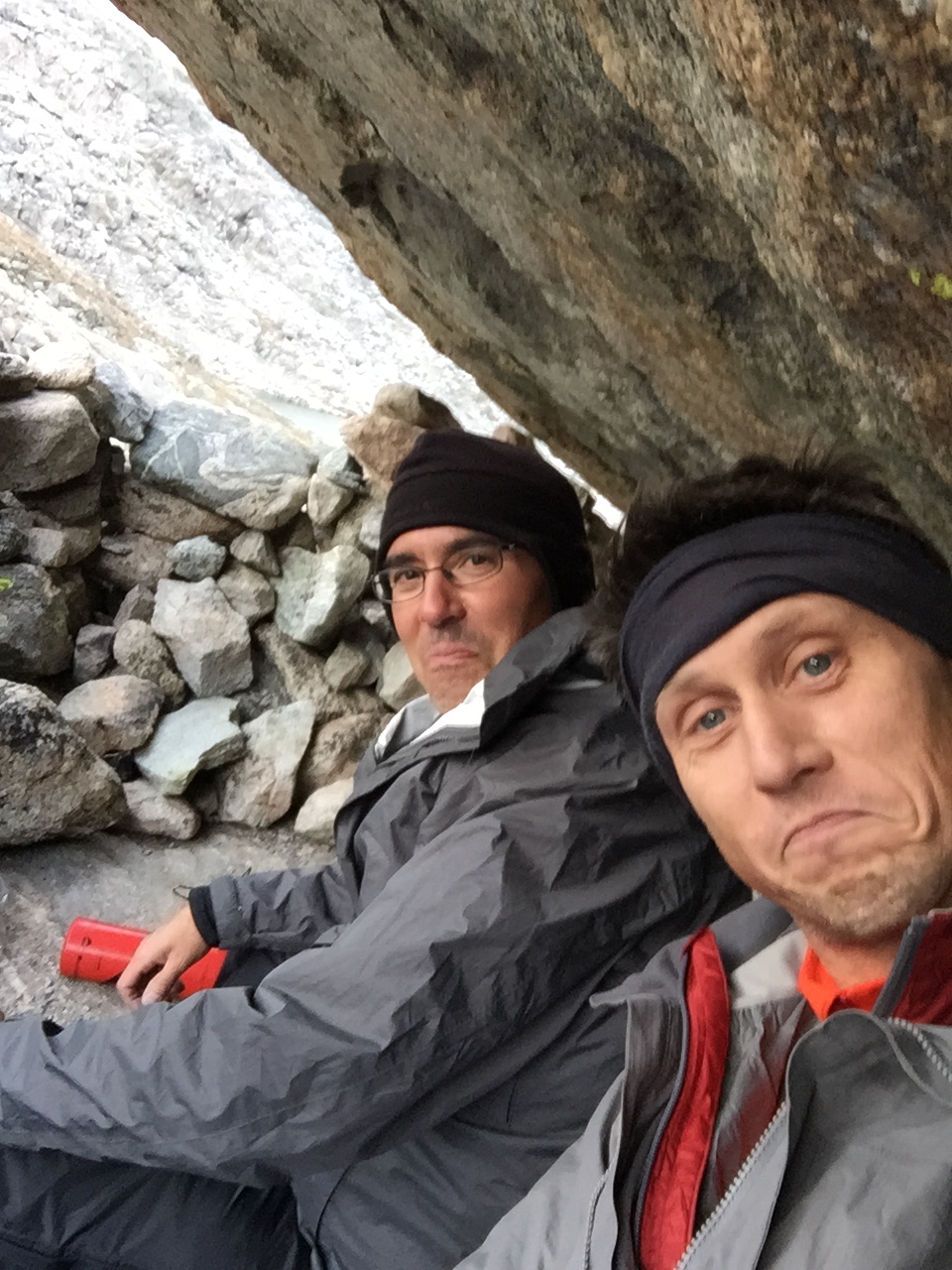
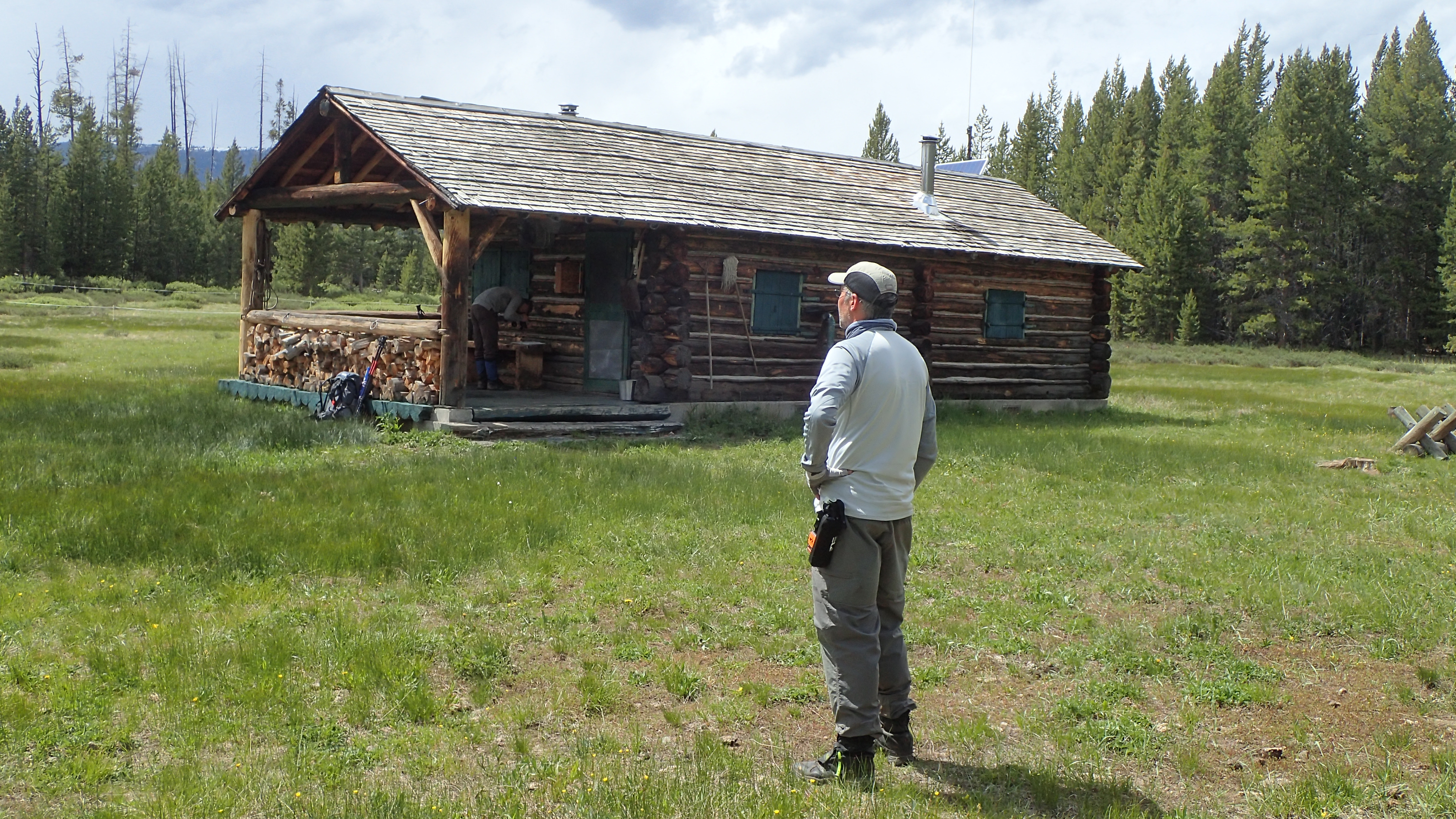
This trip started out with the usual pick up from DIA, drove to Riverton (with a quick dinner at Taco Johns in Laramie…..this is a ritual now) where we would stay the night and get our ride to South Pass in the morning. We had both purchased the InReach Mini this past year (this would have been a much better tool last year than our SPOT device on our Thorofare adventure) and really liked the functionality of two way texts in the backcountry. We drove to South Pass and headed up to Louis Lake Guard Station. We were using CalTopo and it showed the trailhead just behind the guard station. We drove around some and finally parked there, still not finding a trailhead. We decided we were close enough and would find the trail soon enough if we just hiked west. This is what we did, we said goodbye to my uncle (not sure, but seems he had that uncertainty about the whole thing like he did last year at the Ishawooa Creek Trailhead) and proceeded to hike up the slope into the trees and disappear. There was some downfall, steep sections, but in about 15 minutes we came to a trail that was going are way. We assumed this was the trail and officially started our journey to Christina Lake.

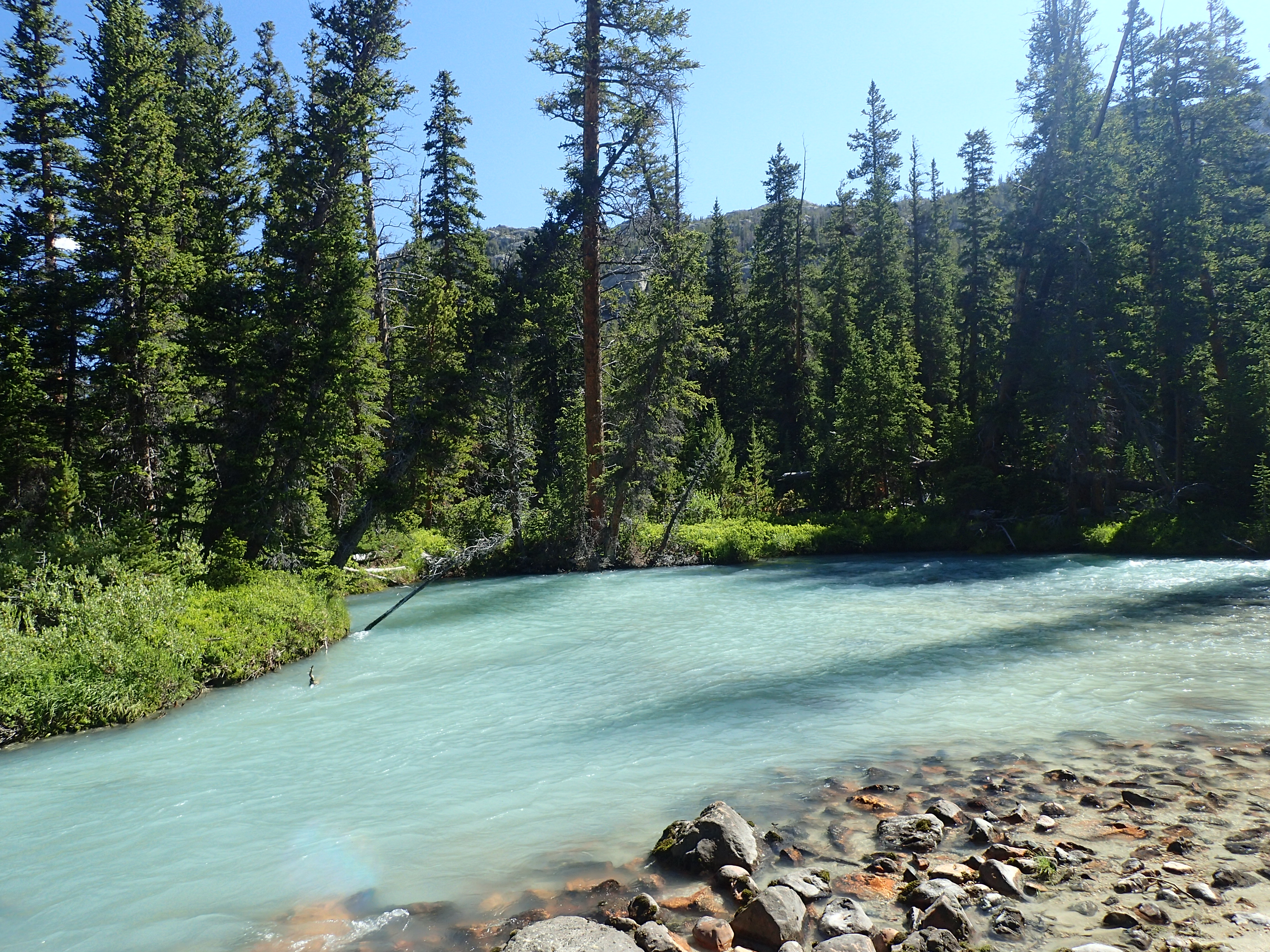
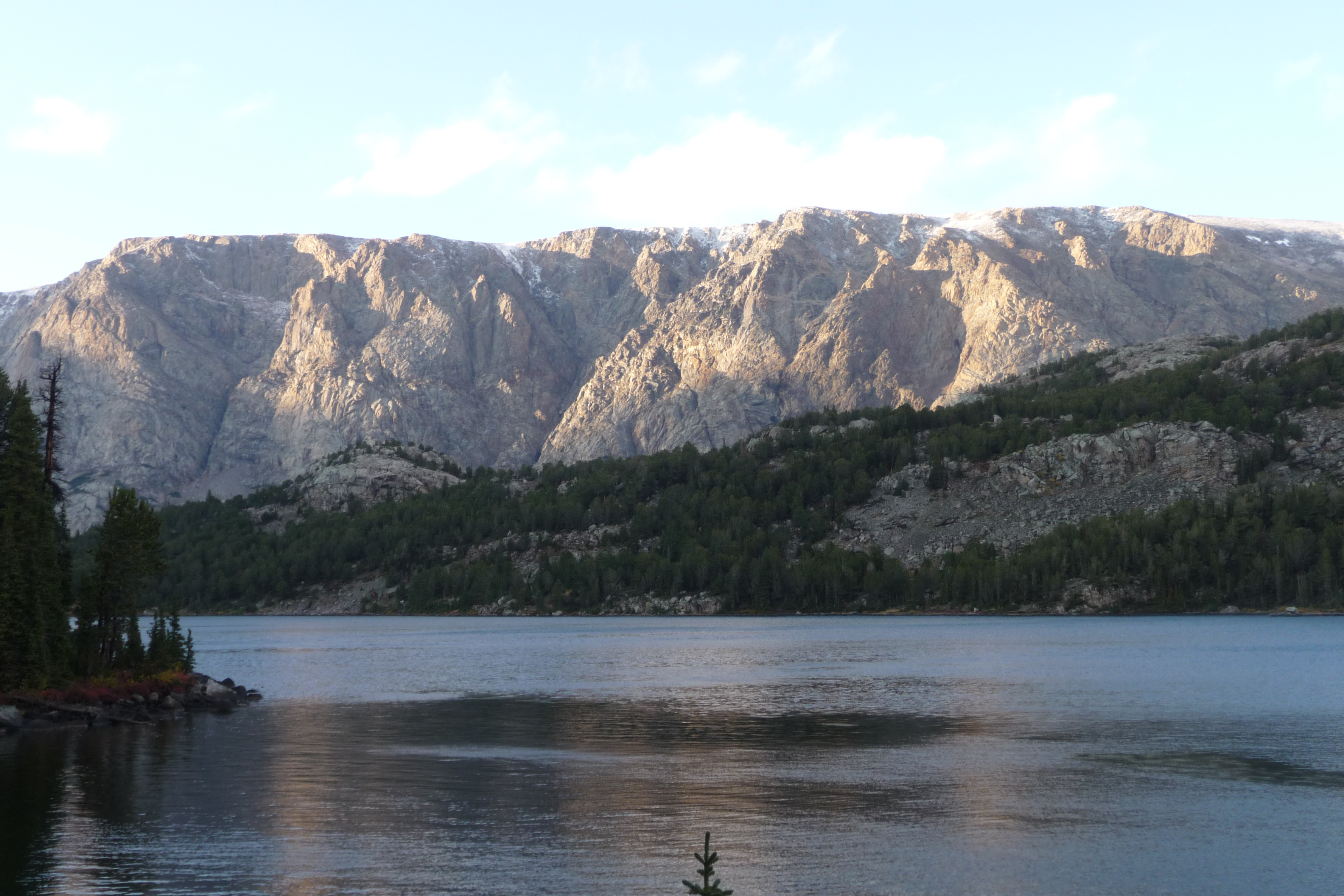
This hike was extremely pretty, lots of low mountain scenery with some really cool rock formations. It wasn’t long before we hit the 4-wd road that comes in from down below Lake Louise. We would follow this up to Christina Lake. We did not see or hear anybody on this road all the way to beautiful Christina Lake. This lake is a very large lake, that has an old dam with a headgate of some sort on it. The backdrop is spectacular with some high mountains at the west end of the lake. It looks to be heavily used by 4-wd vehicles, but we would only pass one campsite on the north side of the lake on our way shortly into the Popo-Agie Wilderness heading to Atlantic Creek.

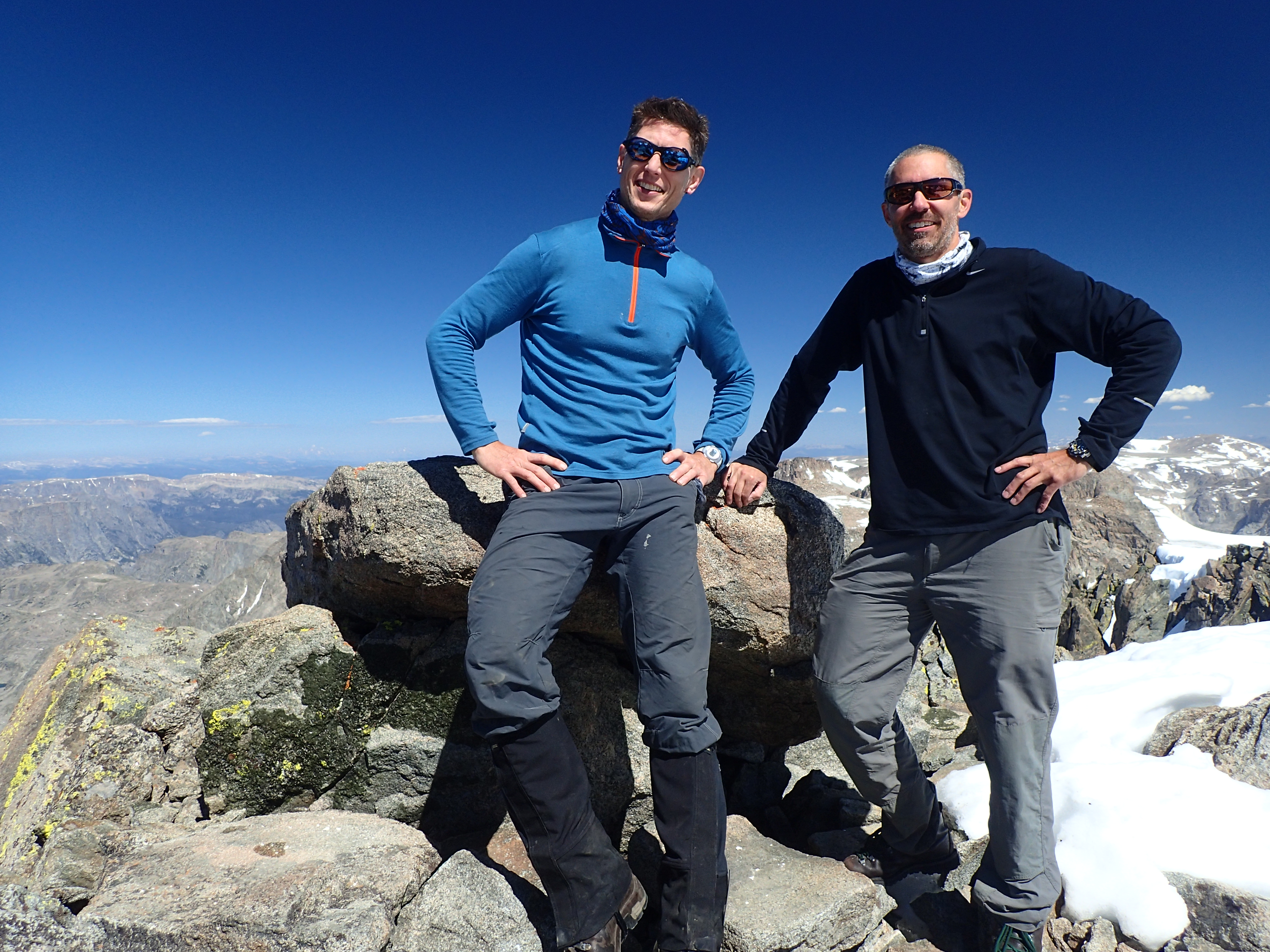
This first day was to be the longest day we had, after drafting a new schedule a couple of days before. It was already designed to be a big day, we just made it epic. Jason and I were in very good shape (I would almost say exceptional shape for hiking, minus my bad arm). We had worked hard all summer getting into and maintaining decent shape. I was running 4 to 6 miles three to four times a week with weighted packs (16-20 pounds) with some core exercises thrown in, and Jason was going on crazy pre-dawn monster elevation gain hikes before work in the Seattle area (unfortunately not at higher altitudes though). We hiked north, entered the Popo-Agie Wilderness a short distance from Christina Lake and proceeded towards Atlantic Lake. It was not long before we were on the shores of Atlantic Lake, looking to the northwest at the ridge we were to climb. We were headed off-trail to 12,000 feet and eventually drop into Stough Creek Lake Basin.

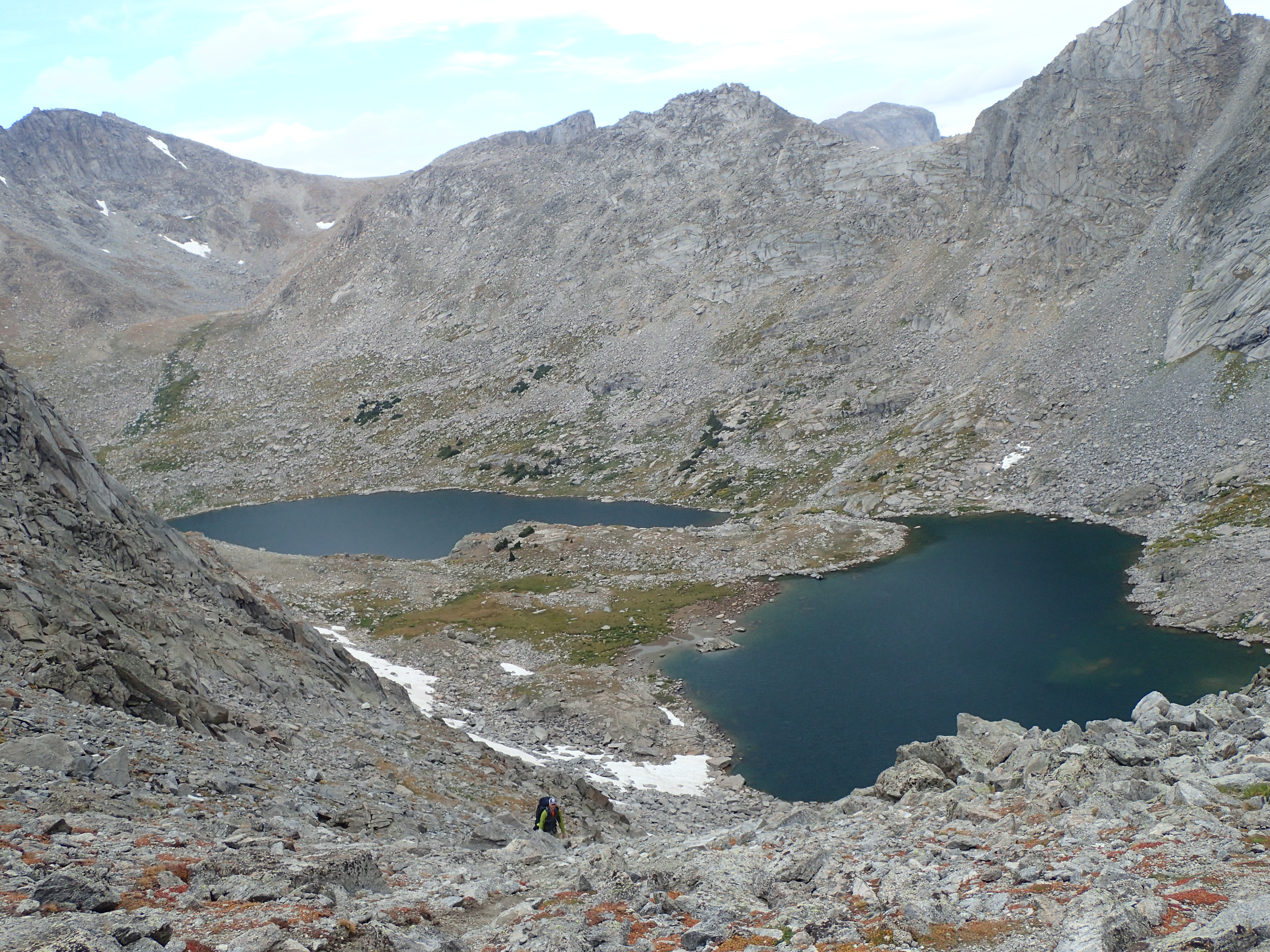
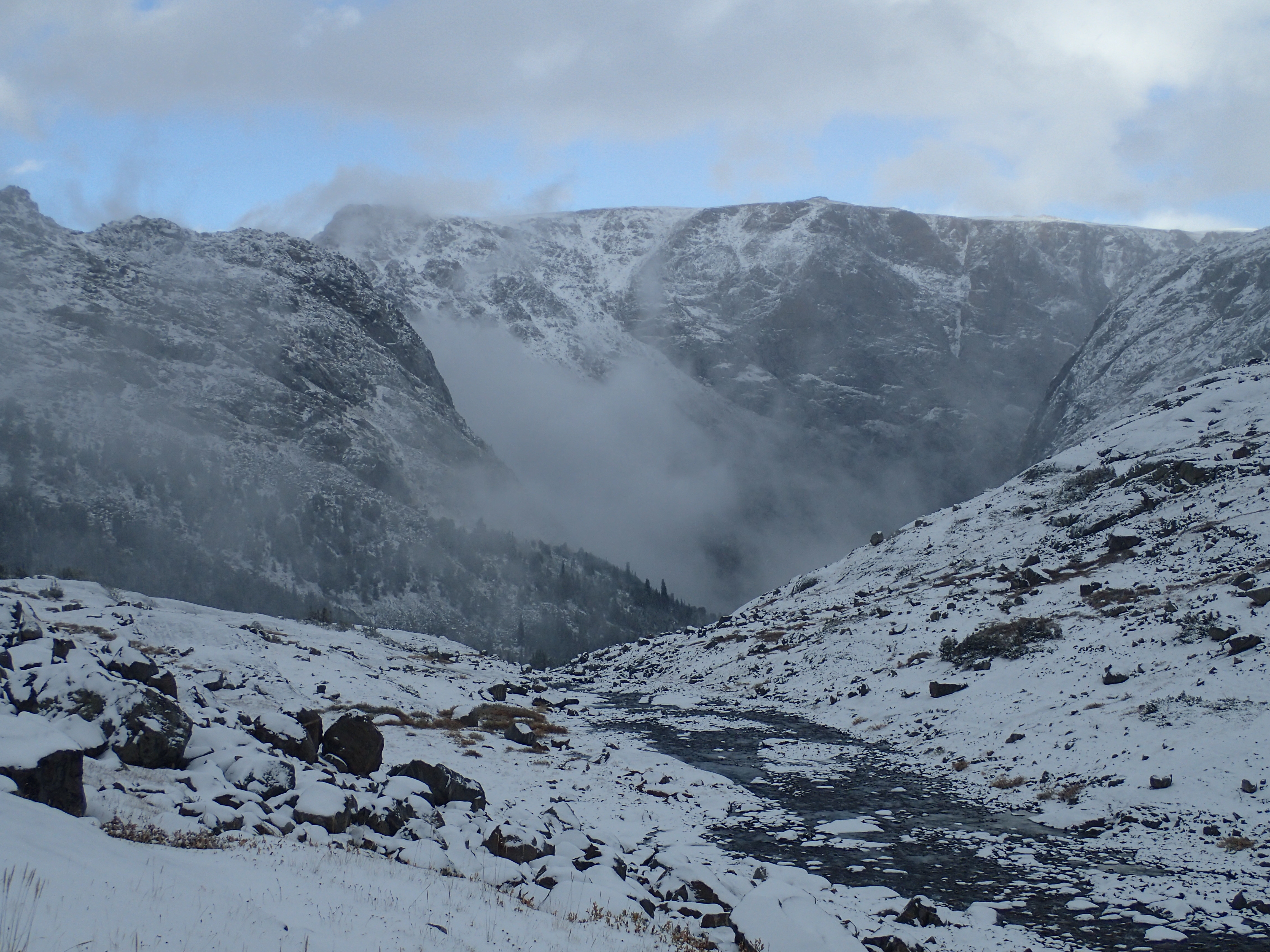
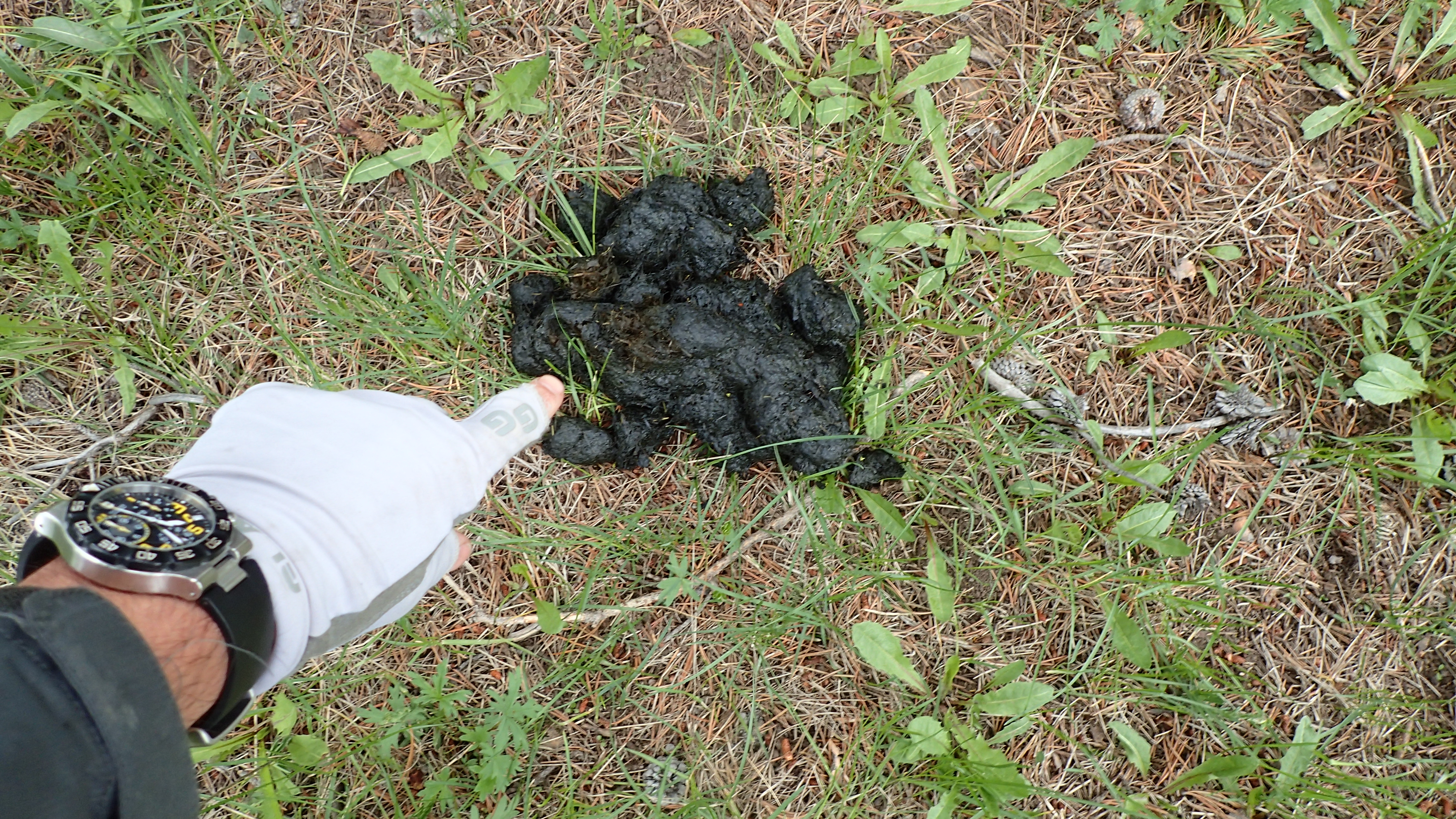
I found a net at Atlantic Lake. It was a Brodin ghost net. After much thought, I decided to add this extra pound to my already too heavy pack weight (38-39 lbs at this point. My desired weight going in was 34 lbs. Some last minute mountaineering gear threw me over the top) and hike over 100 miles with it. From Atlantic Lake, we crossed the outlet, and proceeded northwest up a slope. The views up the Atlantic Lake drainage were some spectacular high Winds scenery. The ramps we found leading up were fine, and eventually made the summit ridge of the plain on top. We were now just under 12,000 feet and looking down into the Thumb Lake drainage. This was a very rugged drainage looking down onto Thumb Lake. We followed the ridge northwest up to 12,000 feet (the topo sure makes it look easier than it really is on the ground!). We were headed to the saddle that is used a bit from Leg Lake to the Stough Creek Lake Basin as the descent into the lake drainage was rimmed with cliffs where we were traversing. The altitude had taken it’s toll on us the first day. We had already made plans of stopping in Stough Creek Lakes area this first day as we our original plan was to go back up to Roaring Fork Mountain (west of the basin) and hit the Sweetwater Gap trail. This was not happening today. After cliffing out ounce just above the saddle between Leg Lake and Stough Creek Lakes, we finally made the saddle where we finally found our first water source since Atlantic Lake. We drank as much water as we dared (Jason did throw up his water here, think the altitude really knocked him down this first day) and made the fairly steep descent to one of the many Stough Creek Lakes.

Roaring Fork Mountain and Stough Creek Lake Basin

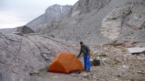
We set up camp on one of the lakes in the basin and had to set up the tarp as an evening storm pushed through. We ate, drank, and ciphered. We were behind. We had been in this area before and new it fairly well. We finally opted for trail miles to try and get us back on track. We figured we could drop a little lower here, cruise on the trail system and make some time. We planned to go around the western Roaring Fork Mountain via trail and on up to Tayo Lake, Wind River Peak, and decide on our options from there. We slept, if you can call it that, my arm would ache this whole trip, and unfortunately, a little anxiety was setting in. We had to make Union Pass!

We awoke to a gorgeous morning (I would say any morning in the Winds is gorgeous though) and proceeded to pack up and hit the trail. We were setting our alarm at 5:15am every morning and getting out of camp about 6:45am. This would be our routine the entire trip. As we hiked by some of the many lakes in the basin, we started seeing our first hikers (people for that matter) this entire trip. We flew down the trail and eventually made the intersection with the Sweetwater Gap trail. Unfortunately we had lost a lot of elevation and now were looking to start back up. We met a couple hikers coming down from the Ice Lakes in Tayo Park and talked briefly. We then proceeded up to beautiful Tayo Lake at the base of Wind River Peak where we had lunch and took a quick siesta. It should be noted too, since we started this trip the day before, all the smoke from the California fires at the time was very prevalent and hindered our high mountain views greatly.

We ascended the slopes from Tayo Lake aiming for the saddle between Wind River Peak and Chimney Rock at around 12,600ft. This was a very pretty hike up, and the small drainage we ascended east of Tayo Lake was very lush and pretty, even in this very dry year. We made the saddle and could see three people making their way up to Wind River Peak. We assumed they were heading over the top into the gully that would take them down to the Black Joe Creek drainage (we assumed this was the Skurka route for the WRHR). We stopped with anticipation of dropping our packs and bagging Wind River Peak. It was already getting late, so we discussed and decided we needed to get off this mountain preferably before dark, so we chose to descend to Deep Creek Lakes for the night. Our original route in this area had two options. Basically we were to find a way from Wind River Peak or even Deep Creek Lakes, and take a bench over to the North Fork Trail and on up to the Cirque of the Towers. We did not have any first hand intel on this and not sure of how we would proceed once we got there. We would leave it up to our observations and map work.

We busted down the long but gentle ledge towards the Deep Creek Lakes. We would pass the Ice Lakes drainage, far below and encircled with cliffs, and eventually reach one of the upper Deep Creek Lakes mid evening. We had a pretty precipitous drop onto the shores of the lake but found a decent camp spot there to set up the tarp. We proceeded to have dinner and again, ciphered on our plan of action the next day as we got about a half a day behind today.

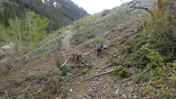
We awoke the next morning and proceeded to literally climb out of camp back up to the bench we had traversed the previous evening. We had decided that to make up time again, we would drop down to the trail that comes up from the North Fork Trail to the lower Deep Lakes and do some trail miles up to the Cirque. This unfortunately would require another significant loss in elevation and ultimately gain in elevation, but we felt it would be faster. We met a couple at the trail intersection just packing up their camp. Seems they had come in the Sweetwater Gap trail and were headed over Wind River Peak that day. They were doing the Skurka WRHR, which Jason and I knew a little of the logistics of that route, but not much. We eventually made our way to Lonesome lake and it was here that we met the most people on the entire trip. We had been to Lonesome lake many times before, coming in from Jackass Pass, Texas Pass, Sanford Park, you name it over the years. We had never witnessed it this crowded before, but we were not staying long. We took a break here, replenished our water supplies and again, decided to deviate from our original route. We decided to take the easy Texas Pass over the slightly less easy New York Pass. We still had the “original” Illinois pass to go over to get to Macon Lake that night. We easily cruised up to the top of Texas Pass (and still encountered a lot of people) and headed down to Texas Lake. We had been over and on the “new” Illinois Pass a couple of times before and opted for the unknown “original” pass that goes to the base of Washakie Peak. The south side of the pass was very straightforward and the view on top was amazing, looking back towards the back side of the Cirque and towards Mount Washakie. It was getting to be early evening on top and we knew we had the worst to come. The description is of loose boulders on an old terminal moraine all the way to Washakie Creek at Pass Lake. It did not disappoint. In the slowly fading light, we made our way down this very loose pile of rubble. The remnants of the Washakie Glacier were visible all the way down. Cliffing out a couple of times just coming off the top of the pass made for some mid hike re-routing. It took us a while to navigate and skirting the east side of Pass Lake, we finally made Washakie Creek and it was up now to Macon Lake. We bushwhacked through the dense willows and foliage and the odd boulder field up the relatively steep slope to Macon Lake, our destination for the night. We popped out on the bench and found the Washakie pass trail and followed it east for a while until we were at the midway point of Macon Lake. It was getting dark by now and we found a place to camp. Jason went to get water, I set up the stove for cooking. We would cowboy camp this night. We had visitors come in and set up their campsite about 30 yards away. We were annoyed they set up so close, but at least they were polite and asked if it was ok ( I guess we were too polite to tell them to get out of here, there are tons of camp spots to choose from on this bench). We probably annoyed them the next morning when we awoke at 5am though, so we got a little revenge.

Washakie Glacier from “old” Illinois Pass

After a nice sleep out under the stars we were up at 5:15am and out at just before 7am like clockwork. We where headed up a little off-trail pass over to Grave Lake today, then up to Baptiste Lake and then our biggest unknown of the whole trip, could we get over Mount Lander to Moraine Lake? We knew the Moraine Lake side was doable, as we have seen that side on previous pack trips on the reservation. This little pass area was very pretty and dropping into Grave Lake drainage, there were some nice big evergreen trees and some relatively easy hiking. Towards the bottom it did become quit steep and more difficult in sections. We soon found the trail from Hailey Pass to Grave Lake and followed it up to the Baptiste Lake trail.

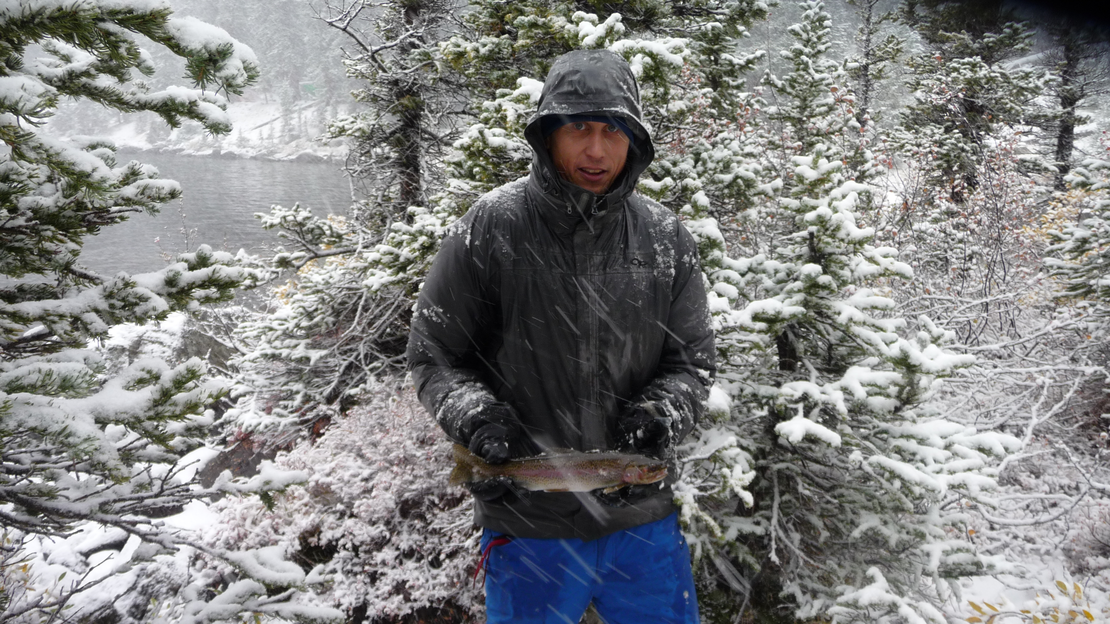
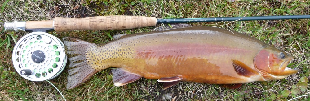
Baptiste Lake is set in a wide open basin with Mt. Lander at the head of it. To our surprise, there were quit a few people fishing when we got up there (Baptiste has always had a good reputation for some nice cutts). We had both complained we were in some sort of funk. It was actually good to hear that Jason was feeling like me. We were drained this day. We stared at the daunting task and unknown of getting over Mt Lander and it did look daunting to say the least. We again discussed our forward progress, and feeling the way we did ( was actually good we were both in a funk this day, makes the decision much easier for the both of us) we decided to go back over Hailey Pass and then up to Pyramid Lake area for the night. This decision was a little disappointing but, Pyramid Lake area is one corner of the Winds neither of us had been. This made our bailout decision a little easier. I also got about an hour of fishing time at Baptiste while we relaxed.

We cruised back down the trail and headed up over Hailey Pass. Going up and over was straight forward (we had been over this pass a few years prior) and before long we were down at Mays Lake. Coming down we saw a group of three or four people with climbing gear and carrying 5 gallon home depot buckets filled with gear. The lead was carrying his in both hands while shouldering what looked like a way too heavy of a pack. None of them looked happy. A short time after this, we hit Mays Lake and cruised on up to Pyramid Lake where we decided we would stay the night as we were still both in that funk. We set up the tarp again as we encountered some evening rain and wind. Tomorrow we had decided that we needed to be at the base of Europe Pass on the reservation. This would involve the short rise into the beautiful East Fork Lakes drainage, then over a pass dropping into the lower Bonneville Lakes Basin, only to ascend once again to another pass above the upper Bonneville Lakes then down to Middle Fork Lake, then again to climb the steep slope up to Bewmark Lake and follow the drainage up to Photo Pass only to descend into the South Fork Bull Lake Creek drainage and eventually pull up to the west under Europe Pass.

We awoke the next morning feeling much better and got our usual early start. The little notch from Pyramid Lake to the East Fork Lakes proved to be very easy, and although technically trailess, a very well beaten path did exist before fading in and out in the upper valley of the East Fork Lakes valley. The sun was just hitting the peaks to the west (Raid Peak, Mt Bonneville, Mt Geike) and made for some great scenery. This valley is exceptionally beautiful and is a great representation of most of the high country in the Winds. From Pyramid Lake to the Bonneville Lakes was the only country that Jason and I had not traveled, minus Christina Lake to Stough Creek Lakes Basin down south.

We made quick time up this valley and to the little pass to the west (some light boulder hopping, but very straightforward) overlooking the South Fork Boulder Creek drainage. We decided to head down west and then skirt the cliff bands to the north to hit the lower Baptiste Lake. We rested briefly, and headed up the drainage towards the upper Baptiste Lake and Sheila Lake. The upper Baptiste Lake and Sheila Lake are in a very pretty cirque. We encountered a couple camping at the outlet of Baptiste Lake and soon busted up to the Pass, looking down into the Middle Fork drainage. We were stoked upon this site. We knew this country well. We felt we could stay on track and make up some time now. We could see clear across to Photo Pass at this point and past there, hopefully part way up to Europe Pass, we would camp this evening.

With our upbeat mood, we pushed on and soon hit the massive Middle Fork Lake and started cruising towards Bewmark Lake. We had done a loop a few years earlier from Bewmark Lake, over to Lake Heebeecheeche, then back south over to Moraine Lake, up and over St. Michel Col passing Noel Lake and eventually out via Scab Creek. We followed Middle Fork Lakes east shore until we got to the outlet stream from Bewmark Lake and headed up. It’s a short but steep hike form here but before long we hit the top and pulled out onto the bench at the same overhanging boulder we had camped at a few years prior. We startled a solo hiker from New York here just setting up his camp. We chatted a bit (mainly Jason and him as they discussed camera gear) and moved on to our next destination, Photo Pass. The hiking was easy and the pass was made in short order. The north side of the pass was very well constructed and easy to follow. It was getting a little later in the evening, we had been hiking for a long time with some significant elevation gain and loss, we were getting a little tired. We decided to hit the trees, hike a bit where we would need to head west towards Europe Pass and call it a day. We found a great campsite in the trees, filtered some water, set up the tarp, cooked dinner and called it a night.

Jason with Photo Pass in the far distance

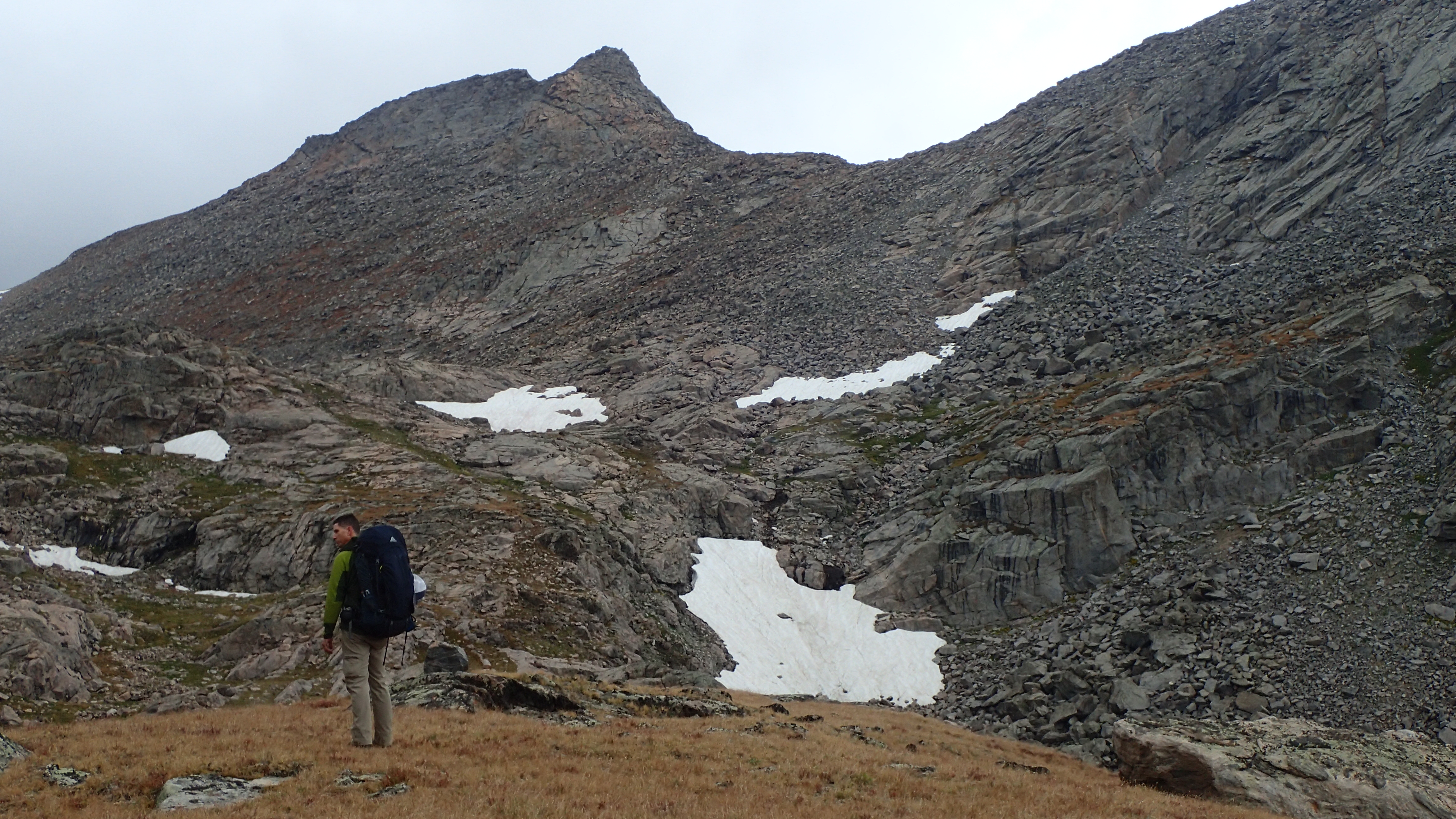
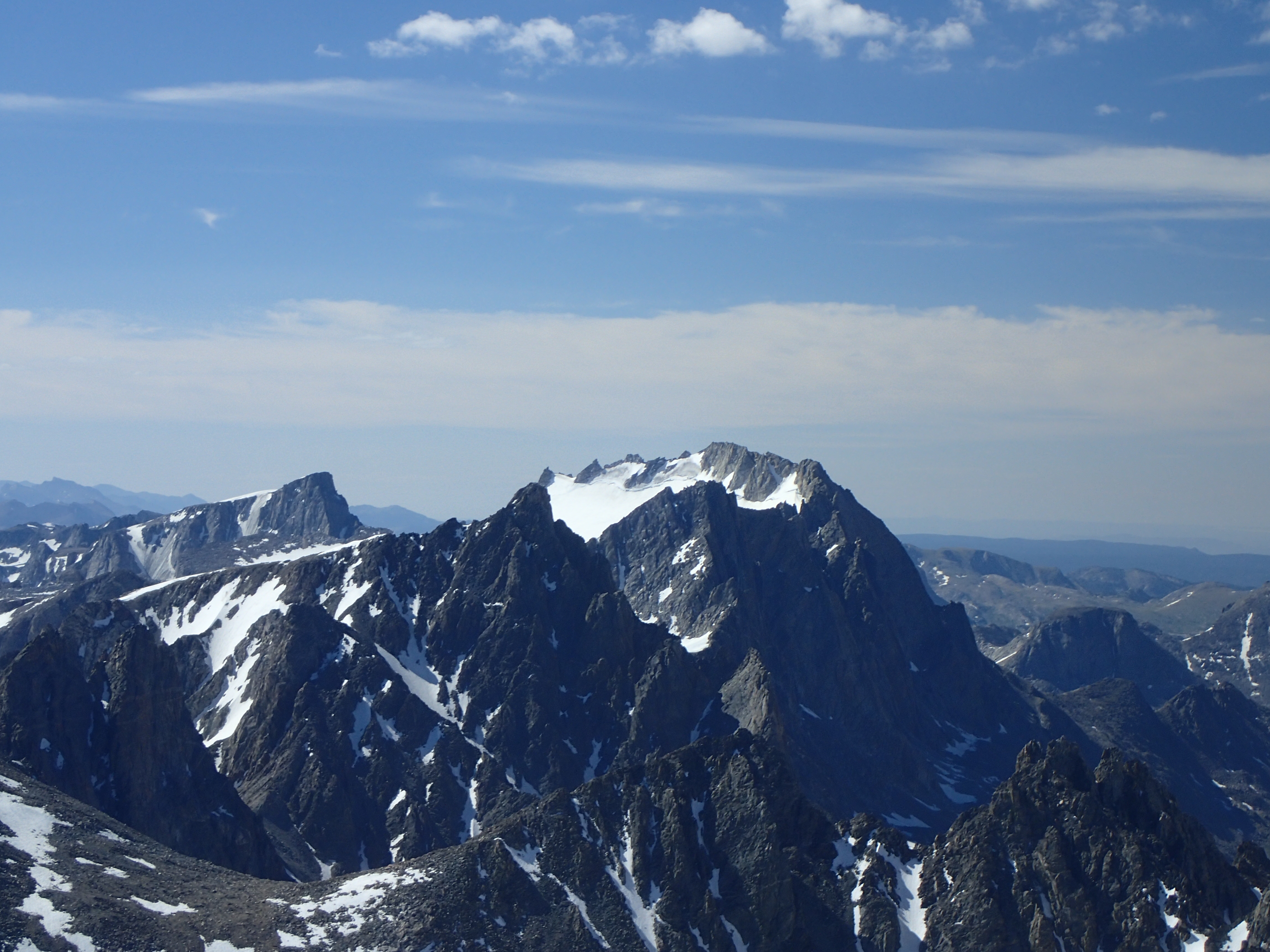
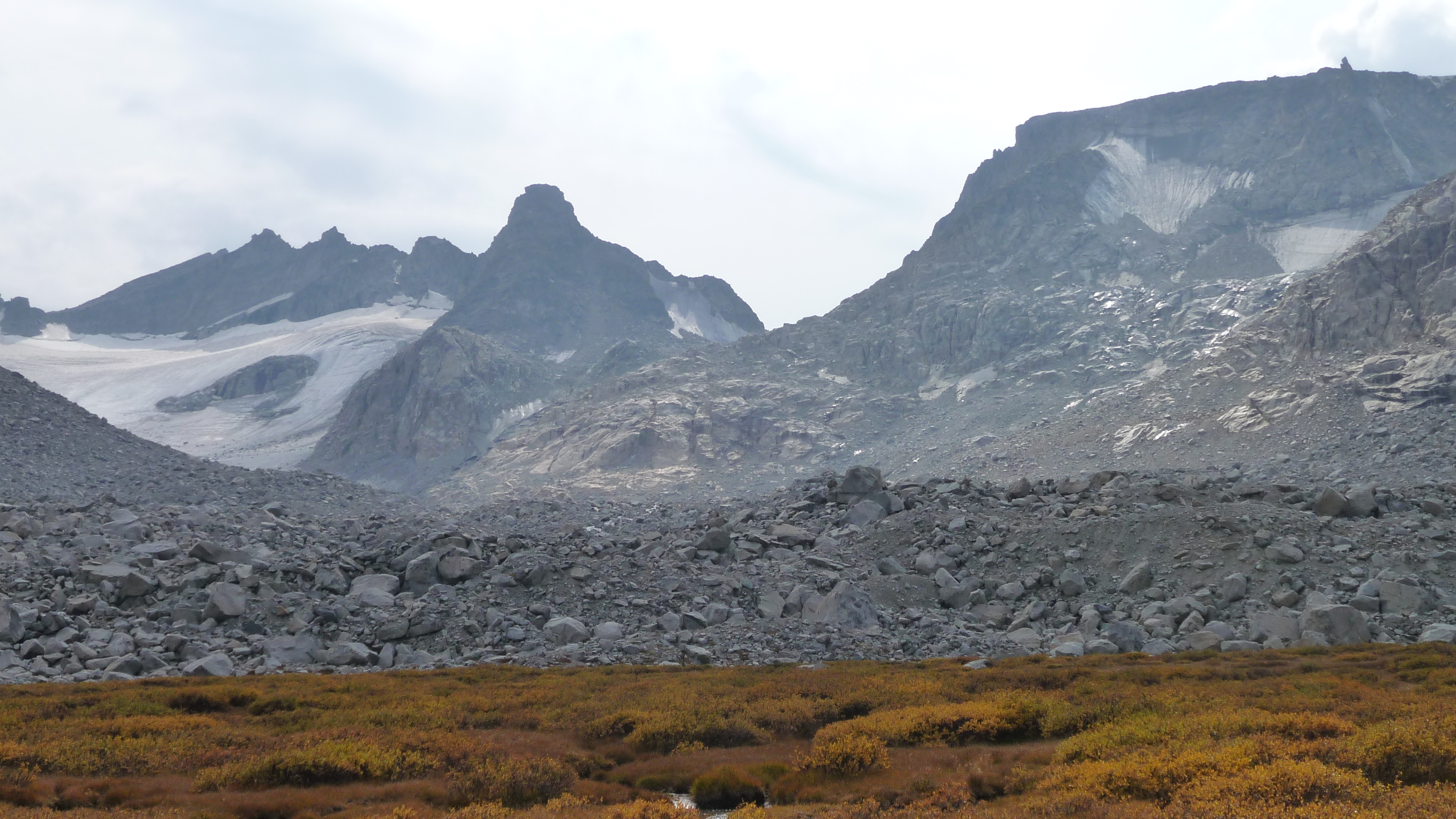
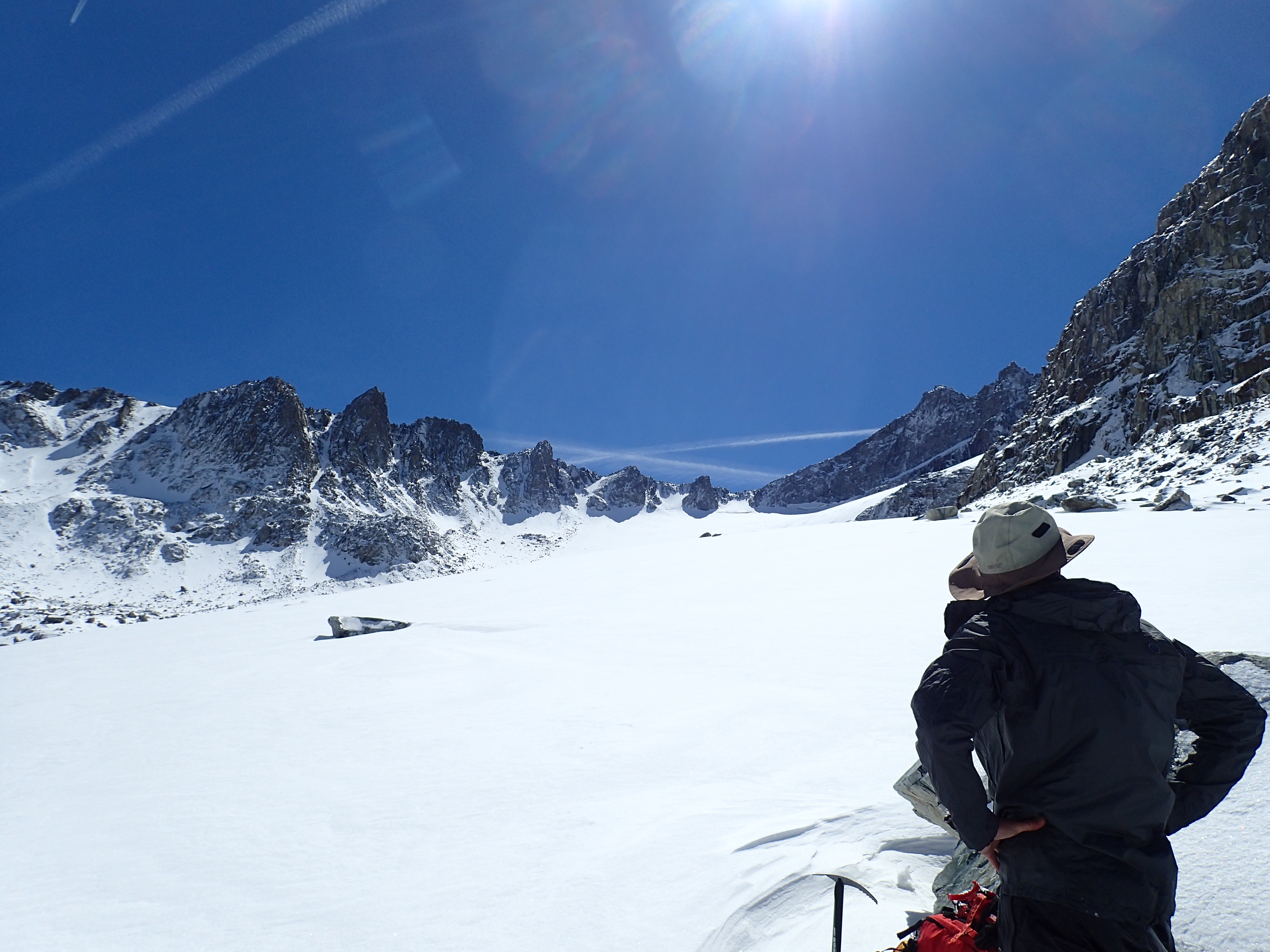
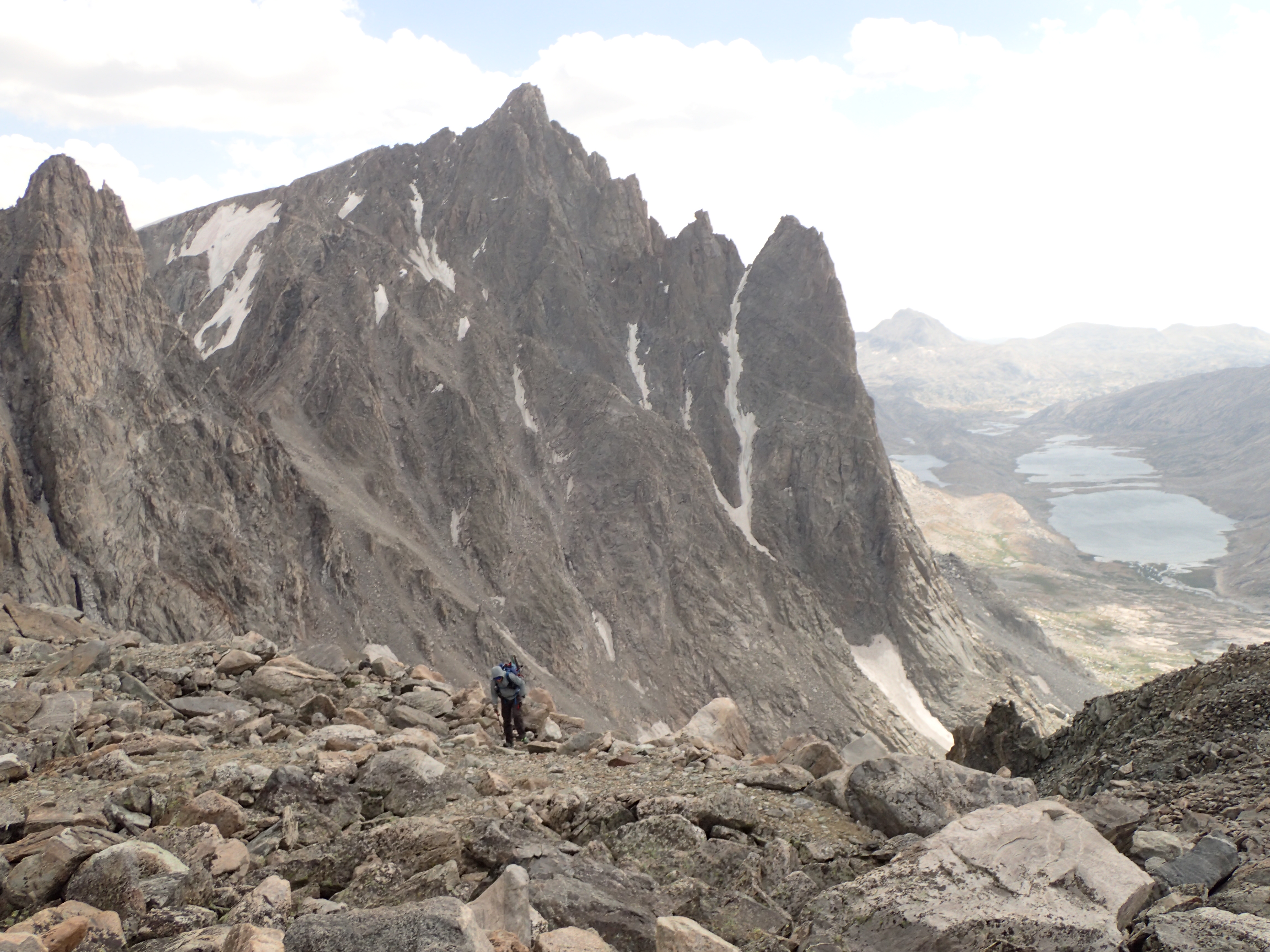
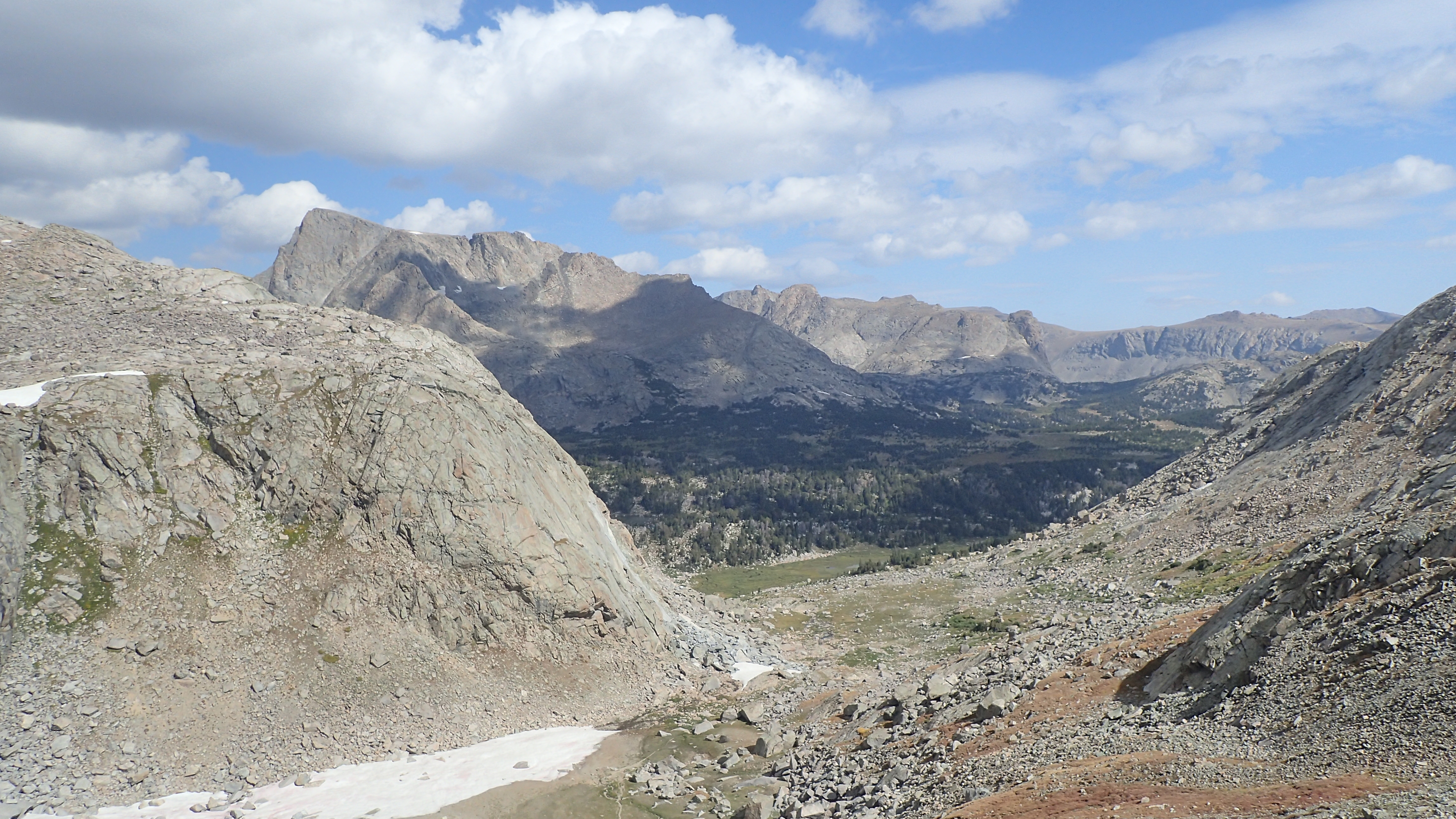
The morning started out bright and beautiful. We had more ambitious plans today to keep us on track and hopefully make up some time. We had been out of this drainage up to Europe Pass a few years ago and was pretty straight forward. We had come in from Deadman Lake to the south that time. Well, coming from the north proved a little bit more interesting in the route finding. We stayed a little too far north, and skirted lake 10,563 thinking it was the lake we had stayed at few years ago. Something did not add up and we soon ciphered we where on the wrong side of the ridge. We found a nice notch from this drainage up and over to our lake at around 11,200ft and realized what we had done. From here it was an easy hike up to the Europe Pass plain proper. We hit the plain on top and both of us anticipated a nice ascent ramp up to the even higher plain that we would take down into the Golden Lakes drainage. Again, something did not add up in our minds. We sat staring at a mountain in our way. Did we have to go over this? As with a lot of our passes we had taken already, it looked impassable. What little we knew of the so called “Skurka Route”, we knew that you had to go up Europe Peak. So, we decided to head up and see what we could do (here is one instance where the topo map makes this look a little easier than it is on the ground). As we approached, the intimidation factor abated a bit as we saw the knife ridge, basically the Continental Divide, that looked like the only pleasant way to tackle this block of grass and rubble. Once we hit this ridge, it was straightforward and smooth sailing to the upper plain at over 12,000ft. The last 50 yards or so had some very easy class 4 scrambling and a section of about 20 yards of exposure on each side, but then you were on an immense plain with the norther Winds in full view.

Climbing up the ridge was actually pretty straightforward once we started up. We used a bit more energy already (going into the wrong drainage towards Europe Pass, and now basically climbing Europe Peak) than we had planned, but we were feeling very good and still on track. We started hiking north. The hiking was very easy at this time as we headed towards the distant Golden Lakes drainage. We would stop on top and take a quick snack break and nap before moving on.

Europe Peak

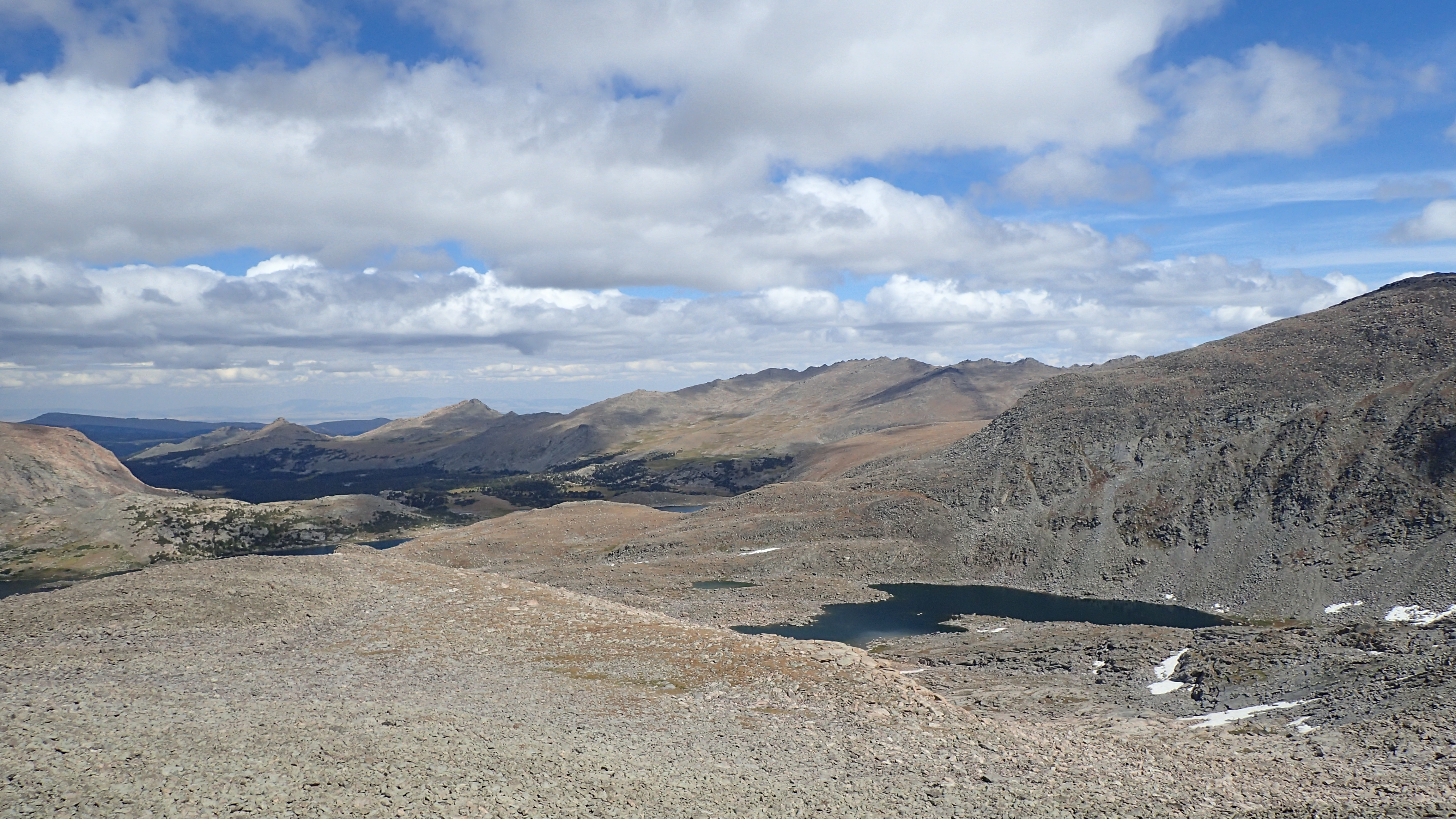
It was not long before we hit the main trail on the lower Golden Lake and headed north. It was not long before we started seeing people. Our previous hikes in this drainage , we had seen a total of 0 (zero) people over the years. It seems this area is getting a lot more use these days, and the few we actually talked to, are doing either the Skurka high route or the Adventure Alan high route. This used to be a fairly remote spot in the Winds that Jason and I have visited several times over the years. I was disappointed to see so much traffic back this way, but it was not crowded by any means. As we busted north, we were running out of energy and time and good weather to make a pass over into the Alpine Lakes drainage, so we decided to stop at a lake at the top of the pass to Camp Lake.

We set up camp on a beautiful outcropping that jutted into the lake. Water was a steep affair to get from the lake, but Jason hoofed it down to the rocky shore as I set up the tarp and kitchen. By this time, the weather had turned windy and cloudy and we could hear the distant rumbling of thunder. We were not in the best spot for inclement weather, especially to deal with potential lightning, but we would have to manage and hope for the best at this time. There were not many better options except back down in the Golden Lakes drainage or push on down to Camp Lake. Jason returned with the water, I had the tarp set up with the west wall set as close to the ground as possible to block the wind and soon to come rain. We found some shelter in the boulders to get out of the wind to boil our water and make our dinner. Just as we finished with our kitchen chores, the rain came in. We hoofed it to the tarp and ate dinner there as the torrential rain and scary lightning came down in a fury. The storm lasted an hour or two before abating. We heard a significant rock slide just after dark on the other side of the lake.

We awoke to a beautiful morning. We had decided to take the trail to Camp Lake and head up the Alpine Lakes drainage instead of “Douglas Pass” to what we thought would make up some time. We did forget about the significant elevation loss down to Camp Lake, but reached it in no time and started the long haul out of there to the Alpine Lakes. A couple steep slopes and some route finding and we were on the bench that held the lower Alpine Lake. We had met a hiker doing the high route at Camp Lake and he told us about some scrambling if you went the north route around this lake. He described it as pretty intense. We fueled up here and rested for a quick 15 before heading to the north route above this lake. You did have to skirt a cliff, but then there is a break in it, where there are ledges to descend down to the lake shore. I guess it could be listed as easy class 4 scrambling in places (I did have to take my pack off and lower it down, this more had to do with my bum shoulder) , but overall was easy and not anything as what was described to us.

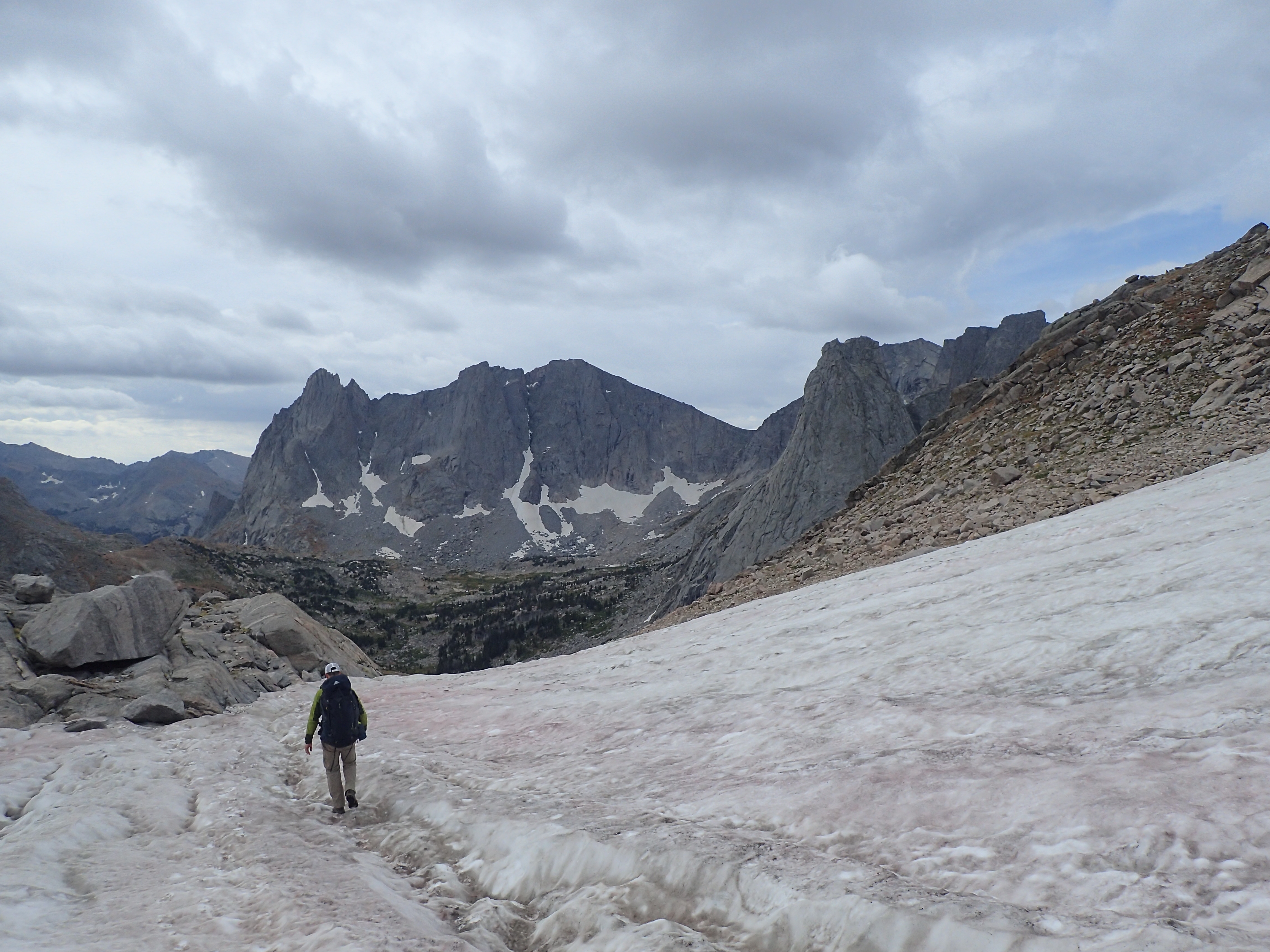
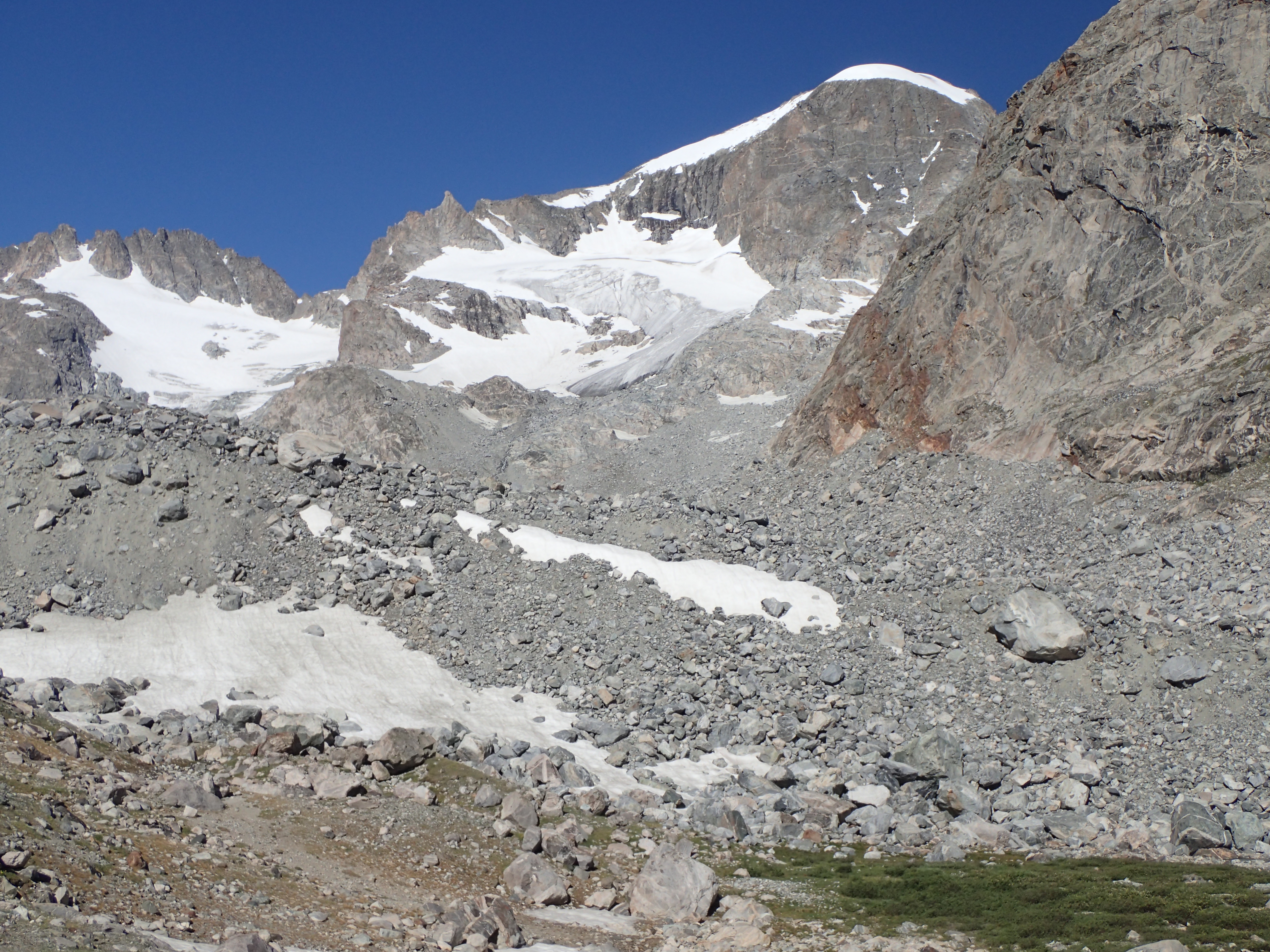
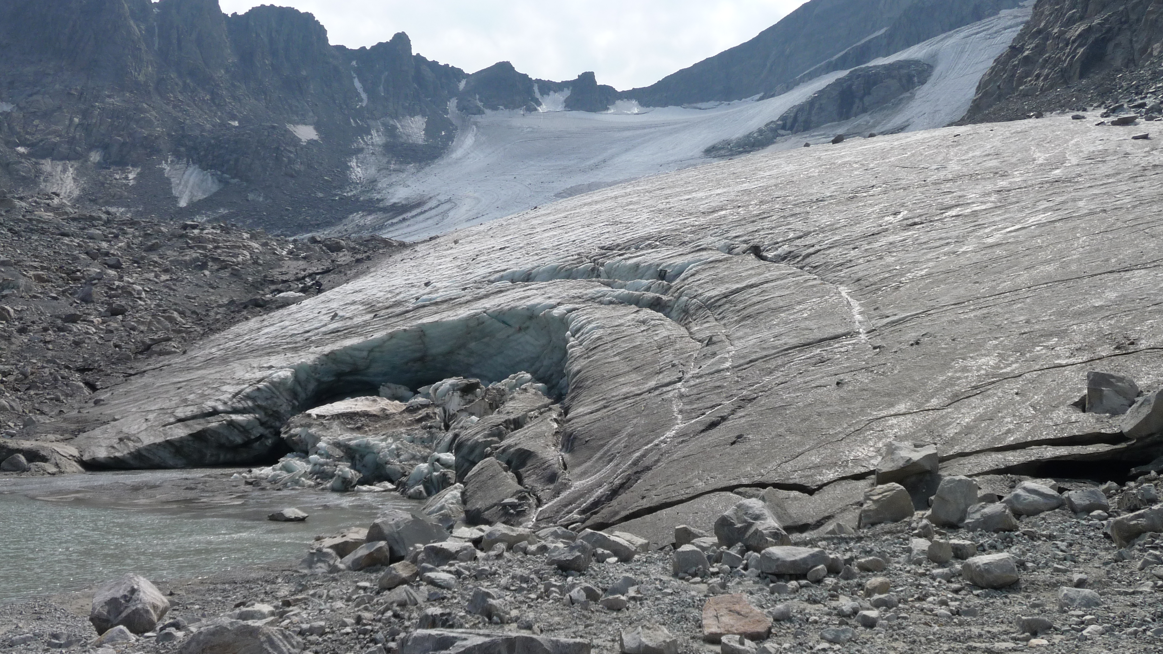
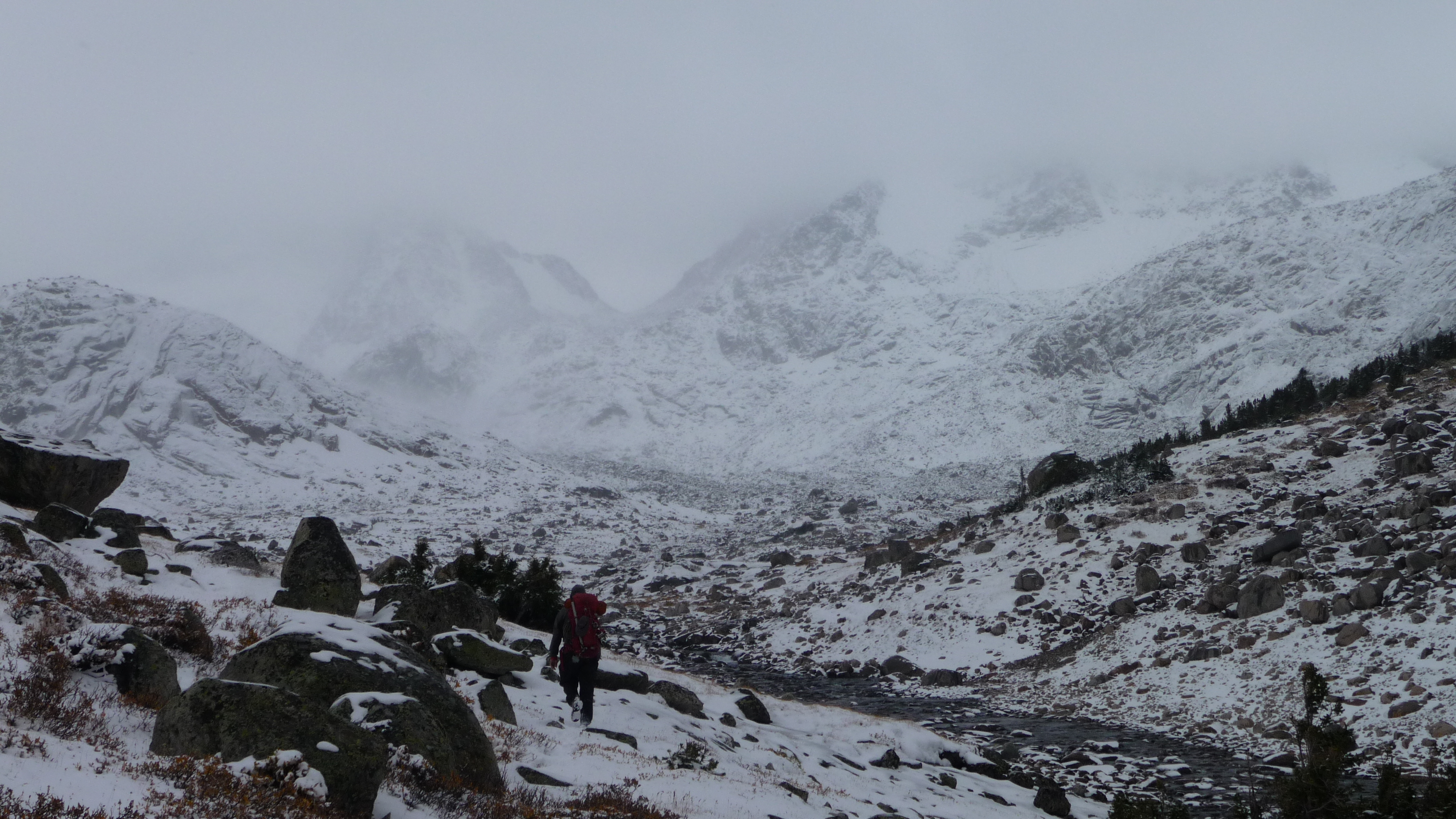
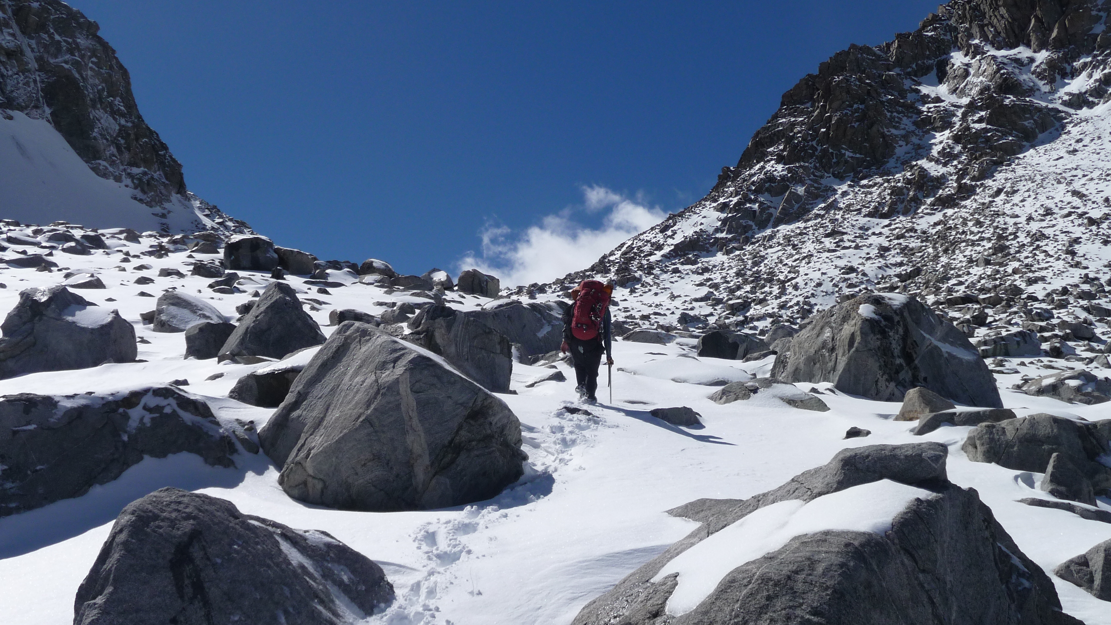
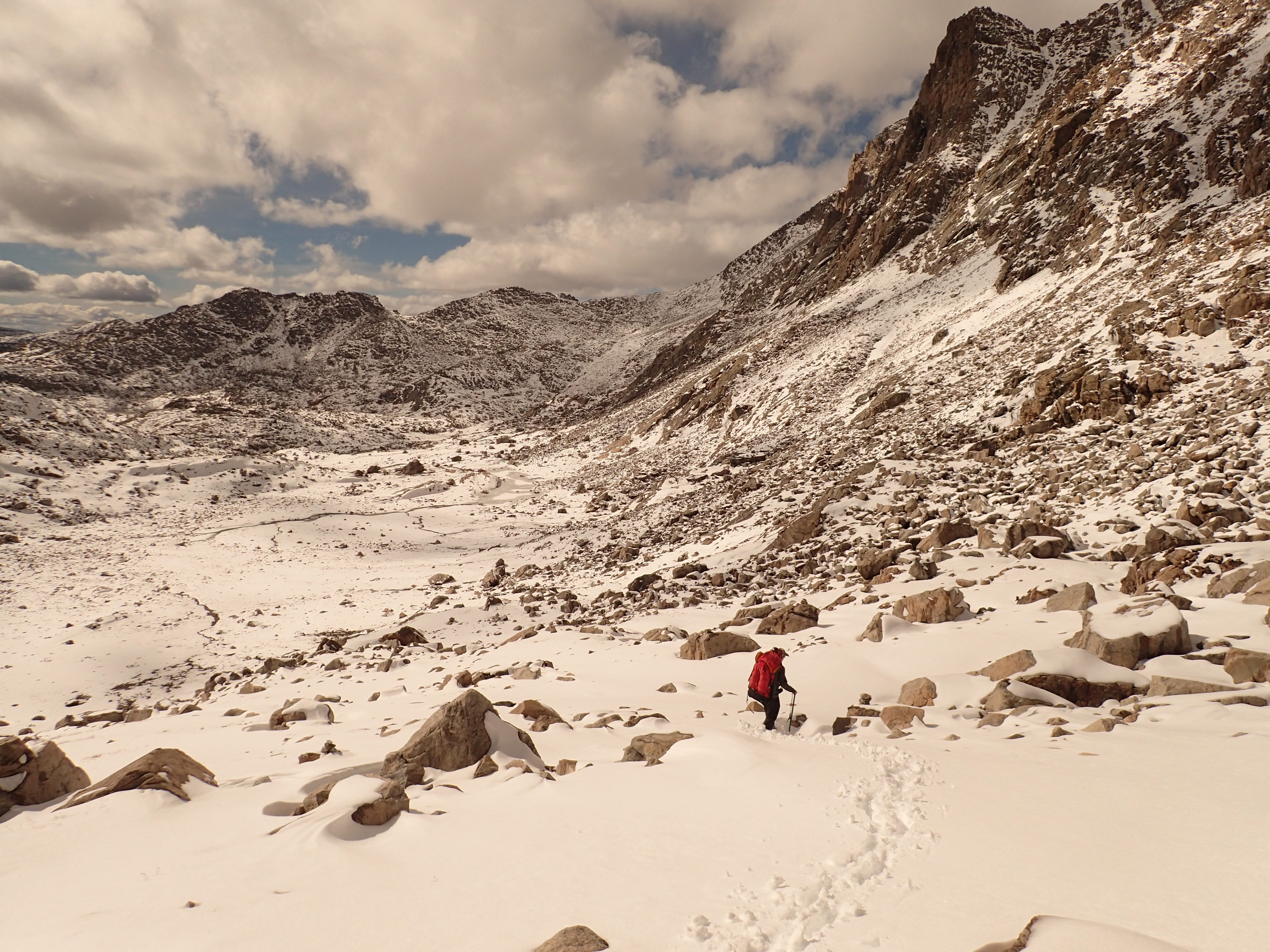
We continued up the Alpine Lakes drainage under clear skies and just a beautiful day. We did not have much intel on this drainage, but knew that is was some rough country and we were both aware of the Mike Turner story. We managed up the drainage fairly easily at first and found this remote lake basin absolutely gorgeous. We now had a decision to make after getting to one of the middle lakes. Do we follow the outlet to the upper lake or go around and high as one “published” account states. We decided to go with the known “published” route and got into some most treacherous terminal moraine conditions we have ever encountered. Scrambling through huge bus sized rocks held loosely by sandy soil and in places ice, it was a slog and mentality draining. we scrambled out of there and the “published” route still indicated the path was to go higher. We finally saw a way down to the top lake and at the very bottom of the pass. We would lose a ton of elevation, but would be out of that mess and just grunt it up the pass. Already spent from the high route, we made the pass fairly quickly as weather seemed to be approaching. The view from the top was superb. The disappearing Knife point glacier was before us and our next objective for the day, Indian Pass. We were in familiar territory now, and could see todays destination in site.

Upper portion of Knife Point Glacier and Indian Pass

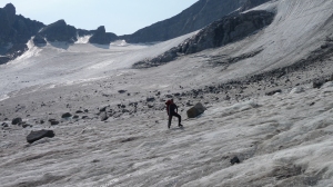
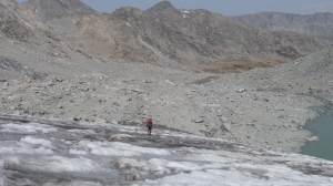
We decided to try and stay high to get on Knife Point Glacier, and might have been much easier 20+ years ago when the glacial ice came up higher towards Alpine Lakes Pass, but now was a jumble of loose terminal moraine. This moraine field was much easier, although steeper, than the one encountered in the Alpine Lakes drainage. There were a few decision making items to discuss here and as we were both getting a little exhausted, tempers flared a bit (mainly mine once we got onto Knife Point Glacier) as we finally crossed Knife Point Glacier. We dodged a few small crevasses as we were able to stay high and finally got onto the rocks just under Indian Pass. we busted out the pass in fairly short order as we watched a small herd of deer go over the pass in front of us. It was getting fairly late as we made the pass and we finally had trail to bust out to one of the many tarns to camp. This was a “bailout” route, as we had anticipated doing the glacier traverse on the east side of the divide, traversing Elsie Col to the Dinwoody drainage. As with most of this trip, we were winging it day by day, as we had to be out to butcher some sheep.

We made a tarn and camped in the exact spot we had camped on a previous trip many years prior. It was basically dark and we decided to cowboy camp again as the night looked cloudless and peaceful. We filtered some water, ate and settled in for the night. We decided on our last 2 days and figured they would be easier days, so we decided to sleep in, we would wake up an hour later, 6:30 AM.

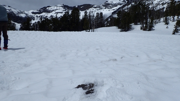
Something woke me up. I look up at the sky and do not see any stars. It’s all black. It is 4 in the morning. I feel moisture hit my face. I hear Jason rustling in his bag to my right. We converse and mention we both felt a few drops of rain and could hear wind coming. We decide we need to act. Just as we get out of our sleeping bags, a huge gust of Wyoming wind and moisture begin. The wind is intense and I see my groundsheet (silnylon sheet) fly what looks to me away in the dark out of sight of my headlamp. I wad up my quilt, sleeping pad, and my groundsheet (it was wrapped around my leg) and go stuff them between a couple rocks. The gust almost blows my sleep system away until I can throw a few rocks on it to keep it in place. I quickly grab the tarp (which flapped uncontrollably in the intense wind) and staked down 4 corners as Jason took charge in securing everything blowing around. I set up the two trekking poles and we had some resemblance of a shelter now. We loaded all our bedding inside and finally went outside to fully secure from the wind. We got things situated inside, and after the adrenaline rush, listened to the rain and wind for maybe twenty minutes before the storm left as fast as it came.

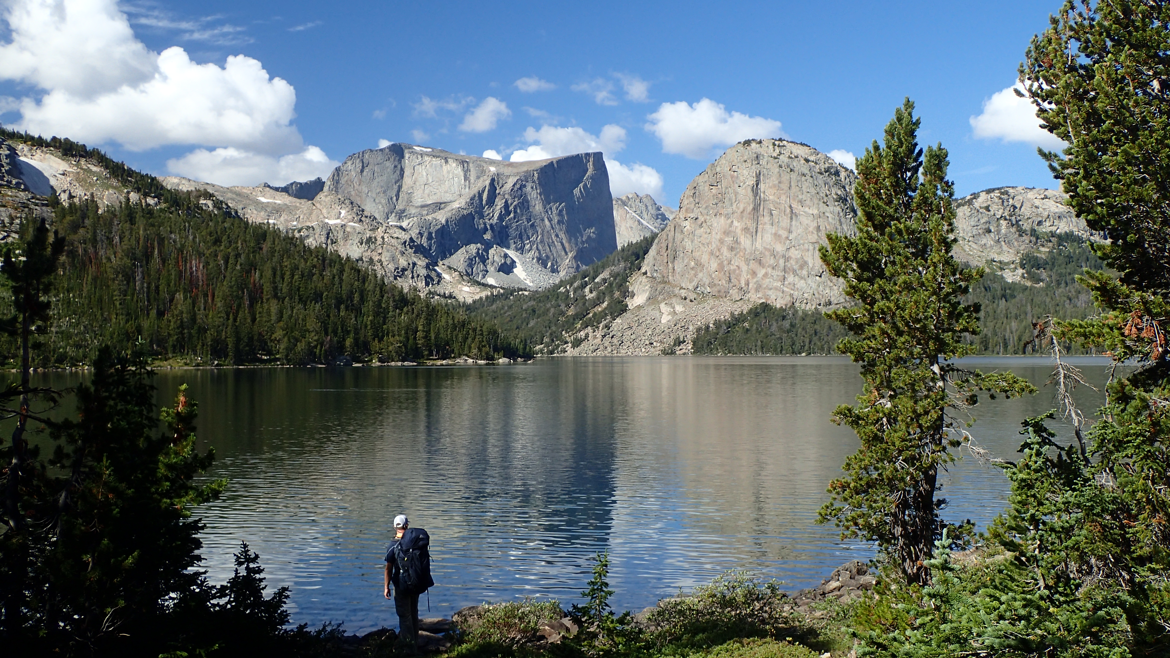
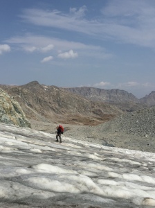
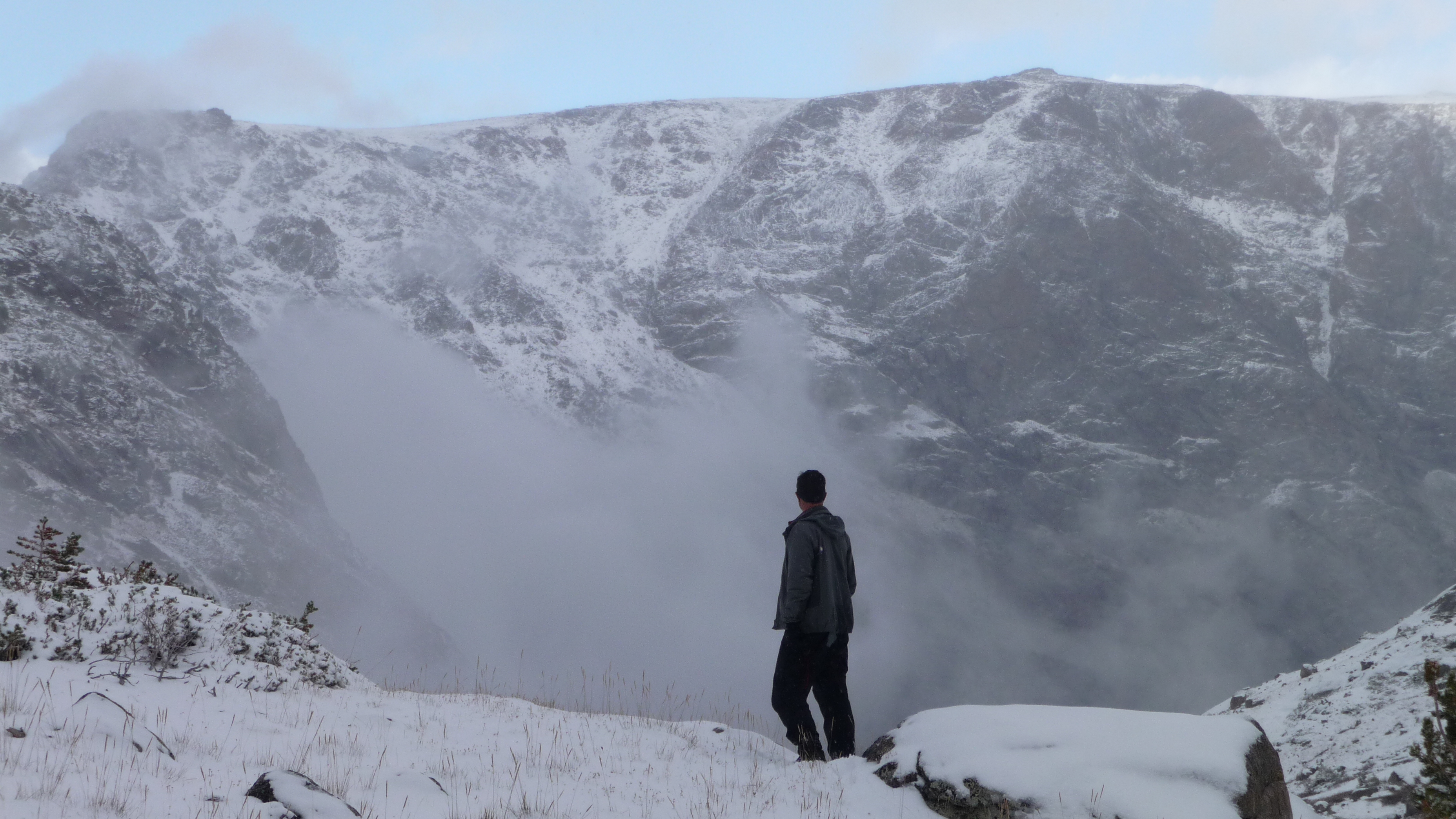
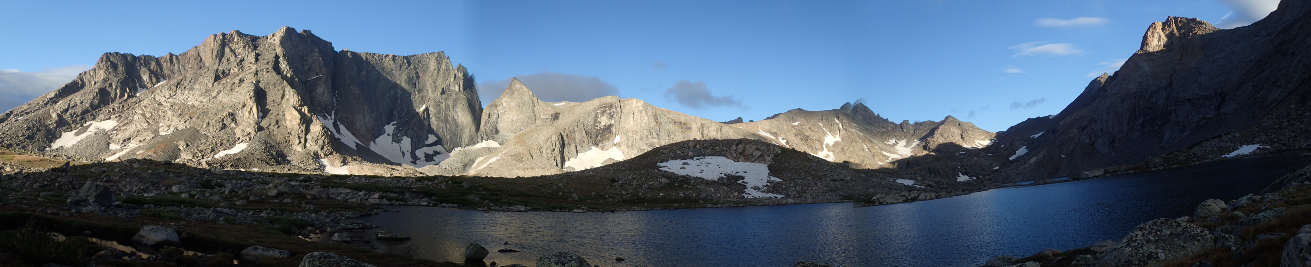
We woke up to a beautiful clear morning with a beautiful sunrise. We decided we were going over Dinwoody Pass, across Dinwoody Glacier and down the Glacier Trail as far as we could today, for an easy exit tomorrow. We packed up and headed out. We started seeing a few people about halfway out of Indian Basin (you used to rarely see many people in the basin, times have changed) and made our way down towards Island Lake. We hit the trail into Titcomb Basin and proceeded to ascend towards Dinwoody Pass. This was Jason’s first time in Titcomb Basin and my second. I had done a solo hike from Dubois to Pinedale some 20 years prior using this route. It is spectacular and we surprisingly only saw one other hiker walking through (no other camps either). The hiking was very easy through here and we made it to the base of Dinwoody Pass fairly quickly. This was a warm summer and the high country snow was some of the sparsest I have seen it. My crossing of Dinwoody Pass some years ago revealed snow almost to the pass on the north side and all snow on the south side. This year, it was all rock.

Jason with Titcomb Basin in the background

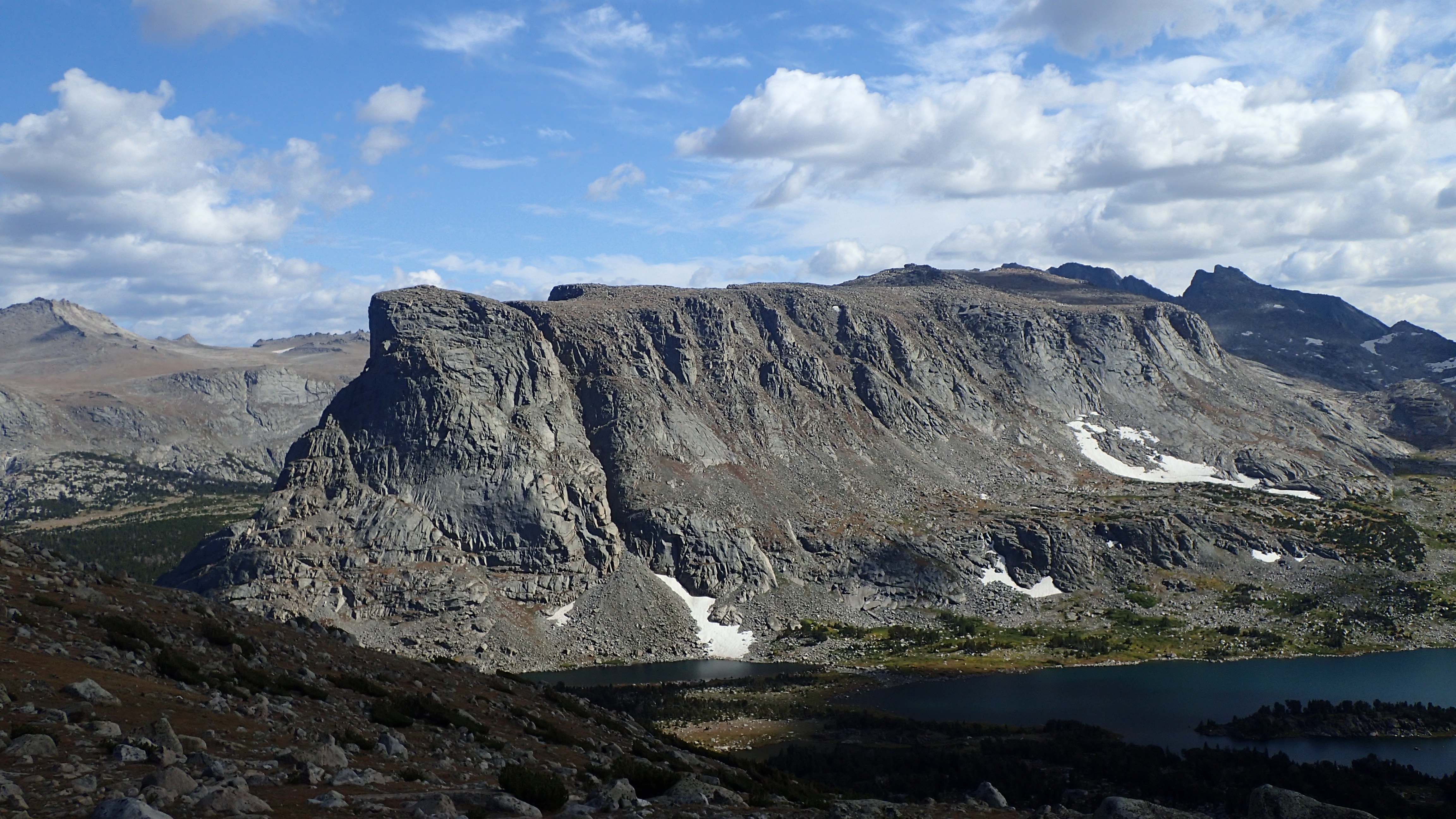
We busted up the high use Dinwoody Pass and enjoyed some fantastic views of Gannett Peak and back into Titcomb Basin from the top. I still would rate this view as my favorite in the Winds. There were no climbing camps in Titcomb Basin (the snow bridge had melted out by now) but we would see a few at the base of Gooseneck Glacier. We traveled the slope down to Dinwoody Glacier, put the crampons on once we hit the ice and skirted away from the easily seen crevasses. We finally hit the dreaded boulder field (we had gone through this at 4am in the morning under headlamps on our Gannett Peak climb a few years earlier) and worked our way towards the ending of the Glacier Trail. We finally hit the trail and were able to bust out some miles. We would see a few people on trail but most of the activity seemed to have died down, assuming this was due to a much harder climb of Gannett due to the snow bridge being melted out. We made Floyd Wilson Meadows and cowboy camped for the night.

Gannett Peak from Dinwoody Pass
Jason on Dinwoody Pass

We woke up the next morning with a heavy dew on everything and proceeded to pack away our wet gear. We had an estimated 16 miles to get out today and wanted out by 3PM at the latest. We proceeded to meet Jason’s dad at the trailhead at exactly 3PM and head down the highway towards Midvale/Riverton area for our next adventure of our trip. Lamb Kabobs and Lamb Tacos.

Planes, Trains, and Automobiles…..and Packrafts

6-18-2019: Jason was due to land at DIA mid morning June 18th 2019. We were starting the hiking season early this year. A spring trip was finalized to the Thorofare region of the Teton Wilderness in Wyoming. We had discussed doing a trip in this area for years, mainly to check out the fishery, but also to see how “remote” this area really was. Jason would spend the day in Downtown Denver getting his high intake of carbs and fat  at Mexico City Restaurant and Lounge (best fried tacos anywhere), while waiting for me to get off work.  We then would start the journey up to the Midvale/Pavilion area to spend the night at his dad’s outpost in Wyoming.

Midvale, Wyoming

We reached Midvale a bit before midnight and had a couple nightcaps with Jason’s dad and then Jason headed off to sleep in the Sheepcamp (the “guest” bedroom) and I slept in the back of the pickup truck. It is very quite in this part of Wyoming at night and I slept very sound. I was awoken early the next morning by the sound of lambs making a ruckus as they were being fed their grain. Today, My uncle would take Jason and I to the Trailhead outside of Cody.

6-19-2019: We drove through Shoshone, then saw the whitewater in Wind River Canyon, and saw with some anxiety, the amount of snow in the high country of the Absaroka’s as we flew through Meeteetse and Cody. We had been watching the weather for the last couple of months to see if this trip was even doable from this side. Our plan was to hike in at the Ishawooa Creek trailhead, go over into the Silvertip drainage by another short pass to Open Creek, and then down into the Bridger Lake area. From here we would travel up the Yellowstone to the base of Younts Peak, Scramble up to the Divide and follow it out at Brooks Lake.

We drove the South fork road and got to the Ishawooa Creek trailhead a little before noon. Our plan this day was to hike as far as we could go (ideally 16 miles to the pass) and camp. We started unloading our gear and I pulled my Gregory z55 out and proceeded to blow out the back pocket and bust a cinch strap. I would later notice about day 4 that the hip belt buckle was broke but still functioning. This was disappointing as this pack has not been used much in the past, and I had already done some repairs on it prior to this trip.  We took a few pictures, strapped on the bear spray and headed out. As you can imagine, there was nobody at the trailhead, and probably for good reason as we would find out in a short while.

Ishawooa Creek Trail Head

Ishawooa Creek drainage

Washakie Wilderness

Jason and I really went through our gear this past winter and got it dialed down to the essentials and ultimately cut POUNDS off our normal hiking weight (in years past, 45-50+ pound packs were the norm at the beginning of a trip). I had my pack dialed in at 33-34 pounds for 9 to 10 days and that included all the weight of the tent, fuel and stove, items that can normally be shared. The only shared weight we had was the Packraft. Jason carried the raft (2.5Lbs) and I carried the light weight paddles (1.5Lbs). Jason had all the camera gear for the hordes of wildlife we expected to see. I thought this was pretty amazing considering we had a few “abnormal” backpacking items with us, such as the packraft, microspikes, and bear spray.

We started hiking on the dry, dusty, treeless trail for the first mile or two. Once we entered the aspens, we encountered some springs and muddy trail in spots. The most surprising site was that of our first fresh grizzly tracks. Less than an hour into our hike, we had encountered fresh grizzly prints and some scat. We started talking and making noise as we would do over the course of the trip to hopefully alert any wildlife we were passing through.

First Grizzly tracks

We could hear the creek as we got closer, and in our trip planning, Ishawooa Creek was not deemed an obstacle or crux of the trip in any way. We assumed Thorofare Creek would be the hardest obstacle to overcome and possibly snow conditions in the Pass Creek drainage. Well, not too far into the trip we had to cross Ishawooa Creek. We went to the trail creek crossing and ruled that out. Ishawooa Creek was running high and dirty. The creek meanders like a snake through here and is choked with much deadfall, and not many straight riffle sections. It was impossible to see how deep it was. It was fairly high gradient. All of these factors led up to us spending 3 hours trying to cross. The first attempt was a failed crossing in the packraft (which we had decided to throw in only 2 weeks prior in anticipation of crossing Thorofare Creek) by Jason. We decided to hike up offtrail in the wooded, narrowing canyon (we would do a bit of travel this trip that probably was not the “safest” in grizzly country) to see if we could find some riffles or a straightaway to cross. Less than a mile up the creek, we found a likely spot to cross.

A tree had fallen across the creek as it swept by a bank. It looked possible to easily cross from a distance. As we got closer and inspected it further, it was a tangle of trees, and would still leave you with a jump over to solid ground. Further complicating this mess, was the thought of slipping off and getting caught in these strainers. This option was quickly ruled out. This mess of trees did back up the water behind it though, creating some slower water coming out and a decent straightaway that looked floatable. This was the longest straight portion of the river we had seen so far. Decent launch area (actually from an island braid of the river) and iffy, but doable landing area. The concern here was, that if you did not make the landing area (there was a very small window to land), you would have to bail and get to shore as the fast water went down into a bend with some deadfall. Researching this area, I had my bear spray fall off my pack as I took it off scouting around. It fell in the river and Jason was the closest but could not grab it. I ran down a ways and was able to retrieve it. It was looking to be a tough day in general.

Ishawooa Creek

The plan was devised and we went for it. I had packed a “SealBuddy” PFD for this trip and it was to be my pillow at night too (after cutting my real ultralight pillow for the multipurpose PFD). The plan was simple. Jason would go first, load his pack in the front of the boat (we used his camera straps to secure to the boat) and push off and paddle as fast as you could to get to the landing area. The water was very fast so you were going to have to get after it and cross the main current quickly. We had a sliver of  slack water to push off into before being taken downstream in the main current. Upon reaching the other side, we would throw a 50ft cord (we used our bear line) to the other side, secure the boat, paddles, and PFD and pull to to the other side as we only had one packraft.

Jason was the first to go. He flew down river and landed in some relatively slack water above our scouted take out. He grabbed onto a branch to try and slow down and get out. The current was deceptively strong and eventually he could not get out and was swept down towards our scouted take out. He hit the takeout but was immediately thrown into the fast, main current on that edge of the river. He bailed and fought his way to shore and pulled the raft with him. Needless to say, he was completely soaked.

I was next. Jason tied everything down and I pulled the boat over to me. The boat hit the fast current and flipped and next thing I see is the “SealBuddy” floating down the creek. There goes my pillow for the trip! I proceeded to wrap my Thermarest pad around me and put on my rain jacket. Makeshift PFD but better than nothing. I did not mess around and got ready and pushed off. I hit the scouted takeout on the mark, then proceeded to get in the main current as Jason did. I heard Jason yell “bail” but I think I already had bailed. Half in and half out of the water, the current was very strong to get a footing. I pulled myself out while dragging the raft and my pack to shore.

We had accomplished to get to the other side, and now we were committed to getting to Hawks Rest, as we did not want to cross Ishawooa Creek again. It took us 3 hours of scouting, hiking, and floating to get across Ishawooa Creek. We had miles to make up and it was getting late. We were both pretty wet from “bailing” in the creek. We started hiking to warm up and make some progress. We kept seeing a lot of bear sign as we progressed up the canyon. The roar of Ishawooa Creek got louder as it was being narrowed in its stream bed. A massive waterfall was seen from the trail as we ascended up the canyon walls. We started going up and as dark was falling, it was hard to find a decent camp site. We finally found a spot that would do, although it was too close to the trail, but we new that nobody was anywhere back here (it is also prudent to camp a ways from the trail in grizzly country, as they frequently use the trails also). We found a decent bear hang, campsite was actually decent and spent the first night nowhere near where we expected to be on this first day.

Tarptent Double Rainbow: We set this up for the very first time around 11pm the previous night.

6-20-2019: The next morning we had breakfast on a fantastic overlook of the Ishawooa Creek gorge and the surrounding Absaroka’s. This was some rugged looking country.  The trail from camp wound up higher and higher ever so slightly. There were some precarious drops into the gorge below from the trail. There was plenty of rotten rock and fresh avalanche slides through this section (and plenty of fresh grizzly sign. We would see more grizzly sign in the Washakie Wilderness than any other area on this trip except possibly the Yellowstone Meadows in the Thorofare) .  We headed on up the trail and planned on making the pass today, but as we got higher, we saw more snow and decided to save the pass for the next day. This is the only campsite on the whole trip that we did not stop on the trail and eat, then hike another few miles to camp. We ate maybe a half mile from our camp on the creek. By now, Ishawooa Creek was cross-able, but still moving.

Jason going through some avalanche debris

6-21-2019: It snowed overnight! Welcome to the first day of summer in the Wyoming backcountry. It was just enough snow to dust the ground and make everything white. We had big plans today. We were going to try and make up some time and get over Ishawooa Pass and Silvertip Pass today and hopefully down the Silvertip drainage a ways towards Open Creek. We expected decent snow on the Washakie side, and where hoping it abated soon on the Teton side. We had a couple of miles to go until we crossed Ishawooa Creek (now a small mountain stream, very easily crossed) and would start our ascent towards Ishawooa Pass. We crossed, fueled up and looked into the trees. There was no bare ground to be seen. The “trail” (only resemblance of a trail was the virtual one on our GPS) was gone! The snow was hard though and we put on our microspikes and headed up (Little did we know, we would be hiking with the microspikes for the next 10+ miles today, as the snow never left). The slope was fairly steep in spots and we checked the GPS periodically so that we stayed close to the trail. We eventually neared the top and it leveled out some, and there was some windswept snow free areas we could see, and even small portions of the actual trail. We eventually headed towards the saddle and hit the pass. We had a hard time locating the sign for the pass (I had seen pictures of a sign on the internet, so assumed it was there somewhere) and eventually Jason found a corner barely sticking out of the snow! Mission accomplished.

First day of summer!

Jason headed towards Ishawooa Pass from the Washakie Wilderness

Sign at Ishawooa Pass

Looking down the Pass Creek drainage from Ishawooa Pass

We re-fueled on top and took a few pictures. It looked like the dead of winter from our vantage point. Since the upper crossing of Ishawooa Creek earlier that morning, we had not seen any sign of the trail except some wind blown areas on the Absaroka side of the pass and the virtual sings from the GPS. It was all walking on snow. Looking down the Pass Creek drainage, we could not see any relief from the snow in site. We started down the slopes to meet up with the massive Pass Creek meadows and eventually cross Pass Creek. We eventually made it to a very tall sign marking the Silvertip Trail. It was up from here, and the snow squalls we had been encountering all morning, seemed to be intensifying. It was here we had to triangulate our location using the old map and compass, as a technical error in our GPS app put us at a much different position (about a mile and a half off!). It was a good lesson to not just rely on the latest technology, but be able to use some tried and true navigational tools to verify your whereabouts.

Jason crossing Pass Creek

Pass Creek

Silvertip trail sign from Pass Creek

From the junction of the Pass Creek trail and the Silvertip Creek Trail, it was all uphill. I keep saying trail, but our only idea that a trail existed anywhere for miles around was that one sign sticking out of the snow. This did make for a feeling of being very isolated. We were now about 20 miles from the nearest trailhead (Ishawooa Creek) and over 40 miles from the nearest trailhead in the Teton Wilderness or Yellowstone National Park. The first mile heading up was relatively easy, but then became steeper and Jason was busting through the snow at a little greater rate than me (maybe 3 times to my 1). We finally pulled out of the trees and hit the open slopes above (open from trees, not snow!). From here, we had to stop a few times and use the GPS and even triangulated again, as the pass was not straight forward without a trail. We finally ended up cresting the top after crossing some steeper snow slopes. The view from the pass was beautiful looking into the Silvertip Creek drainage. The slope getting down was much steeper than anticipated from looking at the map, and was of course completely snow covered. The one bright spot from our vantage point was that we could see the snow line down the valley towards Open Creek, something we could not see from Ishawooa Pass.

It was a long, steep, slog down to Silvertip Creek through the trees. We finally hit the Silvertip Creek meadows and decided to cook dinner. By this time it was getting to be later (6’ish, 7’ish if I remember right) and we still had a ways to go to get out of the snow. After eating alongside Silvertip Creek, we proceeded down the meadows through intermittent snow squalls and fading light. The snow was receding fast as we moved down the meadow a few miles and eventually came to more marshy meadows and bogs than snow. We finally could make out the trail, even though it was a miniature creek, and follow it down and made some faster time and eventually located a decent camping spot. We were not out of the snow 100% yet as many deep drifts were around, but there was plenty of relatively dry ground to pitch the tent for the night.

Late evening snow squall in the Silvertip drainage

It was cold enough to freeze the waterfalls

6-22-2019: We woke up to a beautiful sunrise and contemplated our next step. Should we put the microSpikes on or were we going to get out of the snow soon enough as we lost elevation? We decided to leave the microSpikes in our packs and head out. We had maybe another mile of intermittent snow and drifts and it was looking more like spring every step we took. We were on the trail now and headed towards Open Creek and eventually Thorofare Creek. The hiking was easy as we lost elevation slowly, and we were able to make some good time. We had a short section (maybe a mile or two) of an offtrail shortcut to Open Creek where we would cross at the confluence of Silvertip Creek and Open Creek. Anxiety was a little high, as we did not know what Open Creek would look like this far down in the drainage. Pass Creek and Silvertip Creek up high were easily negotiated. Silvertip Creek by now was looking to be a more difficult, cold , crossing as it had gained a lot of water as it headed towards Open Creek. We were still seeing some fairly fresh Grizzly sign and jumped a porcupine near the confluence.


We fueled up prior to crossing Open Creek. Open Creek was very easily negotiated, but was moving swiftly and very cold. Silvertip Creek looked to have about twice the volume of water that Open Creek had. Once they merged here, the two flowed to Thorofare Creek under the Open Creek name. We continued on down, slowly losing elevation. We eventually entered a massive meadow and towards Open Creek saw a very unsightly horse camp site. If we had more time, we would have dismantled this unsightly mess. The only good about the campsite, at least it is used year after year in the same spot, preventing new scars on the land every hunting season. We did encounter a much smaller outfitting camp in the Absaroka’s along upper Ishawooa Creek, complete with bear container.


We pushed on, spooked a cow elk (the only big game animal that we saw the whole trip), scared up some mating Sandhill Cranes (who were starting to be our noisy, familiar friends as we got closer to the Yellowstone), and just kept walking in this wide expanse of wilderness. The feeling of being remote was not the most pronounced back here (even though we were very remote, especially considering the conditions) but the vastness of the meadows and mountains was tremendous. It was big wilderness and a lot of it. We just kept walking and walking and walking……and walking. The hiking was some of the easiest (minus the snow and river crossings) I have ever done in any mountain area. With a light load, and legs in decent shape, you could cruise through this area relatively easy.

We pressed on and eventually came to the confluence of Thorofare Creek and Open Creek. We finally saw what we deemed in the planning stages of our trip as the crux. To our relief, It did not look anywhere near as daunting as our Ishawooa Creek crossing, 4 days earlier. We still had a few miles to go and then search out a campsite for the night. We eventually walked up on our freshest elk kill of the trip on the trail, bear spray was immediately pulled out and we hoofed it out of there as fast as we could without running. After  about another mile, we took a side trail that ended in a massive swamp, and we had to backtrack or swim to get back on the main trail (so much for the shortcut). We proceeded up the Thorofare trail going north towards Yellowstone (The park boundary was only a little over a mile away from here) and found a knob overlooking Thorofare Creek, Hawks Rest directly to our west and the Trident to the northeast in Yellowstone. There were an abundance of good bear hang trees all around in this country, we got the tent set up and relaxed. This was our best campsite of the whole trip. The views were amazing.

OLYMPUS DIGITAL CAMERA

Camp above Thorofare Creek

6-23-2019: We woke up early this morning to hike the short distance to the Wyoming Game and Fish cabin on the park boundary. It was a short, easy hike on a flat plateau to the cabin. It was all boarded up and you could tell it was well taken care. It was a bout a quarter of a mile past the cabin to the park boundary, so we decided to check it out and take some pics. We were anxious to get back and and take down camp, as we did not know what we had in store for us at Thorofare Creek.

OLYMPUS DIGITAL CAMERA

WGF Cabin near the Yellowstone border

OLYMPUS DIGITAL CAMERA

Jason getting ready to cross Thorofare Creek

We got camp stuffed in our packs and headed the short distance to the Thorofare crossing. We approached the official trail crossing and on our side it was easily 6 feet deep and flowing fast. The depth of the water surprised us a little. We bushwhacked upstream about a half mile and found what looked to be a perfect spot to launch the packraft and had a good landing on the other side about an 1/8th of a mile downstream. We had measured on Google Earth the width of Thorofare creek in most spots was just 100 feet across. The bear ropes we carried were each 50 feet, so we would tie these together to throw a line across the river for the second man to get the boat after the first crossing.

Jason took the first run. There was one midstream obstacle to maneuver around, a log with a tree limb sticking out. This was not a strainer hazard, but was enough you had to worry if you hit it, the boat might get damaged. The flow on Thorofare creek was moving decent but nowhere near the velocity of Ishawooa Creek. Thorofare creek also had some long runs and most places gave you plenty of time to maneuver before you would get in trouble. Thorofare creek was cross-able on foot, but you would swim the last bit to shore in every spot we saw. It was just a bit too deep and flowing a bit too fast. The packraft made a very nice option in fording it. I pushed Jason off and he glided downstream, got into the main current, and easily paddled out of it before gliding into the far shore with the fast current and beached the raft. He would bring the raft upstream, I waded out as far as I could and he threw me the bear cord and I pulled the raft back over and proceeded to do just as he did. All this before the rain came in! We were now on the “right” side of Thorofare Creek and knew we could easily get out via the Turpin Meadow trailhead if that is what we had to do.

We ate lunch, and headed off to Bridger Lake, where we “lost” the trail and pushed through some of the thickest new growth I think I have ever seen. This was another example of what not to do in grizzly country. Once we broke free of the new growth, we popped out onto a high use trail skirting the lake. we first went east, but turned around to go back towards the Yellowstone to look for a place to set up camp. Bridger Lake was not at all what I expected. I was expecting a pristine mountain lake with crystal clear water. It looked like a very large seep pond to me, with discolored water and in many places heavily used campsites. It was not the ideal mountain lake in my eyes.

We followed the trail skirting Bridger Lake and eventually caught our first glimpse of the Upper Yellowstone and it’s meadows. As we crossed what looked like the outlet of Bridger Lake into the Yellowstone, 2 horses and riders appeared coming out of the trees further along the trail heading towards us. This was the first people we had seen in 5 days. Turns out they were Wyoming Game and Fish. They were staying at the forest service cabin (Hawks Rest Cabin) with permission as they were unable to cross Thorofare Creek to gain access to their cabin we had just been to earlier in the day. We talked a bit, inquired on camping options ahead and departed. They invited us to visit them at Hawks Rest but in our couple of visits to the cabin, they were not there.

We pushed on through the swamp getting soaked (we had wet shoes from day one of the trip anyway, so this was nothing new) and walked into a very large outfitter camp. This was a little tidier and not as obtrusive as the camp on Open Creek. There was a bear box also. There was fresh bear scat everywhere. We decided this would be a good place to cook and we would move on down river, towards the park, to camp. We could store our food bags in the box and not have to worry about hanging our food too. The weather was off and on cool, rainy, then sunny. We hung out and re-fueled and explored the immediate area. We had planned by now to hang out in the Thorofare for the rest of our time fishing and exploring as we had ruled out the possibility of doing our CDT high route with the amount of snow in the high country. It delayed us this much getting in, we couldn’t get delayed that much getting out, as we had to meet our ride home.

We hiked north towards Yellowstone and found a decent camp in the trees off the trail. It was a much smaller outfitter camp, but did not have bear scat everywhere. We could see the Yellowstone from our camp. We decided in the morning, we would hike to the park boundary and fish our way back to camp.

6-24-2019: We woke up and headed north up to a massive meadow on the Yellowstone. We saw a structure in the middle of the meadow that we walked towards and soon found it was a pretty elaborate sign indicating the Yellowstone boundary and the Teton Wilderness boundary. We snapped a few picks and headed off down the the invisible boundary line towards the Yellowstone. The Yellowstone river in the park is officially closed to fishing until mid July and any off-trail travel was prohibited at the time due to the Grizzly bears. We soon found a small, old stone marker indicating the south boundary of Yellowstone near the river. Some more pics were taken and we proceeded the short distance to the Yellowstone.

OLYMPUS DIGITAL CAMERA

Huge sign marking Yellowstone National Park and the Teton Wilderness Boundary

The Yellowstone is a very placid river flowing from Hawks Rest to the Yellowstone Park boundary and beyond. The river was bank to bank full of water (I see pictures later in the year and it looks  a quarter of the size or less than we encountered). It honestly looked more like an irrigation ditch than the longest undammed river in the lower 48. It was very scenic though with the meadows and mountains all around. Again, this was big, wide open country. We started fishing at the park boundary and worked our way south towards our campsite. The water was clear, cold and moving deceptively faster than at first glance. At the boundary there was a very deep run with structure on the bottom that looked to be the perfect place for some Yellowstone Cutts. We tried all sorts of nymphs, drys, and even some buggers in the deeper channels. No luck. We did not even see any fish until just before camp. Most of the river was featureless on the bottom and did not look “fishy” on closer inspection. The riffles were far and few between the long docile stretches of flat water. Where we did end up finding fish, were in these riffles and just after them. We found that the majority of them were still in the spawning stages and we left them alone (the Cutts have a hard enough time with the Lake Trout invasion from the 80’s or possible 90’s).

We were able to fish for a few in the deep holes after the riffles and hooked a few. These were surprisingly large fish up to 20+ inches, obviously they had made the journey from Yellowstone lake some 17 miles away. Overall the fishing was very slow. We decided to head up to the Yellowstone bridge and fish down to camp the second half of the day. We had not been to the Hawks Rest cabin or the bridge since we got to the Thorofare. We walked around the cabin and took some pictures, the Wyoming Game and Fish personnel were not around and the cabin was locked up tight. The cabin is located at the base of Hawks Rest and opens up to a beautiful fenced corral and a wonderful view of the Yellowstone and Two Ocean Plateau in the distance.

There was a large outfitted party down from the cabin closer to the river. This was only the second group of people we had seen this trip. We started fishing just downstream of the bridge where the river was very deep (the crossing at the bridge was actually “shallow” and even at high flows would have been an easy crossing minus the bridge). We fished some nymphs deep, and finally some buggers and surprisingly, nothing. This looked to be some of the more “fishy” water we had seen all day. We worked our way down towards camp and bypassed most of the long flat stretches and looked for the riffles. We spooked a couple of fish, but did not see any more than that. We decided to call it a day as it was getting to be early evening by now.

While at the bridge fishing, we saw a big horse packing group come in and head on down the trail towards Bridger Lake. I told Jason that they were probably headed to our “kitchen” to camp. Sure enough, as we were walking through on our way to camp, they were setting up their tents and already had the horses and asses hobbled. We came into their camp to retrieve our food sacks from the bear box and chatted with them a little. They were a ranching family from around the Turpin Meadow area. They were to come in earlier, but the rain and snow that we had delayed them. So much for our bear box, we where going to have to find a tree to hang our food again.

OLYMPUS DIGITAL CAMERA

Jason on the Yellowstone bridge

OLYMPUS DIGITAL CAMERA

Hawks Rest (forest service cabin)

6-25-2019: We had decided to fish Thorofare Creek today. Thorofare Creek looks like your typical freestone river and has more types of water to fish than the Yellowstone, at least in the Teton Wilderness. We had also decided to pack the raft and go over to the Thorofare Ranger Cabin in the park (in hind-site, we should have visited it 2 days prior when we were at the WGF cabin. It is an easy 1.5 mile walk from there) and check it out. Since we were moving our camp today, we loaded our packs and headed out. We decided to head north towards the park boundary with plans of following the boundary line down to Thorofare Creek, where we would put in and cross (all this to avoid the swamp by Bridger Lake…..again in hind site getting wet feet would have been much faster getting to Thorofare Creek). Plans change, so we headed up the trail in the park (we were aware that you cannot float rivers in the park) and shortly hit the official Thorofare Creek crossing. It was not crossable on foot, so we had to backtrack out of the park to where we could float. This is where we followed the creek back up to the wilderness boundary (1 or 2 miles?) to put in. We found a perfect straightaway with a perfect landing on the other side. We made a short time of it the best we could (blowing up the raft and situating everything is very time consuming though) and crossed. We hid the boat in the trees and put plenty of rocks on it so it would not blow away and tied it to an evergreen. We put our packs on and headed cross country towards the trail that would take us to the Thorofare Ranger station. It was another easy jaunt and before long we were in a maze of park signs pointing out campgrounds, trails, and mileages of each. We found the sign we were looking for: Thorofare Ranger station.

We walked up to the cabin and it was locked up tight. There were 3 horses in the corral and two of them had big cow bells on them. We assumed this cabin would not be manned this time of year so we were a little surprised. We ate lunch on the porch, signed the book (where the last entry was from 2018….We were the first visitors for 2019?) and walked around and took some pictures. As we were getting ready to leave we heard a chainsaw in the distance. We wanted to see the inside but figured they would be working for awhile so we loaded up and started heading out. We had walked maybe 200 yards from the cabin when the 2 rangers came walking up the trail. We definitely  caught them by surprise. They inquired how we had gotten back in there, as they said coming in from Nine Mile Trailhead (the park trailhead, 32 miles away), was impassable by foot due to a couple of the creek crossings. They said they had just gotten in and was a tough go on the horses. They had evaluated, as we had, that Thorofare Creek was impassable on foot or with stock also. We told them about Ishawooa Creek and Pass and coming in from Cody. They did not seem too familiar with the country south of the park that we had traversed in the Washakie and Teton Wildernesses. We did mention it was very busy just across the river at Hawks Rest with three big outfitter camps and the WGF staying at Hawks Rest. This kind of surprised them also.

OLYMPUS DIGITAL CAMERA

Yellowstone’s Thorofare cabin (National Park Service)

OLYMPUS DIGITAL CAMERA

Thorofare cabin sleeping quarters

They set about opening up the cabin and asked if we would like to look around inside. The inside was divided into two rooms, a dining area with a massive cast iron stove (I later read, packed in pieces by mules and horses), some cabinets and even a trap door to a cellar for food storage. In the back was the living quarters with bunks for sleeping and a small wood burning stove for heat. A big solar panel on the roof hooked up to a huge battery in the living quarters that supplied all the electricity for the cabin and to recharge all their equipment (radios, etc). This was the first year for either ranger at the Thorofare cabin. One of the rangers had gone through a NOLS course in the Winds and was familiar with some of the country that Jason and I know so well. The other ranger had been a front country ranger and applied for a backcountry position and was stationed here. I would have thought a backcountry position would be difficult to obtain, but with the combination of wanting to be in the backcountry, you also had to be trained in law enforcement (they were packing heat AND bear spray) and have a good knowledge of horsemanship.

We had a short but pleasant visit. I envied these guys for getting to stay in this area for the whole summer in relatively plush accommodations. I mentioned once people were able to get back there (how did we get back there?), I bet they would be busy entertaining guests all summer long. They said that they do not encounter many backpackers throughout the season, mainly horse packers. I guess the Yellowstone side of the Thorofare is horse country also.

We headed back to the packraft about 2 miles away mid to late afternoon. We crossed the Thorofare and were going to hike south towards the trail and find a campsite for the night. We came across another carcass bushwhacking through the deadfall towards the trail. We immediately evacuated the area as fast as we could with bear spray drawn.   We decided to eat dinner on the banks of Thorofare Creek and then hike another mile or two to set up camp.

OLYMPUS DIGITAL CAMERA

Backcountry PFD

OLYMPUS DIGITAL CAMERA

Jason crossing Thorofare Creek after our Yellowstone visit

We did not want to hike all the way to Hawks Rest, as there were too many people around. We did not want to stumble through the trees to Bridger Lake, so we opted for staying on the little plateau north of Hawks Rest for the night. This area was heavily burned (1988 fires?) at one time and most of the big old trees had already fallen to the ground. The new tree growth was very thick, but most trees were 8 to 10 feet high at the most. This was the only time we had a hard time finding a decent bear hang the whole trip. We eventually found a suitable tree, and hung our food and toiletries for the night.

6-26-2019: We had decided to head out a day early (as we would find out, actually 2 days early) as we needed to get in touch with Jason’s dad to let him know we would be at a different trailhead than previously planned. We had been informed that there was spotty cell service near the trailhead, at you first views of the Tetons (this information was gathered from the Wyoming Game and Fish couple that we had met when we first entered the Yellowstone Meadows). We were concerned that if we did not get any cell service, we would have to hike out to the highway, and go either east or west and try and find cell service.

We broke camp and headed towards the Yellowstone bridge. We detoured to the Hawks Rest cabin to see if the Wyoming Game and Fish couple were around, but the cabin again was locked up tight. We headed out and hit the first crossing of Atlantic Creek. We saw 3 or 4 Cutthroat Trout in spawning mode near the crossing (they looked to be the typical size we had seen the whole trip, around 20 inches) as we peeled our socks off and took our insoles out to try and keep our feet relatively dry. After crossing (a very easy crossing), we proceeded to put everything back in order and noticed we were surrounded by mud and lots of horse crap. The horse crap would be a continuous site and smell for the next 26 miles out.

We crossed paths with some of the members that had a big horse camp up the hill from Atlantic Creek. They looked to all be on a guided fly fishing excursion. We then continued to pull out of the upper Yellowstone Meadows and say goodbye to the Thorofare proper. We had another crossing of Atlantic Creek soon after we got into the trees (this looked like it could be a trickier crossing during heavier snowmelt) and other than one other crossing near Two Ocean Creek, we could keep our feet dry. We saw some bald eagles, more horsepackers and a few camps near Two Ocean Creek area. We were busting out the miles by now. We took the wrong trail that would have taken us directly to Two Ocean Creek were it splits into Atlantic Creek and Pacific Creek, so we had to backtrack a bit and added another 1.5 miles to our daily total. We just kept walking and enjoying the beautiful openness of the country we were traveling through. The area had many scars from the ’88 fires and even some more recent ones, but the vastness of the country was amazing. The trails in spots were torn up greatly by pack stock and made for some difficult travel at time, as every small source of water on the trail was turned to a bog by the pack stock. The meadows had at times 10 parallel trails in them scarring the land from pack stock use. It was disappointing to see this, but the country was still magnificent and beautiful. Heading down towards the trail confluence to one of the forks of the Buffalo Fork River, looking back east were some pretty awesome mountain views, rugged, burnt, and wild. Storm clouds and lightning lit up the snowy peaks as we kept heading down. The hiking was very easy along the trail and we were chewing up some miles. We had already gone past the point we thought we might camp for the night and reached the Buffalo Fork. Here we decided we were only about 8 miles from the trailhead and still had lots of daylight left (it was early evening if I recall, around 6:00pm or so). We kept hiking, and eventually got to our view of the Tetons. We did get very spotty service and not enough to text or make a phone call. We still had a couple miles at least to go until the trailhead.

OLYMPUS DIGITAL CAMERA

Parting of the Waters (National Landmark)

We busted out the last few miles and hit the Turpin Meadows trailhead as the sun was setting behind the Tetons in the distance. We hiked over to the lodge to see if we could get cell service or possibly use their phone. The people at Turpin Meadow lodge were the nicest, most accommodating people we have met. They offered the use of their phone to contact Jason’s dad to set up a rendezvous to pick us up the next day (we would later get enough service after breakfast the next morning to contact Jason’s dad and verify). We then proceeded back to the campsite to camp for the night (luckily had a few dollars to pay, but were still a dollar short), eat our last stove cooked meal and rest.

OLYMPUS DIGITAL CAMERA

The Tetons from Turpin Meadows Trailhead

We woke up the next morning and went to the Lodge for breakfast and heard that there had been a grizzly going through the camp the past couple of nights. I think the whole trip, this might have been our closest encounter that we knew of with a Grizzly! My uncle (Jason’s dad) had received our voice mail and was already on his way from the Riverton area to pick us up. He arrived, we drove to Dubois where we stopped to get some package liquor for lunch and had a beer at the Rustic Pine Tavern.  We stopped in Midvale and had lunch with my uncle and then proceeded on to Casper where we would spend the next couple of days, Jason at his mom’s place and me at my parent’s place, hanging out before the drive back to Denver.

This was a great trip, I had always wanted to see this country and do a little fishing. We were a little ambitious on our trip planning this time of year (we knew this going into it though). Coming in the Washakie side did seem wild and remote (partly because we knew we were the ONLY ones back there this time of year), but after crossing the Thorofare river, the feeling of “remoteness” faded quickly. The fishing was not stellar (just a timing issue, It looked as if the spawning was mostly over and most of the fish we could find were actively spawning), the country was. This may be the “most remote” spot in the lower 48 but it is a pretty busy back in there (we only saw horse pack parties, no other backpackers. The Yellowstone rangers stated that over the summer, they see few backpackers and lots of horse parties). One word I would have to say about this country, BIG. There is a lot of open country back there. The hiking is super easy (well………let me say that again, during the normal hiking season, after the passes melt out from under the 4 to 6 feet of snow that accumulates over the winter and the rivers go down after runoff), and you can bust out a LOT of miles in a short amount of time. I would eventually like to come back and do our CDT high route that we were unable to do due to the early spring conditions or even do a Yellowstone portion (Nine Mile to South Boundary) to see some thermal features and gasp…..maybe even a Grizzly (from far away though) since we did not see one this trip (plenty of fresh sign, but I guess we did everything right to not have an encounter).

OLYMPUS DIGITAL CAMERA

Hawks Rest and the Yellowstone River

OLYMPUS DIGITAL CAMERA

Bear Scat

Seven Passes in Seven Days

OLYMPUS DIGITAL CAMERAThis trip was originally going to be 7 passes in 8 or 9 days. We had received word on our second to last day in, that there was a storm filtering into the area that was to drop snow in the higher elevations (where we were) measured in feet, not inches. We have done plenty of trips in heavy rain and snow over the years in all parts of the Winds and this was not a major cause for concern, we just didn’t know if we wanted to deal with it since we were towards the end of our trip. We had only one more pass to cross (easy trail pass) over the divide, then it would be smooth sailing to the trailhead. We would wait until the morning to make the call.

I was back at DIA again in the early evening picking up Jason, and then on up to Wyoming. We decided to drive all the way to Boulder (Wyoming) and pull off somewhere to camp in the back of the pickup this year. The last few years we had stopped in Laramie or Rawlins this first night and cruised on up early in the morning. By driving up to Boulder, we could get up early and head into Pinedale to get our reservation trespass permits and even have time to see Hugh at the Boulder Store ( a good friend of Jason’s from his Casper College days). By the time we found a spot and had a couple nightcaps, it was about 2am.

We camped on the shores of Boulder Lake and arose around 7am to a very smokey morning where it was difficult to even see the opposite shoreline at times (This was around the same time most of western Montana was on fire, mid September). We soon packed up and ran our errands and headed to our trailhead, Big Sandy.

The last time either of us had been to the Big Sandy Trailhead was in 1999. We did the very popular route into the Cirque of Towers via Jackass Pass, over the Lizard Head Trail then around the Moccasin Lake Trail over to Graves Lake, down the South Fork of the Little Wind River to Washakie Lake, then Washakie Pass and out. We had pulled into the Big Sandy Trailhead about 2am in the morning for this trip and hiked in for about 2 miles and set up camp.

We arrived in short order to the trailhead (this was a Saturday and the trailhead was full). We put on our boots and loaded up. We were headed as far in as we could get, preferably at the base of Hailey Pass. Hailey Pass would be the first pass of the trip and the first one over the Continental Divide (4 of the 7 passes would involve the Continental Divide).

The smoke was thick all day as we marched northward towards Mae’s Lake. We were a little bummed with the smokey views and were hoping the smoke would clear out sometime during the trip. We kept marching up the drainage, and by the time we decided we would stop at Mae’s Lake for the night, I could honestly say that the 11 to 12 mile hike was the easiest I have done in the Winds. If we had started hiking earlier, we easily could and would have made Hailey Pass and on to Graves Lake without any problem at around 14 miles.

OLYMPUS DIGITAL CAMERA
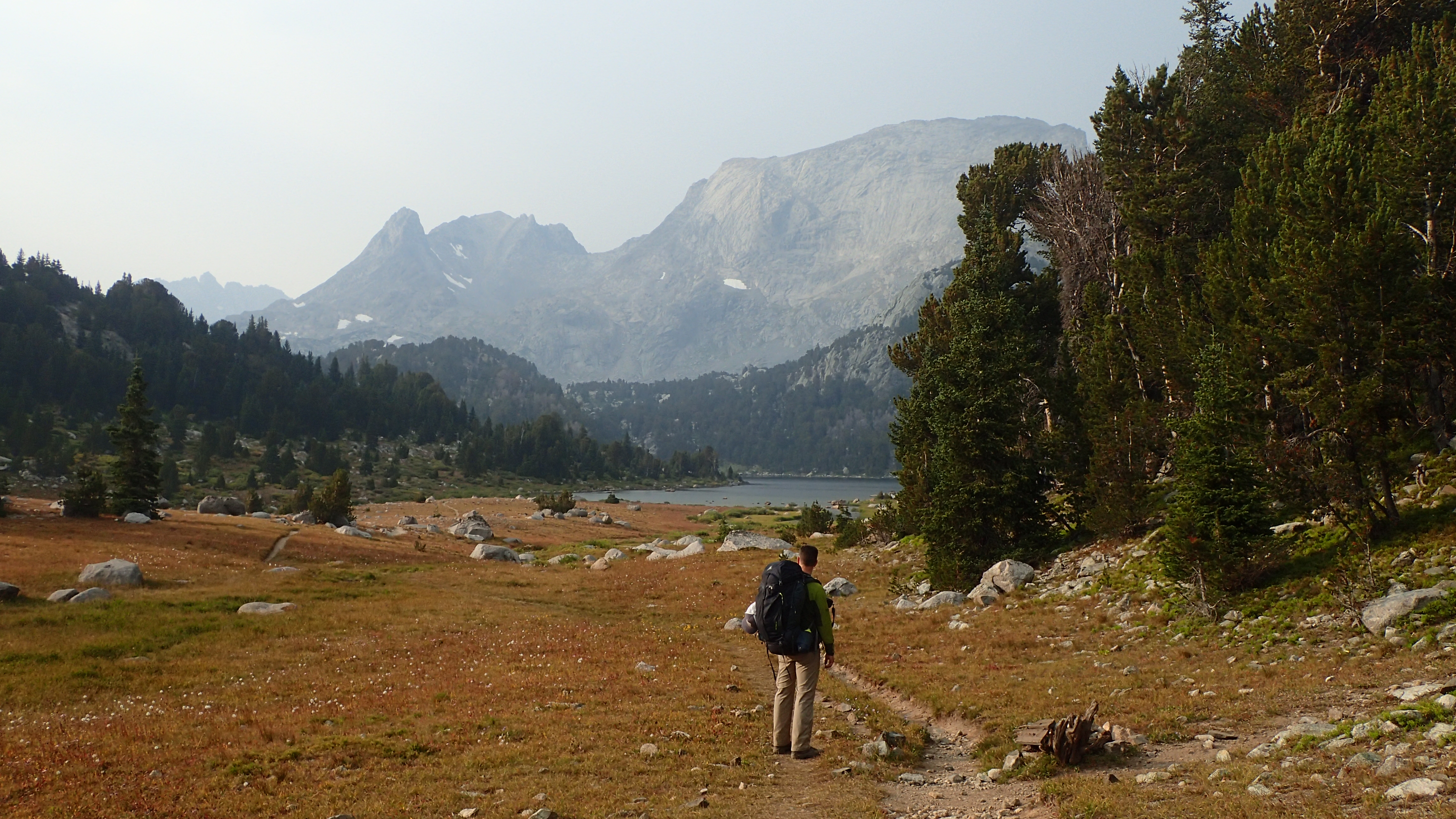
We had seen a fair amount of people along the trail to Mae’s Lake (an older group camping at Mae’s Lake were headed up to Pyramid Lake to get into some Goldens for the first time.) but overall, most of the traffic must have been over Jackass Pass into the Cirque.

At our Mae’s Lake camp, our first night in the backcountry, we discovered our first forgotten item. Pulling out our stoves, I realized I had left my pump assembly for my MSR Whisperlite at home. Jason carries a Whisperlite also, so at least we had one working stove for the trip (even though we had to do some field repairs on it for awhile before it would work properly).

Hailey Pass is very easy from the south, but the north side has a bit of loose scree that you have to be careful with. This being a sanctioned forest service trail (no livestock advised), it was a little dicey in a couple spots going down (it is one of those passes that I think would be easier north to south) with a full pack. That being said, Hailey Pass is a very gentle notch over the divide. The views into the Baptiste Creek drainage are astounding and get even better as you descend down to reveal the whole mass of Mount Hooker to the west.

OLYMPUS DIGITAL CAMERA

Looking at Hailey Pass from the south (Pass #1)

OLYMPUS DIGITAL CAMERA

Looking north from Hailey Pass into Baptiste Creek drainage

OLYMPUS DIGITAL CAMERA

Mount Hooker and Musembeah Peak

We hit Baptiste Creek at the bottom of Hailey Pass and found the connecting trail to Baptiste Lake.  A couple years earlier we had been over the divide from Baptiste lake with no easy route to the east. We followed the trail for a bit and rounded the end of Graves Lake before turning our attention north. We hiked into a beautiful cirque for the evening.

DSC_4462

Crossing Baptiste Creek with Mount Hooker in the background

The expanse of views around us was truly amazing. A couple years before, we had been over the divide from our current location and had similar amazing views (there is no route directly connecting these two cirques). The flat tundra seemed to stretch to eternity and you had massive granite peaks to the west at the head of the cirque and high peaks dotting the skyline to the east, towards the Wind River Basin. Jason took some spectacular night shots of the Milky Way from this location. I bundled up and sipped whiskey this night while gazing at the stars on the open tundra as Jason fumbled with all his photography equipment. His pictures were astounding.

OLYMPUS DIGITAL CAMERAWe awoke sometime in the late night to heavy rainfall. I normally do not carry a pack cover, as I usually spray my pack with a waterproofing agent each year and carry a garbage bag for intense rain in camp. I have only had the contents of my pack get wet once in all my years of backpacking and that was due to some intense rain and snow encountered while hiking (that being said, I always keep my sleeping bag and clothes in a small garbage bag). I did not do either this year. We both woke up and raced to bring our packs under our vestibules.OLYMPUS DIGITAL CAMERA

We arose to mostly overcast skies but they did not look too threatening at the moment. Some of the peaks to our west were enshrouded in clouds or partially obscured. We had 1 pass to go over today and another we would ascend to see what was on the other side to the north. There was another pass we found (from the south it looks like a mini Angel Pass) that would make a nice little loop on a future trip (8 passes in 8 days?). We loaded up and headed west. We went to the far west of the cirque and then turned north to start hiking steeply up the notch to our pass. This was a scramble over steep slopes and some boulder fields (class 4) but was very short. We made the pass in short order. Looking back from where we had come there were lakes everywhere in the basin. It was a beautiful site. Looking to the north, the mild slope was littered with boulders.

OLYMPUS DIGITAL CAMERA

Pass #2 to the right

We stopped on top to refuel and found an old bighorn sheep skull. It was all bleached and had many holes eaten out of it and looked like it had been there for many years. We took some photos and started our partial descent, as we were going to go back up and check out another pass and take the view in to the north. We basically headed due north and gained the easy pass in no time. From this pass you could view some magnificent lake country on the WRIR and clear down into the Wind River Valley. The country was not as rugged as what we were currently in, but looked like a great area to explore with many lakes and streams to be seen. We snapped some photos and decided to head down our drainage to our next camping spot.

OLYMPUS DIGITAL CAMERA

Bighorn Sheep skull on the top of Pass #2

OLYMPUS DIGITAL CAMERA

View north from Pass #2 (“Little Angel Pass” can be seen down the drainage)

OLYMPUS DIGITAL CAMERA

View north from Pass #3

OLYMPUS DIGITAL CAMERA

Hazy view into the Wind River Valley

Skirting a snowfield, it was easy bushwhacking down the drainage. A little ways down we noticed to the north the ” Little Angel Pass” . we called it Little Angel Pass due to its resemblance to the real Angel Pass in the northern Winds. The ledges lead up to the notch and by checking maps looked to be an easy descent to a lake on the other side. This little pass might make for a nice loop sometime if or when we ever get back to this area. We continued down the drainage and stayed high as the stream went into a fairly steep and rugged canyon. A very small glacier still hangs in one of the cirques that drains into the canyon section. Past this section we got caught is some rather nasty Krummholz. This section also had some springs and seeps in it that were not making easy travel. We pushed through this section and went down to a connecting stream between two lakes and travel eased up. We now started to climb again as the lake we were targeting set above the other lakes in the drainage.

This camp area was on par with what we had the previous night, possibly better. Nothing but row upon row of high peaks in a 360 view. The lowlands were nowhere to be seen. The sunset and sunrise were magnificent.

OLYMPUS DIGITAL CAMERA

Golden Trout

The next day we were to get back on the trail system, only for a little while as we decided to take the “scenic” route to some rather popular places. We did this mainly to get away from the masses but also to see new country in an area that we have been to before. We wandered game trails (very nice game trails too) from the reservation to Graves Lake. We were spooking up elk (BIG bulls) all along this route. We made Graves Lake in no time and decided to fish. Back in 1999, we camped at Graves Lake and a very windy evening and morning we were catching feisty Lake Trout at a good clip, but never could land them. It was redemption time. I immediately hooked into a beautiful Snake River Cutthroat and landed it. A while later, scrambling over some boulders, it was site casting to smaller Lake Trout. Jason and I managed to land a couple a piece. Redemption done. It was time to move on.

OLYMPUS DIGITAL CAMERA

Grave Lake

OLYMPUS DIGITAL CAMERA

Jason at Grave Lake

We would cross the outlet of Graves Lake via a bridge (one of the very few I have personally seen in the Winds) and head south for a bit before we would again wander off into the woods. We followed the trail for a bit until we decided it was time to head west, to Spearpoint Lake and over a short pass down to Loch Leven Lake. Leaving the trail we climbed through some nasty downfall timber for awhile then hit a level bench that we followed to the outlet stream of Spearpoint Lake. We then followed game trails up the very steep slope, staying close to the outlet stream. We had to do some route finding as we cliffed out a couple times. In hind-site,  we should have not followed this outlet stream so close. we would have been better off following a gully more to the north. We made the top in short order and crossed the outlet stream and took a break. I actually fell asleep for about a 1/2 hour overlooking Spearpoint Lake. From our vantage point, we could see what looked like a straightforward pass heading towards Loch Leven Lake. This was a very beautiful cirque. Setting off again we made the bottom of the pass in short order and headed up. It was fairly steep, but a fairly decent use trail was found (we assume NOLS uses this offtrail pass a lot) and getting to the top was easy. Reaching the top, the views of Washakie peak, Washakie Lake, Illinois Pass, and Payson Peak were awsome. This pass was not on the Continental Divide. In the next 3 passes we would cross from the Atlantic, to the Pacific, back to the Atlantic drainage over the next 3 days.

OLYMPUS DIGITAL CAMERA

Spearpoint Lake with Pass #4

OLYMPUS DIGITAL CAMERA

Jason on Pass #4 with Mount Washakie

OLYMPUS DIGITAL CAMERA

Payson Peak with Little Washakie Lake and Washakie Lake from Pass #4

We soon lost what semblance of a trail existed so we just started to zigzag down the benches towards Washakie Lake. We encountered some crazy Krummholz here (also spooking more elk) that we fought our way through for a long time before emerging into a wash that we followed down to the bottom and headed to Loch Leven Lake.

Loch Leven Lake had great camping spots, ample tree cover and mosquitoes. I never bring DEET on September Winds trips. I rarely see them this time of year. Jason luckily had some and we both applied it to keep them at bay. We were after the lakes namesake Brown Trout. I’m surprised that any are still in the lake but I have been assured, even though rare now, they are in there. We did not luck into any Browns but we did catch a lot of chunky Rainbows. This lake was fun fishing with decent action. By now, we had caught Snake River Cutthroats, Yellowstone Cutthroats, Lake Trout, Rainbows, and Goldens. We were searching out Brook Trout and Brown Trout (grayling would have been nice but not in our area) to finish out the trip.

OLYMPUS DIGITAL CAMERA

Loch Leven Lake Rainbow

We spent an enjoyable evening and night “out of the high country” at Loch Leven Lake and got up early to head over Illinois Pass to Texas or Barren Lake. We stopped at Little Washakie Lake on this cold and breezy morning to get Jason his Brookie. I jumped up to Washakie Lake and finally caught my brookie. With that in order, it was time to head over Illinois Pass.

OLYMPUS DIGITAL CAMERA

Mount Washakie

Jason and I had dayhiked up this drainage close to Illinois Pass back in 1999. We went east for an overlook of the South Fork Lakes (again in 1999 we spooked one of the biggest bull elk I have seen in the Winds at one of the tarns in this drainage)  instead of staying due south and hitting Illinois Pass. This time we were carrying fully loaded packs. The hiking was easy and towards the top we had to skirt some snow, but very straightforward. There was a rock cairn on top and the views towards Texas Pass and Texas and Barren Lakes were supreme! We stayed on top as this day was a very short day and we could easily see our next camp. The ledges on the north side were very easy to follow and we made it down in short order. We did encounter some loose rubble towards the bottom. Looking back (from the north to the south) at the pass once we were down, it looked more formidable as far as route finding was concerned. I’ve heard a lot of people say stay to the right, and some people say stay to the left. It is hard to pick a line from this side and I can see where confusion can come in. All I can say is, coming from the top, following the ledges, guides you down the north slope very easily. This route had us coming down the “left” side as you look south.

OLYMPUS DIGITAL CAMERA

Illinois Pass (Pass #5)

OLYMPUS DIGITAL CAMERA

Jason headed down south side of Illinois Pass (Pass #5)

OLYMPUS DIGITAL CAMERA

Texas Pass (Pass #6) and Texas Lake as seen from Illinois Pass (Pass # 5)

We camped just above Barren Lake this night. Texas Pass looked steep but very short.

I was sure it was Finis Mitchell’s lost Camera! I had run to take care of some “business” and there it was. Scattered around the rocks on the hillside. There was bits of metal, and what looked like decayed batteries and other unidentifiable stuff. I gathered all that I could find and went back to camp to show Jason. We both agreed it was old. It seemed to me to be a video camera of some sort, based on what was left. We were sure that it was Finis Mitchell’s lost camera (Finis Mitchell supposedly had broken his leg while in the backcountry and it took him 2 days to crawl out, but he lost his cameras during this struggle). We may never know.

OLYMPUS DIGITAL CAMERA

Jason coming up Texas Pass (Pass #6). Illinois Pass (Pass #5) can be seen in the background to the right.

OLYMPUS DIGITAL CAMERA

Jason headed into the Cirque of The Towers

Texas Pass proved to be short, easy and a very good trail (or I should say trails, plural, as there were many routes cairn-ed to choose from). We met 2 groups on the top and one of them mentioned the weather coming in the next day. We continued on down, stopped a lot to take photos, wait out a drenching rain and thunderstorm, and then peel off to eventually hit the designated trail above Lizard Head Meadows, our destination for the night. We crossed the meadow to the south and set up camp. Jason went out to take pictures and I went out to fish. I told him I was going east down the river, but went west. Jason said he was going towards the Lizard Head Trail, he went towards the Cirque. I guess we should communicate better.

OLYMPUS DIGITAL CAMERA

Pingora!

OLYMPUS DIGITAL CAMERA

North Fork Popo Agie and Lizard Head Meadows

Fishing small streams. The North Fork Popo Agie from Lonesome Lake is a blast! I dig fishing small streams. I geared up my 4 weight Winston BiiiX and hit the water ( I did wish I had my custom 3 weight I built this past winter though). It was big floating flies, Cutts and one rogue Brookie all day long. Slapping a fat dry in any slack water section elicited a strike. A couple of the Cutts surprised me by their size. I had my fill of slinging bugs in lakes this trip and was enjoying some moving water. I started out at the western end of Lizard Head Meadows for some spooky Cutts. The meadow section was very marshy and I did not want to deal with it, so I headed upstream into the trees. I had the rest of the day to myself fishing my own private water some 10 miles from the nearest trailhead in one of the most scenic areas in the Rocky Mountains. This was by far my favorite day I had fishing this past year ( that includes a couple epic days on the North Platte this past spring and fall). You combine a lengthy pack trip, spectacular scenery, good company, and great fishing, that is my recipe for a great time.

OLYMPUS DIGITAL CAMERA

North Fork Popo Agie

Jason and I gathered again and headed out towards sunset to get some shots of Pingora in the Cirque. We found a nice spot on the other side of the river and stationed ourselves there for some photos. It would be way past dark as we had to negotiate our way back through the meadow and all of its marshes to camp. It is safe to say that we were not necessarily dry once we got back to camp.

It rained hard off and on all night and we awoke to low hanging clouds and Lizard Head Peak hanging above us was hidden. We had allotted ourselves an extra whole day in the Cirque to possibly ascend Lizard Head Peak. This was not going to happen today. We heated our drinks for the morning and contemplated on what we wanted to do. We discussed the weather forecast we were given by the couple on top of Texas Pass, and if we wanted to “deal” with possible drenching rain and snow and have to hike out the next day. We hated to cut the trip short, but decided neither of us really wanted to deal with the potential weather coming in and would head out this day.

We loaded up and headed up over Jackass Pass. We had been to the Cirque of Towers twice before, the first time via Dickinson Park and once via Jackass Pass. This trip dropped us in via Texas Pass and out via Jackass Pass. The clouds lifted and enabled us to get some dramatic photos of the Cirque from the pass. Just to the other side we met a young man pumping water. He inquired on the quickest way out. We did not talk long, but gathered that he had come in (he looked to be solo) via the Big Sandy Trailhead, but went east somewhere around Big Sandy Lake ( Possibly getting on the trail to Clear Lake?). He mentioned that he dropped into somewhere around Lizard Head Meadows. I assume he found a notch somewhere east of Mitchell Peak. He said he didn’t really know. I mentioned I did not know any easy way over the divide due east of Mitchell Peak and he must of had a hell of a trip over. He looked a little frazzled but then I noticed he followed us on the climbers trail west of the actual trail (a mistake. with full packs, a short section of this route was a little difficult around Arrowhead Lake). We got to the inlet of North Lake and eventually stayed too low and went through a boulder field that was a cairned mess. Whoever took the time to cairn this mess was/is an idiot.  Advice: go high and stay out of the boulder field.

We busted out the last 10 miles in short order and just before the sky opened up. By the time we reached Pinedale (we decided to stay in town and not drive to Denver) it was raining/sleeting pretty good. We headed to the Wind River Brewery (still have my favorite porter) to grab a post hike beer and some food. When we awoke the next morning, when you could catch a glimpse of the high country, there looked to be plenty of fresh snow. This made our decision the previous day more palatable.

We did not know how this route would turn out when we planned it. We wanted to visit the Cirque again but also see some new territory along the way and avoid some of the crowds. It just turned out that we were passing lakes with many different species of trout and that turned into a fun “game”, trying to catch as many different species as we could. It was great to get back to a place where our fondness of the Winds was first fostered. This was our third time back in the Cirque and I hope not the last. Continue reading

Gannett Peak

Gannett Peak, Wyoming

Gannett Peak, Wyoming

Early August 2000: My back-country partner and cousin, Jason Sellers, had officially opted out for this years Winds trip. I had been planning a trip to the base of Dinwoody Glacier for months to climb Gannett Peak, the highest point in Wyoming. I decided to go anyway and do a little reconnaissance on the route. I had no intention of climbing it alone. I decided to head up the Glacier Trail outside of Dubois and hike over the crest of the divide into Titcomb Basin and exit Elkhart Park outside of Pinedale (my parents offered to shuttle my car around). It would be a whirlwind 4 day hike through the northern Winds. I would Haul a 55 pound pack up and over Dinwoody Pass during an August sleet and snow storm (a storm in which I would frostbite 3 fingers)  and see one of the most beautiful sites in the Winds as the clouds lifted from the high peaks surrounding Titcomb Basin (Gannett would be enshrouded in clouds this whole day). Little did I know at the time, it would be 16 years later before I would venture up the Glacier Trail again.

Mid July 2016: Jason and I decided to make Gannett a reality in 2016. We had been for years searching out the most remote corners of the Winds in the “off seasons” (many trail-less miles over the years)  in hopes of finding untapped scenery and fisheries. We found many drainages holding large cutthroats and even larger golden trout. Many of the best fisheries (and scenery) were many trail-less miles far from any trailhead. Some of the most beautiful sunrises we awoke to were on the Wind River Indian Reservation Roadless Area, a vast area on the eastern side of the Wind Rivers with some of the best cutthroat action we have had in the Winds (a couple spectacular golden lakes are on the WRIR also, but we have found much better golden lakes on public land). We have almost always made the pilgrimage to the WRIR from the “Bridger” side of the Winds.

Gannett was going to be a unique trip for us this year. We both decided to step away from remote parts of the Winds and join the masses attempting Gannett Peak. We would pack away the rods (even though we did bring fishing equipment and spent an enjoyable afternoon chasing some spunky brookies and cutts) and head up the Glacier Trail for our attempt. We chose the Glacier Trail, even though at 25 miles from the trailhead to the base of Dinwoody Glacier (you still have about 3 miles to the top of Gannett Peak from here) is a bit longer than the approximate 18 miles to a base camp at the base of Dinwoody Pass in Titcomb Basin, because it would allow us a much easier and shorter ascent day. The Elkhart Park route via Titcomb Basin, you have to climb up the 13,000ft Dinwoody Pass (also known as Bonney Pass), then lose most of that elevation down onto Dinwoody Glacier, cross Dinwoody Glacier (not heavily crevassed but caution is advised, and depending on conditions can be steep snow or slick scree on the Titcomb side (snow much preferred)) then ascend Gooseneck Glacier then Gannett proper. This would have to be done in reverse obviously going back. This can easily be a 12+ hour day of mixed snow and rock. The Glacier trail approach is a much easier summit day as you can set up a base camp near Dinwoody Glacier and have a straightforward summit attempt from the base of the mountain.

Day 1: I left early from Denver to drive up to Casper and have breakfast with my parents. Jason was wrapping up his brothers wedding in Buffalo, at the base of the Bighorns, and was due to be back in Casper around noon. We headed out of Casper after stopping at the Mills Taco Johns (it’s a Wyoming thing) for our pre-hike meal around 1 PM. We were headed to Dubois.

Glacier Trail Trailhead

Glacier Trail Trailhead

We hit the Glacier trail early evening and hiked until it was fully dark (about 6 miles). We had a full moon though that allowed us to stumble to the creek and filter some water for dinner and the morning. We had busted out the switchbacks headed toward Arrow Pass and were in view of the pass from our camp. Tomorrow we would head down into the Dinwoody Creek drainage, running high and fast with its large amount of glacial silt.

Day 2: We awaken to a view to the north that is spectacular. We witnessed a beautiful sunrise on the Absaroka’s  across the valley from us. We soon packed up and headed over Arrow Pass and down into the Dinwoody drainage.    From here we would have the long slog up to the terminal moraine of Dinwoody Glacier. We were already pleasantly surprised that we had not met anybody on the trail yet. The trail up the Dinwoody drainage is a beautiful path with massive Dinwoody Creek (creek? depending on glacier melt,  this “creek” can be a raging torrent of ice-cold aquamarine water that would deter anybody from crossing) that slowly works its way upstream. The high peaks are hidden for miles, but the traveling is easy.

The flat expanse of Arrow Pass

The flat expanse of Arrow Pass

Traveling the Dinwoody Creek drainage, we approached Downs Fork Creek, a creek draining the Downs Fork Glacier. This is the only real bridge on the Glacier trail and it has taken a hit over the years. It has been severely damaged (although just by looking at it, looks ok) from flooding waters from above over the years. We actually talked with forest personnel at the bridge as they did a survey on possible repairs or re-routing the trail a mile up Downs Fork Creek for another bridge for a safe dry crossing. This would add another 2 miles to the Glacier Trail. Our opinion was to re-route the trail, if you wanted a dry crossing. You could use the “old” trail if you wanted to save the miles and wet wade through it (even though this is a substantial “creek” with slippery glacial silt). As it was, the creek was flooding the banks anyway and we had a significant portion of wet wading even with the bridge there.

Glacial melt of the Downs Fork

Glacial melt of the Downs Fork


We hiked around 11 miles to Big Meadows and decided to camp for the evening. We found a high use campsite above Dinwoody Creek that had some tree coverage. We filtered our water out of a seep pond to try and not plug up our filters with glacial silt from the main creek and relaxed for the evening. Towards dusk we heard the sound of horses coming from upriver (a few of them had loud cowbells attached to them….assuming so they would be easier to locate in the morning and as a bear deterrent…….this part of the Winds is now established grizzly habitat) heading towards our camp. It seems that there was a large outfitter camp a couple of miles upriver and the horses being familiar with the country, traveled in a circle from their camp down through this meadow….all night long. The clanging of their bells and the wallow pit they would roll in just a few yards from our tent kept us up most of the night.

Day 3: We awoke to a beautiful morning. The past couple of days, the weather had been hot and dry during the day and today looked to be no different. We packed up and planned on hitting our base camp at the terminal moraine of Dinwoody Glacier later that day. We hiked out of Big Meadows and decided to filter some water out of Dinwoody Creek. I immediately proceeded to break the handle on my pump (it had not been working too well up to this point anyway, even after extensive cleaning) and once I fixed that, proceeded to blow out all the seals (due to the glacial silt) rendering it useless. This left us with one operating pump for rest of the trip, even though it had slowed quit a bit and did not know how long it would last (this pump did not have a filter that you could perform any field maintenance on).

Dinwoody Creek

Dinwoody Creek

We eventually made our way with the intersection of the Ink Wells Trail, about 18 miles from the trailhead. We saw the big outfitters camp, near this junction. Around mile 19, rounding a corner opening up before Floyd Wilson Meadows, we saw Gannett Peak for the first time this trip. This is the classic vantage point of Wyoming’s highest peak that is flanked by five of the largest glaciers in the Rocky Mountains. There is not a more true alpine peak in the lower 48. We stopped frequently to snap some photos and gradually headed upstream. We would eventually have to cross Gannett Creek. This proved to be the crux of my 2000 solo hike. This is a high gradient torrent draining Gannett Glacier. In 2000 I was able to cross on logs and once on the other side, pull my backpack across with some parachute cord. This time the crossing proved much easier as we headed upstream, where the “creek” was more braided and managed to cross fairly easily.

Finally our first glimpse of Gannett Peak

Finally our first glimpse of Gannett Peak

From Gannett Creek, you start climbing towards the divide. We started to see a few camps and people at this point. We stopped and talked with a NOLS group (you can spot a NOLS disciple by the hiking shorts and gators) that were setting up camp at the terminal moraine and heading over Blaurock Pass the next day.

We finally picked out a decent spot to camp and filtered some water and ate. Our plan was to turn in early tonight and get up around 4am to get a jump on the mountain. With the warm temperatures we were having, we wanted to get up and down off the summit ridge snow-line and Gooseneck Glacier prior to the snow getting too soft.

Our first view of our route up Gooseneck Glacier

Our first view of our route up Gooseneck Glacier

Day 4: We awoke around 4am and drank some hot fluids and some breakfast bars and made sure we had all our equipment. We packed our helmets, crampons, mountaineering axes, cameras and other essentials and headed out under headlamp to tackle the boulder field. We saw a couple headlamps in the distance on Dinwoody Glacier (they must have been coming from Titcomb Basin) as we pulled out.  They must have left their camp at 2am or 3am to get where they were now.

The boulder field was interesting under headlamp but we were able to pick our way through it fairly quickly. As we approached the base of Gannett Peak, the sun was starting to rise in the east. We started to ascend the mountain now alongside a small stream coming down from Gooseneck Glacier. We found a cliff band with some seams in it that we took up to the bottom of the glacier. We had spotted another group (3 people) coming from the Glacier Trail side only about 30 minutes behind us. They would skirt this cliff band and hit the east side of Gooseneck Glacier, staying all on snow, versus our mixed rock and snow route. The two headlamps we saw coming over the divide earlier that morning were working their way above Gooseneck Pinnacle now.

On the Pinnacle Ridge looking up to the summit ridge

On the Pinnacle Ridge looking up to the summit ridge

We put on our crampons now and headed up the mild slope towards the pinnacle.  We had a fairly steep gully to push up and hit a ridge, where we took the crampons off and traveled on the rocks until hitting the glacier again. Once we got onto the Glacier a second time, we cruised over to the make or break point of the summit attempt, the Bergschrund. This is the point where Gooseneck Glacier pulls away from the mountain as it travels downward and creates a vast crevasse. A snow bridge exists most years until late July or even into early August, but once it is gone, the complexity of the route changes dramatically. We banked on the snow bridge being intact for our attempt as we did not come prepared with equipment needed for a collapsed snowbridge.

We surveyed the snow bridge (it was actually like two snowbridges as you had to make a “Z” over the crevasse) and deemed it safe. It was calving in pretty fast and with the weather looked to be only a week, maybe two from falling in. Once across the bergschrund, the slope steepened significantly. It was about a 50 degree angle on snow and a fall could land you at the bottom of the opened bergschrund if you did not slide over the bridge (this is one spot on the mountain that many people rope up). If you did slide over the bergschrund unscathed, there was a nice run out to stop you though. At this point we were approximately 13,000ft above sea level.

We worked our way up the gully beside Gooseneck Pinnacle and hit the rock again. We once again took off our crampons and proceeded to make our way towards the ridge line. We had one gully to cross before climbing and popping out on the ridge that would lead us to the next snowfield and finally the summit. This gully had a snow chute that we decided to cross in boots, as it was short and had good hand holds on rocks. A slip though was a steep 100 yard drop then an even steeper drop over a 500 foot cliff to Gooseneck Glacier below. once on top, we could look over the other side and see the upper portions of Dinwoody Glacier below us. It was a beautiful site.

We continued up this ridge and eventually hit the summit ridge snow crown. This is a fairly steep and exposed section with a 1000+ foot cliff at the bottom. We started up this section and we met the two climbers ahead of us coming down (we were about 30 minutes from the summit from here). We found out that one of the climbers, this was his third and only successful attempt on Gannett. He had been turned back once by the bergschrund and another time by personnel conflicts.  He was being guided by a man out of Jackson, and they were roped up, moving cautiously down. They still had a big day ahead of them as they still had to climb back over Dinwoody Glacier and Dinwoody Pass back down into Titcomb Basin. Jason and I were glad we had taken the slightly longer hike in to do an easier summit day.

Gannett Peak Summit ridge

Gannett Peak Summit ridge

We pushed on and finally made the summit ridge line. Once on the ridge line, it was straightforward to the summit. It was mainly on snow with some rocks mixed in, but you could leave you crampons on until the final summit block. We were careful with our footing as a slip could be disastrous. A fall could be hard to self arrest and if you failed to do so, you had a 1000+ foot cliff at the bottom where you would land on top of Gooseneck Glacier. We clung as high on the ridge as possible, but not too high as the other side was a 3000+ foot drop to Mammoth Glacier below. We could see the Grand Teton in the distance (about 70 air miles from Gannett) and a haze caused by a big fire in the Gros Ventre on the Hoback River. Some of the “open” crossings where you could get a good glimpse of the other side and the exposure were a little gnarly as the wind would whip through them, keeping your balance was important.

We finally hit the summit block and took off our crampons and scrambled up the last 50 yards or so to the top. We were the second group to summit this day and had the summit to ourselves. The weather was perfect, a little windy but not bad. We had a 360 degree view of Wyoming from its highest point and what a view it was. We proceeded to check things out and explore the summit and set up the tripod for some summit photos. We spent more time on the summit than planned and the party that was behind us reached the summit about an hour after we did (we spent a little over an hour on the summit). It was a husband and wife (both in their early 60’s) being guided by another guide from Jackson. They were state highpointers and they had done Denali and many other major mountains, but Gannett had eluded them the first time. Everybody that we met on the mountain this day, all had previous failed attempts on this mountain. Jason and I felt fortunate to get the perfect conditions to summit in our first attempt.

Summit of Gannett Peak, highest point in Wyoming at 13,804 ft

Summit of Gannett Peak, highest point in Wyoming at 13,804 ft

We decided we had stayed long enough (much longer than anticipated, especially after our “late” start) and headed down. The snow, even on the summit ridge, was getting a little mushy and footing not as good as it was coming up. Leaving the summit ridge,via snow, to the ridge that heads towards Gooseneck Pinnacle was fairly mushy and footing not good at all. The steepness of the slope here and exposure forced us to beeline as quickly to a cluster of rocks we did not use coming up (we later saw the group we met on the summit, they were being belayed by the guide down to this cluster of rocks. They did not trust the footing either). We followed this ridge down to the Goosneck Gully where snow conditions were even worse. My crampons were constantly balling up with snow and actually took a quick slide on the snow bridge down to Gooseneck Glacier where I easily self arrested. Once on the Glacier we had our mixture of snow and rock going down and a few mental lapses in route finding but easily made our way back to camp. It was a little before 3 PM when we arrived.

Grand Teton (second peak mountain in Wyoming) as seen from Gannett summit ridge

Grand Teton (second highest peak in Wyoming) as seen from Gannett summit ridge


Fremont Peak (third highest peak in Wyoming) as seen from Gannett

Fremont Peak (third highest peak in Wyoming) as seen from Gannett

Jason crushing it prior to getting on the Gooseneck Glacier

Jason crushing it prior to getting on the Gooseneck Glacier

Day 5: We awoke and decided to start our hike out. We had potential plans of heading over into Titcomb Basin or check our Blaurock Pass, but opted for a return (Jason was looking forward to spending time with his dad in the Riverton area) journey. We hung around and took photos all morning then packed up and headed to Honeymoon Lake.

Day 6: After fishing for some cutts in Honeymoon Lake the previous night we headed up the switchbacks towards the Dinwoody Lakes to fish a little and then move on to where we camped the first night, on the north side of Arrow Pass. We were in no hurry to go anywhere (even though Jason’s filter broke at Honeymoon Lake and we were boiling water at this point). Day 6 ended with a bang. After all the years of hiking and gnarly off-trail excursions with 50 lb packs, one of us sustained a backcountry injury. We had just left the trail and entered a gully to get over to our camp site. Jason mentioned there were some loose rocks (he was in the lead) so be careful. I proceeded to follow him with caution and before I knew it, I had slipped and stumbled forward (usually you lose your footing and fall back and land on your pack) and the weight of my pack pushed me forward (I was on a downward slope) and I slammed my face into a rock. I heard a nasty crunching sound as I made contact. I came up a little woozy (don’t know if it was from the adrenaline after falling in my system or hitting my head). Jason asked if I was alright and I said I’m going to be spitting out teeth and gonna need a dentist as I slowly rolled over. I spit and nothing. I gathered myself and examined my mouth and everything seemed intact, no loose teeth, no blood, just a nasty contusion on my cheek that stayed there for months. I was still a little woozy and a storm was coming. Jason noticed my wrist, which I did not at all, and asked if it was alright. I examined it and noticed it was a little puffy and sore. We decided to cover my pack and head the 1/4 mile down and set up camp before the rain and give me time to get that woozy feeling to calm down. I iced my wrist in camp (well, cold creek water in a titanium flask) and contemplated getting my pack.

In a short time I walked back to get my pack. I noticed at this time it was painful to lift things with my right wrist, still just thinking it was a sprain or something. I assumed it would hurt a lot more if it was truly broken.

Day 6: we packed up and headed the 6 miles to the trailhead. We would then drive to Jason’s dad’s house near Pavillion and drop him off, then it was off to Casper for dinner with my parents, then off to Denver later that night.

I still didn’t think my wrist was broken but by the urging of my wife I went to the urgent care to have it checked out. It was broken. I got a cool cast and was still able to fish the rest of the summer (shhhh, don’t tell my wife!) so wasn’t too bummed.

Gannett Peak with Gooseneck Glacier and Pinnacle

Gannett Peak with Gooseneck Glacier and Pinnacle

Gannett Peak is a great mountain to climb. In the best of conditions ( I would say Jason and I had almost perfect conditions), this is a fairly easy mountain to climb if you come prepared with the proper equipment (I would say crampons and ice ax a must in any condition. In anything but perfect conditions, a rope is necessary). Jason and I have slogged 50+ pound packs over off-trail passes in the Winds that were physically harder than climbing Gannett, but Gannett is not an easy peak. You should have basic knowledge of walking in crampons, use of ice ax, self arrest technique, and rope technique for anything other than perfect conditions. You should also be prepared for some decent exposure on the summit ridge. I can truly say Gannett Peak 2016 was a spectacular experience.

Gooseneck Glacier

Gooseneck Glacier

Upper Dinwoody Glacier

Upper Dinwoody Glacier

Fishing Books: My favorites

I love reading. My book collection consists of mainly non-fiction works centered around western  history and exploration ( mainly Wyoming history), a few adventure travelogues and the bulk of it, fishing books ( consisting of both “how to” and  fishing destination books). I am a sucker for any book in any of the above genres, and I would like to share  a few of my very favorites.

“What Trout Want” by Bob WyattThis book is a must have for any fisherman, be it fly fisherman or spin fisherman. It dives into some pseudo science (mainly observations) about how trout respond to certain stimuli and situations. It mimics my approach to fly fishing through my own observations and reinforces what I have gathered about trout. Basically, Mr. Wyatt says trout are dumb (even those trout supposedly “educated” on hard fished waters) and are just a bundle of hardwired nerves. They have a hardwired response to certain stimuli and cannot “think” in the sense that a human can think.

The main takeaway from this excellent book (a book that you have to re-read many times to get the most out of it) is that presentation is crucial in catching trout, not necessarily the correct fly. I have taken that approach for years in my own fishing. I feel that if you take any fly that has the general size and shape of the naturals, and make it act the way the naturals the trout are feeding on, you have a good chance of hooking a fish. I think, as does Mr. Wyatt, color plays a minor role in fly selection. You just have to have something that behaves similar to those naturals and provides some sort of trigger (movement) that shows that your fake is alive. let’s face it, if trout where “smart” how can they overlook the hook even on the most exact imitations? And take a look at those exact imitations.  I would say 99% of the exact imitations do not even look similar to the naturals.

This book also talks about generalist fly design and the different types of presentations and the “why” of catching or not catching trout through observation.

This  book is by far the best “how to” book in my collection. If you are not in the generalists camp, this book will give you something to think about (and maybe convert you).

“Fly Fishing Tailwaters” by Pat Dorsey

Here is another excellent book. It maybe should have been called Fly Fishing Western Tailwaters, but has information on fishing any and all kinds of water, not just your average tailwater. The reason this book excels is in the organization. It has info on hatches and how to fish them (and going back to “What Trout Want”, you do not necessarily need to know what fly to use (a generalist pattern in a similar size and shape of the natural would work just fine in 99% of situations), just how to fish them) and dry fly rigs and nymph rigs and what trout you might find in a tailwater (again, mainly in western tailwaters). This is a good primer on fly fishing in general and I re-read sections of it every season to gain new ideas or correct bad habits I may have gotten into. I would recommend this book to anybody new to fly fishing.

“Sight Fishing For Trout” By Landon Mayer

P1080336

Her is another excellent book by a “local” angler and guide here in Colorado. This might be a little more “advanced” book for fly fishers but has equally enough info to use for someone new to the sport. It is loaded with helpful tips and insights into how to approach trout in many different situations. I like reading Mr. Mayer’s articles in the many different publications he writes for. He is always straight to the point, and usually I end up thinking, “huh, I never would of thought about doing that”. This book is about hunting for trout, not just reading the water and hoping for the best (although you must “read” the water to sight the fish in the first place).

“Fly-Fishing Stillwaters For Trophy Trout” by Denny Rickards

I almost did not buy this book because of the title. That would have been a huge mistake. The information on fishing stillwaters in this book is some of the best. The book consists of the authors thought process fishing mainly trophy stillwaters throughout the west. It is organized very well and he explains in detail the many different lines in use and how to fish those lines and get the best presentation to mimic the insects you are fishing. It does not talk about fishing the high mountain lakes (some of which have trophy potential themselves), but most of the information can be modified to effectively fish most high mountain lakes. I have a few books on fishing the high mountain lakes specifically, but I would recommend this one over all of them. You will have to do a little field research and modifications on your own based on Denny’s method to get the most out of this book for these lakes though.

This book is LOADED with big fish photo’s and that alone makes this book worth the money.

“Handbook of Hatches” and “Trout Rigs and Methods” by Dave Hughes

I would say that “Handbook of Hatches” is the ONLY book you need on trout food for fly fishing. You don’t need to know Latin names of bugs (unless you want to), just where you might find these bugs, at what time of year, how these bugs behave in or on the water and how trout feed on them. This small book is all you need. Very concise and well written. Pat Dorsey does cover trout food behavior very well in his book also.

“Trout Rigs and Methods” is maybe not essential, but useful. It is loaded with hundreds of different trout rigs for all forms of fishing. If you are looking for a new way to rig up, check this book out. It also has a good section on useful knots, but the editing on a few of the diagrams is hard to follow (and on some, actually incorrect).

Fly Fishing Destination Books: a few of the best

“Fly Fishing The North Platte River” by Rod Walinchus

This out of print book is what a river guidebook should be. Mr. Walinchus covers the whole river system from Colorado to the Wyoming/Nebraska border and even includes the High mountain lakes in North Park Colorado. It may be a little dated, but most of his information I do still find true today.

“A Fly Fishing Guide to Colorado’s Indian Peaks Wilderness Area” by Steven Schweitzer and Michael Kruise and “A Fly Fishing Guide to Rocky Mountain National Park” by Steven Schweitzer  

I may be a little biased to these two books as I have fished many of the streams and lakes mentioned in them. That being said, these books are excellent in covering all the small streams and all the lakes containing fish in this wonderful area. It is very well organized and easy to use. The photo’s are a bonus. The only other guidebook I have seen that matches the in-depth  information on a backcountry fishery is “Fishing the Beartooths” by Pat Marcuson.


The North Platte River: November 2015

Beautiful day on the Platte

Beautiful day on the Platte

So I found myself driving again up to Wyoming to visit my parents and fish with my dad in mid November. I had just returned from Iceland and was salivating over the rivers I saw there (unfortunately they were already closed for the season), and couldn’t wait to get some quality fishing done on the North Platte.

Saturday 11/7/2015

I left after my daughters soccer game in the “H.R.” (which they won…Go Fire and Ice!!) and arrived in Casper in the early afternoon. Surprisingly, the wind was not blowing, even though it had blown very hard most of the way to Casper. The forecast had said that the wind was going to be something else this week (50+ MPH gusts….a breeze in Wyoming). I brought along an 8 weight rod just in case ( I will not let a little wind keep me off the water!!). We thought about hitting “The Reef” for a couple hours but ended up talking and catching up.

Sunday 11/8/2015

My parents get up way too early!! I always agree to go walk the dog with them at 5am, mainly because I am so eager to get out and fish at first light, even in the winter. This morning we awoke at 4:30 to walk the dog (to be ready by 5am) and the wind was brutal (I spent the first twenty years of my life in Casper and I still cannot get over how brutal the wind can be). I am serious when I say, It almost blew me over a couple of times. The gusts were incredible. I was starting to contemplate in my head how well this fishing thing was going to work out today.

We headed out of town about 7:30 and decided to hit the canyon and try and get out of the wind.  The upper section was fairly crowded so we went all the way above and hiked in to the base of the dam. The wind howled through here also but we got into fish right away. I hooked a typical canyon rainbow that is almost impossible to get their head up and net. These fish in the canyon are some of the healthiest and strongest fish I have dealt with. A trip to the canyon earlier this spring, had me hooking fish at a good clip but I was having a difficult time landing them in the jumble of pocket water (I was also nailing them on emergers and using 7X tippet on a stiff 6 weight rod…….A recipe for disaster or just not being very smart. Surprisingly though, I had no break-offs, I lost them due to pulling the small, size 20 or 22 emerger from their mouth. I have always carried 7X but never use it because it is impossible to work with. I’m still not sure why I experimented with it down there or why I even carry it). We did not fish long, and after a few hits and a couple of fish to net (one real nice, hefty rainbow) we hiked out and formulated another plan.

Dad hiking into the canyon

Dad hiking into the canyon

Initially we thought about heading to “The Reef” but decided to take a right and head out to “The Mile” despite the wind. I verified my dad had packed enough Pabts for the day and we arrived at the Mile and drove upstream of the bridge. there were not too many people on the river and the wind surprisingly was not bad at all (most of the cars had Colorado plates of course).

We immediately were into fish. Small for the Mile but we had action. I proceeded to go up river as my dad stayed at a long wide pool. Once I hit the pocket water, it was game on. Every good seam I hit had a decent fish in it ready to slam my size 20 brass midge. My top fly was a micro pink San Juan worm (on a size 14 hook), but only the smaller fish were nailing this. I was fishing my 6 weight, and my use of too light of tippet, led me to four fish that broke me off. I landed plenty of beauties but lost a few more than accustomed to. The flow was a little above the minimum at around 800cfs.

Brass Midge

Brass Midge

Dad trying to figure out his rig

Dad trying to figure out his rig

Monday 11/9/2015

The next day we had our usual green chili  breakfast at the Cheese Barrel and sat and caught up with Bill (he is one of the “locals” my dad has coffee with every morning. He looks great for being eighty and has many interesting stories to tell).  We headed straight for the Mile after breakfast. We headed straight for the same pocket water. We would fish this 300 yard stretch all day and not see anybody else fish it. The fishing was identical, if not better than the previous day. The wind was never a factor.

I rigged up my Winston BIIIX nine-foot 4 weight today. This rod has a much softer tip than my St. Croix Legend Ultra I was using the day before (softer than both my 5 weight and 6 weight), and besides my Orvis Ultrafine  eight-foot 4 weight, is my favorite rod. The weather was sunny and eventually got fairly warm. The fishing started out a little slow for smaller rainbows but soon the bigger fish started munching. Fish were where they are supposed to be:  behind rocks, in front of rocks, in the seams on either side of rocks, and the deeper, slower pools. A dead drift through any of these spots would produce a fish or a strike. The larger fish were still hitting the small midge. Later in the day I would get a couple on the worm though.

Miracle Mile brown

Miracle Mile brown

Later in the day I hit the top pool and the riffles coming into it. I had two break-offs immediately and then proceeded to take two beautiful fish from this run. We decided to work our way back and in the tail of this run I hooked a gorgeous rainbow. Once hooked, she hunkered down in the pocket for a while then jumped from the water. This is when I knew I had a massive rainbow on the end of my line. She immediately took to the other side of the river where the main current was (and this current was hugging the far bank, so it was literally on the other side of the river) and headed downstream just a bit. My indicator was under water and for the first time I felt my backing on my index finger coming out of my reel. I was losing all hope of landing this fish once I felt my backing. I messed with the angles on the fish though and I was able to start moving her to my side of the river in fairly short order. The battle did not last that long and I got her to where just my leader was out of my rod tip. She was tired and I could keep her head up BUT my arm was tired also. The combination of the soft tip, longer leader and shaking tired arm made landing very difficult. I finally did land this beautiful rainbow. I have caught longer rainbows, but this might have been the heaviest (It was very close to my previous biggest rainbow caught below Willow Bend Campground on the South Platte a few years ago. It was an obvious escapee from the Wigwam Club. I estimated this fish at around 7 to 8 pounds). My dad and I estimated it at about 8 pounds.

Big Miracle Mile rainbow

Big Miracle Mile rainbow

Dad adjusting his rig

Dad adjusting his rig

Tuesday 11/10/2015

We had a few hours in the morning to fish as I had to return to Denver and beat the storm that was coming in (It would start snowing in Casper about an hour after I left for Denver). We decided to hit “The Reef”. To our surprise there were about 3 or 4 other people fishing near the dam. I proceeded to hit a seam on the far side and had a couple hits and then a real nice one that took me out a ways and broke me off. I eventually landed two or three typical Reef rainbows in the short time we had to fish and was satisfied.

The North Platte River has some of the meanest, biggest, healthiest fish in the west. I haven’t fished every tailwater in the west, but it would be hard to find a river that can pump out the size of fish the North Platte River system does on a consistent basis. This is no doubt my best and favorite destination for big tailwater trout.


Wind River Mountains: September 2015

Jason and I are getting older. It was brought to my attention that this trip would mark 30 years (technically, 29 for me) since we had first ventured into this amazing country. We have done numerous trips over those years ranging from just a few days to 2 week long trips. We have ventured from north to south and from south to north again and have rarely seen the same area twice. You can design epic treks using just the forest service  trail system or designing some great off-trail routes all your own, and you even have the Wind River Indian Reservation Road-less Area to explore (with trespass permit of course). The scenery is what the average person envisions the Rocky Mountains to be, High craggy peaks, tons of glacially carved cirques, and a plethora of high country lakes (most loaded with some species of trout).

I picked Jason up on a Friday night from DIA and we headed up to Rawlins, Wyoming. We have made the trip all the way to the west side of the Winds from Denver at night before, pulling in at 2 am, only to find no camping spots at the trailhead and proceeded to hike 2 miles under headlamp to find a spot. We have opted the last few years to not do this, and stay in luxury at a motel on the way up (luxury being loosely defined in a Rawlins motel). Rawlins would give us a big jump on the hike for Saturday.

We had reports that the weather was to deteriorate  mid-week so we were prepared for the forecast of cold and rain/snow. We would be in the shadows of the highest peaks in the northern Rockies and they had forecast a “few” inches of snow mid-week.

We arrived at a very popular trailhead outside of Pinedale (we would see more people this first day of hiking than we had seen in the past 3 years hiking the Winds combined. It was still not “crowded” by any means. We probably met a dozen people this day). I have been on this trail many times over the years and can see why it is so popular. From the west, it always has views of the high country and gets you to that high country in an easy 12 to 15 miles. Most of the trails on the Bridger side are long and tedious (not necessarily hard) before you get a good glimpse of the high country. We weighed our packs here. We both weighed in at the exact weight…..54 lbs!!!! That is easily 10 lbs over what I like to pack.  Oh well, lets start hiking.

Pack weigt

Pack weight

We hit the trail early afternoon (after a light carb loading lunch and salad at the Pinedale pizza joint) and planned on hiking as far as we could before dark. With a 54 lb pack it was going to be interesting on how far we made it. We met a lot of people coming out and one who had lost her dog (she was hiking in and we met somebody earlier who found the dog hiking out). Everybody coming out had said the past few days had been incredible weather. It was warm but not too warm, perfect hiking weather.

Michael and Jason at the trailhead

Michael and Jason at the trailhead

We made it about 10+ miles in the first day and set up camp. I felt pretty good with the heavy pack but was tired. Staying up till 2 AM, closing down the motel bar in Rawlins (we had time for 2 night caps after pulling into town) and waking up at 7:30 am can make a guy tired. We set up the tent (a new tent Jason had bought in Seattle about a month prior to this trip. He bought it used off craigslist. More on this later.) and proceeded to the lake to pump water and cook dinner. A beautiful night ensued and the Milky Way was easily seen in the moonless night.

We had plans of making it over the divide today and setting up a possible high camp. We both woke up energized and ready to go. The lake we camped at was a very popular layover for a lot of hikers and there were a few campsites occupied near us. Today though, we were headed into the first part of some trail-less country east of the divide. The weather started out fantastic.

Michael at camp 1

Michael at camp 1

Jason and I trudged along and as we started pulling out of the high, treeless, basin,the weather started turning. It was mid-afternoon and the wind came up and started to spit some rain. We decided that it would not be wise to cross the divide today with the weather, as once on the other side we had about 2 miles of glacier travel and boulder hopping to get to decent protected campsites. We found a rock shelter somebody had constructed that worked well for cooking. We set the tent up and waited to make the pass tomorrow.

Wind River Mountains

Camp 2

Camp 2


We awoke to blue skies and mild weather. A great day to head over the pass. We made the pass in short order as a high use trail leads up to the top (albeit via cairns most of the way). We topped out and snapped a few pics and headed down. According to the USGS topo’s, we were expecting to meet the glacier just a little ways off the pass. We could not see any ice, just rubble. We hiked down and had some lunch on a lip that showed on the topo should be glacier. We rounded a corner and finally reached the ice. It had receded fairly significantly on this portion of the mountain, but the main portion was very much intact.  We strapped on the crampons and headed down (the walking MUCH easier on the ice than the loose rubble it had left behind), avoiding the small crevasses that were easily seen. We finally reached the terminal moraine and the real fun began. Crossing large boulders and glacial torrents (coming from other glaciers above), we made our way down the valley. This valley was much more sheltered than the basin on the other side of the divide and we got into some krumholz just past the terminal moraine. The views were spectacular looking down this valley.

Jason on the glacier

Jason on the glacier


We worked our way down the valley via a few game trails until we reached the taller trees and some real protection to set up camp. Most of the water here was carrying a fairly large amount of glacial silt and pumping water became a chore as it would clog your pump after only a couple quarts of water. I set off to pump the evenings water as Jason set up the tent trying to beat the impending rain that was approaching. I found a small tributary off the main stem that held less suspended glacial silt and was able to pump water fairly quickly (that little bit of glacial silt can still wreak havoc on your pump though).

Winds 2015 184

Michael on the glacier with view down the valley

Michael on the glacier with view down the valley

Winds 2015 207

It  started to rain. This was not the rain of the night before, but some real rain. The weather pattern had changed (as we were expecting) and we prepared for it. We had decided to carry along a very lightweight silicone impregnated tarp in anticipation of the in-climate weather and it proved to be one of the best pieces of gear that we toted up the mountain. We configured the tarp into a very handy lean-to to cook and eat under and huddle under when the rain and snow started flying. All through the evening and after dinner we huddled under the tarp and drank sips of whiskey and smoked a cigar. We had already deviated from our initial high route due to the weather, and were now contemplating a route to “Paintbrush” Lake…….Rumored to hold some “very large”  rainbows. Information on the lakes in this area are basically none. I got some intel from a “Golden Oiler” who had visited this lake on a day hike from a fantastic golden trout lake some 20+ years ago (approximately a 24 mile round trip hike from that golden lake). he said at the time they were catching “Huge” rainbows from this lake.

Winds 2015 216

Jason picking his way through the boulders


Winds 2015 225

Fall colors and the pass

Winds 2015 228

Jason overlooking the valley

Winds 2015 261

Here comes the rain

After a night of heavy rain and wind and questions on the storm worthiness of the new tent (we had a bout 2 inches of water on the floor of the tent and looked like the fly had wetted through) we awoke to cloudy skies but no rain. We dried everything out the best we could prior to packing and had decided the night before to take a little pass (the new “high” route) skirting three huge lakes (fish??) and drop down into “Paintbrush” Lake.

We got packed and started the ascent towards the pass. The rain and wind came back with a vengeance.  We boulder hopped along the stream coming through this smaller pass and as we neared the top we came to a cliff so we proceeded to cross the stream and make towards the grassy slopes on the other side. Just as we made the top of this first ascent, Jason said “wow, look at that.” I assumed he meant the view back from where we had come (although most of that was obscured by the downpour of rain), but he was looking at a bleached elk skull with antlers still attached. It was a cool find in the middle of nowhere.

Winds 2015 302

Jason negotiating the “high” route

Winds 2015 304

Elk skull we found on the “high” route

OLYMPUS DIGITAL CAMERA

Michael with elk skull

We continued on up and skirted the steep shores of a huge unnamed  lake and the rain had started to turn over to heavy sleet by now. This was most welcome as the rain was drenching everything. We had 2 flashes of lightning in the clouds, and since we were mostly above tree line, we headed down a bit towards some cover. Thankfully, those 2 bolts were all of the lightning that we encountered. The landscape was gradually turning white as we made our way up to the final push of this pass.

We made the pass in short order and dropped down onto a bench that held a beautiful lake. We would have stopped to fish it, as we could now see “Paintbrush” Lake even further below this bench, but it was sleeting and blowing very hard, so we decided to move on. We saw a few Mule Deer on this bench and then we descended the fairly steep rocky slope  into the trees and the shores of “Paintbrush” Lake. The going was easy once in the trees as they were spaced out fairly well. We proceeded to the south end of the lake looking for a decent camp spot. The sleet had turned to a drenching rain once again as we finally located a decent spot in the trees for a camp.

Winds 2015 333

our destination

Winds 2015 340

Camp at “Paintbrush” Lake

We set up the tent and the tarp and proceeded to relax a bit under the tarp as the rain continued. The drenching rain had soaked through our packs and everything that was not in a waterproof bag was at least damp or soaked through. I always carry my down sleeping bag and clothes in a black garbage bag so they were fine. Jason’s gear was a little more damp than mine (he got some of his damp the day before when we had to toss our packs into a glacial river to cross. My pack proved a bit more water resistant than his was). Ironically, his rain pants were soaked through and would never really dry out to be usable until the next to last day returning to the trailhead.

Our camp was located a little above the lake and we had a clear view of the high plateau to the north. We sat under the tarp as the weather kept deteriorating and had a few sips of whiskey and a cigar until we saw some rises in the lake. It looked as though there were still fish in this lake after all these years. We proceeded to rig up to go fishing.

When I had planned this trip, this area was new to us and as I stated before, not much information at all on the fishing potential. I new that a couple of the lakes below “Paintbrush” Lake held trout but reports were of nothing “big”. I originally had planned on going over a high pass (12,400 ft) and end up on a golden lake that Jason and I had been to previously a few years before. It is a decent golden lake and could pump out a few nice ones (and ironically is listed as void of fish). This plan would never materialize as the weather would keep us from crossing this divide.

We took the short walk to the shore near the inlet of “Paintbrush” Lake and Jason proceeded on his first or second cast to land probably the biggest fish of the trip, a nice plump 18 inch rainbow. I hadn’t even cast a line yet and of course was very excited. Jason was fishing a Mepps #2 red and white. I proceeded to strip a woolly bugger through some of the drop offs and landed a few, but fishing for me was much slower than for Jason. We kept a couple of fish for our meal that night.

The evening turned out to be spectacular as the clouds lifted and we actually got a semblance  of a sunset. We cooked our dinner over an LNT fire and hung any wet clothes we had to dry (I hung my soaked socks in the tree assuming they might be dry in the morning. I would only find them frozen stiff the next morning). We retired to the tent and kept the bear spray handy (this is one of the few places I have carried bear spray in the Winds. This is prime grizzly country in the Winds, and sightings are fairly common to the north and east on the reservation anymore).

Winds 2015 344

Evening sunset from camp

OLYMPUS DIGITAL CAMERA

Pumping water and enjoying the views

Sometime in the very early morning it started to rain again. We awoke to rain and as the morning progressed, the rain intensified. I had 2 pairs of socks and liners and one pair was hanging in the trees frozen. I did not want to get my last pair wet so decided to run around in my boots with no socks for the day. We had planned on day hiking to the lower lakes (milky green with glacial silt but did hold a sizable population of rainbows and brookies) but with the weather not looking too good, we decided to stick around the lake and fish it the whole day. We ate a good breakfast and had some warm fluids (by this time I was cutting my hot cocoa in half as I was planning on drinking more flavored hot liquids than originally planned at home) and decided to hit the lake. The rain never abated and towards the early to mid afternoon the wet heavy snow started to fall and accumulate.

Winds 2015 350

View from out tarp

Winds 2015 366

It started snowing

The fishing proved to be slow once again. I caught a few nice ones on some small midges and here and there one would hit a woolly bugger. Jason’s Mepp’s #2 red and white proved to be faster action. This lake hosted some weed beds that had made it to the surface near the inlet and that is where the rises centered. Casting to this weed bed was another matter. It was just out of range for my longest roll cast (most of the longer casts had to be made with a roll cast, as there were trees along the shoreline. There were a few “avenues” you could get a back-cast into and get a decent double haul, but it was still difficult to hit the weed beds). A small (size 20) brass wire midge proved to be a very effective midge and a brown mini woolly bugger (size 12) was also effective.

Winds 2015 364

Jason with a nice rainbow

We would fish for a couple of hours at a time and regroup under the tarp again to get some warm liquid in us and head out again. The snow had continued in earnest and the scene was of a winter wonderland. It was spitting thick, heavy,wet flakes. We kept a few trout towards the end of the day for dinner. As evening approached, the clouds started to depart and by sunset, the skies were clear of any clouds. This was a great sign but we knew it would probably get very cold this night.

We awoke the next day to no clouds and sunlight. It was relatively mild and this was going to be a travel day. Since we had to reconfigure this whole trip on the fly due to the weather, we were headed back over the divide the way we had come from. The amount of snow we received down low had us concerned as to how much was laying on top of our 12,000+ ft pass we needed to cross to get back to the trail system and civilization. We were able to dry all our gear in the sunlight that morning and soak in all that thermal energy we had been missing for a few days now. It renewed our spirits a bit. We figured this was the end of the unsettled weather. Prior to leaving the trailhead, the forecast was for it to break sometime midday the day before. We would soon find out that this would NOT be the case.

Winds 2015 387

Beautiful morning: The weather would not hold

We loaded our backpacks and finally headed up and out of this basin towards the treeline. We had to stop frequently to shed a few layers as the hiking was very warm. We got to a bench with a lake and we could see the high peaks towards the Continental Divide enshrouded with clouds. The wind had come up and was pushing those same clouds our way fast. We witnessed the last of our blue skies and sunshine evaporate, and pushed on up higher. The snow was not too bad going up this small pass.

Winds 2015 415

Jason on top of the “mini” pass

OLYMPUS DIGITAL CAMERA

It was starting to snow again

We finally passed the elk skull again and made our way down into the main drainage that drained a large portion of the glaciers on the west side of the Continental Divide. It was raining/snowing and blowing once again. We decided we needed to get as high as possible towards the glacier and pass as we could so we could pull out over the top in short order the next day (not knowing what the weather may be like the next day, we needed this “technical” part of the hike to be done as fast as possible). We knew there were some Krumholz with a little (and I mean LITTLE…) shelter towards the terminal moraine of the glacier that might provide an adequate (albiet, not a very comfortable spot) place to set up a camp for the ascent the next day.

Winds 2015 423

The snow and wind intensifies as we head higher towards the divide

Winds 2015 431

Jason checking out the scene at our high camp in a short reprieve from the storm

OLYMPUS DIGITAL CAMERA

The calm before the storm

As we gained elevation quickly, the wind intensified and the temperature plummeted (for the first time this trip, I could say I got a little cold). We proceeded up the south side of the river and could not find any adequate cover so we went down and crossed the glacial silted torrent to get to the north side where there were some breaks from the wind. We stumbled upon a huge boulder with an overhang we thought might work for cooking if we rigged the tarp up. This proved to be not very successful in the blowing snow. We melted snow (Jason melted snow, knocked over hot water, cussed a little, and hiked all the way down to the river to get water) and made dinner.

We hit the tent early as this was the only place to get out of the wind. The gusts had drifts of snow halfway up the sides of the tent and we had to be cautious to keep air flowing into it. We were plenty warm and dry (the tent dealt much better with the drier snow than the drenching rain) inside. Sleep was hard to come by through the night as the wind howled and the snow piled up.

We woke early to blue skies and a very light wind. Even though we were on the north slope, the mountain directly to our south was blocking the sun. The pass we had to go over was basking in golden sunlight. It looked beautiful. Our boots, having been soaked through for most of this trip, were frozen solid. Jason was unable to get his feet into his. I could get my feet in but unable to lace or tie. He proceeded to beat his with an ice ax until they were pliable enough to put on his feet. We hung outside stomping around for a good forty-five minutes until the sun made its way down to our camp.

Winds 2015 436

The tent the next morning

Winds 2015 444

High camp and the 12,000+ ft pass

OLYMPUS DIGITAL CAMERA

Starting towards the pass

We eventually loaded up and headed out. We angled up towards the terminal moraine and decided to go on the south side (we had gone down the north side coming down, but with the snow laying on the level a couple feet deep, we were concerned about the slow going in the boulders and our safety) and stay high until we had to cross the river and gain the glacier. The weather couldn’t have been better. The boulder hopping probably couldn’t have been worse. Boulder hopping is never easy with a 50lb pack, but add the drifting snow, it makes it slower, harder, and more dangerous. I lead the way as we picked our route up towards the glacier. We stayed high until there was no choice but to enter the field. Things immediately ground to a halt as all the nooks and crannies were covered with snow and it was difficult to find passage through these without jamming a leg, ankle, or entire body at some weird angle causing injury. Luckily there were only a couple footholds that I personally slid into that made me cringe as the weight of me and my pack kept forcing my leg down as it shifted to an uncomfortable angle. This was very slow going and frankly, not much fun. Luckily, by going up the south side we missed a significant portion of the boulder field.

Winds 2015 450

Jason working his way up

Winds 2015 452

Looking back once on the glacier

OLYMPUS DIGITAL CAMERA

Looking up across the glacier

We managed the field and finally got on the glacier. Coming over it had been hard ice with rivulets of water tumbling down in areas. We now were looking at about 2 feet, on the level,of new snow on top of the glacier. We had to post-hole up this glacier and hit the unstable rocks above before we could gain the pass. Crampons were not needed with the new snow. The angle and slope did not warrant much in the way of avalanche concern, but you never know. I have seen a “mini” avalanche on Casper Mountain years ago while cross country skiing that snapped a 2 foot diameter pine tree in half!

The glacier travel got our heart-rate up but was MUCH easier than the boulder hopping. We did slide into a “mini” crevasse up to our hips towards the top though. I slid in up to my thighs, but when Jason came through after me, he was up to his hips. Jason lead from here up to the top of the pass where the snow was closer to 3 feet on the level now. That combined with some boulders (not as large as on the terminal moraine but loose) and the steepness made this section one of the slowest.

Winds 2015 455

Jason leading the last few hundred feet to the Continental Divide

OLYMPUS DIGITAL CAMERA

West of the divide and more snow

We finally topped out and could see the east side of the range. More snow. we were getting tired. We were over 12,000 feet but the weather was holding perfectly. I led as we busted down into the high basin dotted with many lakes (unfortunately fish-less) and more snow. Most of the snow on this side of the pass had blown away (except for some very large drifts) and the going was a bit easier for awhile towards the top. We got halfway down the steep part of the pass and after making a few diversions to try and locate a way down, we eventually hit a cairned trail down onto a high bench. We filtered some water and drank and stumbled around the meadows (hike a couple feet and then break through some snow with unstable rock underneath and repeat…) and worked our way down. About 2 miles from the trail, we encountered footprints. Somebody had dayhiked up that far and then returned. This proved beneficial to us as we followed these prints almost all the way back to the trail and we did not have to pick our way back.

We finally made our way to the trail and were greeted with easy hiking from here on out. We still had another 3 miles or so to go and evening was now approaching. We put the hammer down and hit it, even though we were fading fast. We saw a few people hiking in and we must have been a sight to them as we had been hiking in rain gear all day and were soaked and muddy. It was dark by the time we reached our camp, still 12 miles in from the trailhead. Jason set up the tent as I fumbled my way (I fell into the creek on the way back up) down to the lake to pump some water. We made dinner and crashed. We had plans of getting up early in the morning and cruising out so we could meet up with Jason’s dad in Pinedale for lunch.

This morning was by far the coldest we had the entire trip. It was the only night I had to really get down into my sleeping bag to stay warm. We later would find out it was 15 degrees at the trailhead that morning. Our plan was to pack quickly and hit the trail. This was derailed by one thing: frozen boots. This wasn’t the frozen boots we dealt with the day before. This was deep freeze frozen boots. Neither of us could even move them. We lit the MSR Whisperlights and proceeded to heat them up over our stoves to thaw. It took about a half hour before we could get them defrosted and on our feet.

We made good time getting out and arrived at the trailhead a little before one pm. I weighed my pack and it was at 49 lbs. Still don’t know how I could only drop 5 lbs? Jason’s pack weight was down 10 lbs from the start. Almost makes you wonder what Jason slipped into my pack. We made a quick change into street clothes and headed to the Wind River Brewery in Pinedale (great porter by the way) and met Jason’s dad for lunch (he made the drive over from Lander with “Spike” his dog).

We did not get into the fishing that we wanted to on this trip but we saw some country that is truly amazing. I was itching to hit that golden lake again but maybe next year. The “huge” rainbows did not materialize but I would not write this lake off. That is the great thing about backcountry fishing, even if the fishing doesn’t turn out to be spectacular, you get to explore and see some incredible country.

IMG_1341


Lost in the Mountains (In Photos)

As spring quickly approaches and I think about time on the water fishing, I have been reflecting a lot on my time spent exploring many of the wild areas here in the central and northern Rockies. I have had the pleasure of fishing some magnificent backcountry lakes and streams for some beautiful (and sometimes large) fish. What makes fishing the backcountry so special? It is the sites, sounds (or lack of sounds) and smells that really get you pumped up. I enjoy every aspect of the backcountry. The hike to get there, the wandering around to see what is over that next hill, and of course the fishing, but fishing is just icing on the cake. Sometimes the fishing does not pan out, but you always have the satisfaction of seeing some beautiful country. Here are some random pictures (ones I could easily find) of wandering around the Rockies over the years and some of the amazing sites I have been fortunate to see.


Wind River Mountains, Wyoming 2009 (Golden Trout)

Wind River Golden Trout 2009 Winds 2009 Golden TroutWinds 2009Wind Rivers 2009Winds 2009 #1Winds 2009 2

Flat Tops Wilderness, Colorado (2008)

Flat Tops Wilderness 2008 069 Wall LakeFlat Tops Wilderness 2008 071Flat Tops Wilderness 2008 126Flat Tops Wilderness 2008 147Flat Tops Wilderness 2008 151

Eagles Nest Wilderness, Colorado (2007)

Eagles Nest Wilderness 3 Eagles Nest Wilderness 4Eagles Nest Wilderness 5Eagles Nest Wilderness 6

Cloud Peak Wilderness, Wyoming  (1990)……old school!

Cloud Peak 1990 005 Cloud Peak center (13,165 ft)Cloud Peak 1990 024 (2) Me on the SummitCloud Peak 1990 025 (2) Jason on the SummitCloud Peak 1990 021 View north from the summit


Wind River Mountains, Wyoming (1997)…..again, old school!

Stough Creek Basin 1997 005 Wind River Peak (13,192 ft)Stough Creek Basin 1997 019 Me with some cutthroat for dinnerStough Creek Basin 1997 029 Jason with some cutthroat for dinnerStough Creek Basin 1997 042 Stough Creek Lakes Basin

Mount Zirkel Wilderness, Colorado (2009)

Mt Zirkel Wilderness 2009 042Mt Zirkel Wilderness 2009 045Mt Zirkel Wilderness 2009 111Mt Zirkel Wilderness 2009 105

Wind River Mountains, Wyoming (2006)

DSC01811 Cipheringwind river 2006 michael's pics 023 I hadn’t gone digital yet by 2006!DSC01821 Jason with dinnerwind river 2006 michael's pics 022 This was camp…. in our bivy phase. DSC01830 Cipheringwind river 2006 michael's pics 056 Small but beautiful Golden Trout

wind river 2006 michael's pics 060 Jason climbing


Below is an unnamed pass Jason and I unofficially named “Bastard Pass”


wind river 2006 michael's pics 064   Pass is right of centerDSC01837View north from “Bastard Pass”wind river 2006 michael's pics 069DSC01845Fremont Peak 2006


Wind River Mountains, Wyoming (1990)

Wind Rivers 1990 015  Cirque of the Towers Wind Rivers 1990 016 Looking over Jackass PassWind Rivers 1990 019 Pingora Peak (11,884 ft)

Wind River Mountains, Wyoming (1999)

Wind Rivers 1999 014 Temple PeakWind Rivers 1999 025 Temple Peak from Jackass PassWind Rivers 1999 035 Jason and I on Jackass Pass

Wind Rivers 1999 104Massive Grave LakeWind Rivers 1999 119 South Fork Lakes from near Illinois Pass

Wind Rivers 1999 154 Washakie Creek drainage

Finally, a few random pics:

mikes pics from winds 2008 039mikes pics from winds 2008 040Wind River 1


Wind River Mountains 2014: We hit the WRIR again

So I found myself at DIA once again in mid September waiting for a flight from Seattle . My cousin and backpacking partner in crime, Jason (or Sellers as he is commonly known), had relocated since our last  trip to the Winds from New Orleans to the Pacific Northwest. He was due to land in Denver around 10:00 PM and we were going to drive to Laramie, Wyoming that night. It was more towards 11:00 PM by the time we hit E-470 and headed north towards Fort Collins on I-25. We got caught up on the usual details during the drive up and arrived in short order around 1:30 AM, just enough time to get a hotel room and a six pack for a night cap (as liquor stores in the state are open until 2:00 AM, unlike Colorado where you are out of luck after 12:00 AM). This year we had a trip planned onto the Wind River Indian Reservation (WRIR) a little south of where we had explored last time. This area is not as remote as places we had explored further north, but even on the Reservation, you are not bound to see a lot of traffic, especially mid September. We would enter from the Bridger Wilderness and cross the divide to access the many lakes we planned to fish.


P1060812Laramie, Wyoming

This year really had both of us thinking about safety. We consider ourselves pretty well seasoned backpackers and have done up to a dozen trips in the Winds alone (many of them 50 to 70 mile jaunts lasting up to 11+ days), so we both feel fairly confident in our abilities in the outdoors. Jason had a heavy heart as he had witnessed some personal climbing tragedies the past year (and a very tragic one just the week prior to our departure) up in the Northwest and closer to home for me, we lost a family member outside of Crested Butte, Colorado where a simple day hike turned tragic.

We had a wake up call around 7 AM from my uncle Jim (Jason’s dad)  that morning letting us know to be careful and gave us an update on the expected weather (he lives outside of Lander, Wyoming on the east side of the Winds). We loaded up and headed out from Laramie to Rock Springs where we would stop and eat at the local Taco Time (this has turned into a tradition now) and eventually cruise north to Boulder, Wyoming. We stopped at the Boulder Store to see if they sold Reservation permits, and we were informed they did not, and would have to drive into Pinedale, to the Great Outdoor Shop, and purchase them. (turns out that a buddy Jason and I went to Casper College with, helps out at the Boulder Store for his cousin (whom owns it) and he now runs the family ranch right outside of Boulder.). As we inquired about the purchase of the permits in Pinedale, they could only find one nonresident permit in the book. After contacting the owner of the shop, another book of permits was located and we were on our way.

It was bound to happen. It was a little earlier in the trip than expected but……we got a little disoriented. We backtracked the 11 miles from Pinedale to Boulder and turned towards the craggy outline of the divide in the Winds. I had printed out some directions to the trail head (we would be hiking in via the Scab Creek Trail head) since it was the first time either of us had hiked out of this trail head, but they were in my backpack in the back of the truck. We figured we could find the trail head just fine as there where BLM and forest signs showing the way. long story short, we ended up going down the wrong road (sign clearly pointed left….we went right) and drove until the road terminated at a dead end in an alfalfa pasture. After gathering our bearings and backtracking, we finally made the trail head where there were only 2 other vehicles in the parking lot. We made quick time to pack up and head out as we wanted to hike as far as we could this first evening to hopefully make it over the divide the next day.

We made it about 7 miles in as it was approaching dusk. We saw a few good campsites and plenty of water to filter so we decided to stop for the evening. We saw 2 of the 5 people we would see this entire trip here. This had been the extent of their hike for the weekend and were headed back the next day.

IMG_0862The “Bench”

The evening light faded fast and the temps were cool as a we woke to a heavy frost the next morning (an occurrence that we would encounter every day of this trip). We laid out our gear as the sun finally rose and tried to dry it out as much as we could prior to stuffing it in any nook and cranny we could find in our packs. Once packed, we proceeded through the trees for a couple of miles before we finally emerged onto the open and relatively flat bench and meadows of Boulder Creek’s South Fork. It is here where you get your first unobstructed views of the high peaks of the divide, 9 miles in. What a view it is too. It is all easy hiking from here to the divide. We had a 14 mile day up and over the divide planned but as we reached the bench, the weather was already turning for the worse and hopes of making it over, safely, were diminishing. We continued the gradual climb towards the divide and had to settle for a spot just below the short but relatively steep pass we were going to take to access the WRIR. We were above tree line at this point and the wind and very cold rain came in fast. There was just enough lightning to make you a little worried but it diminished soon. We huddled in some rock outcroppings that provided a little shelter and heated up some water and had snacks. We set up camp after the storm abated and witnessed an incredible sunset and a moon-rise over the divide that was incredible.

The next morning was cold as usual but the sky was clear and looked to be shaping up into a fine day. The view of the sunrise in the Col to the north was spectacular. We would be coming down this Col in about a weeks time.

P1060979

Packed and ready, we started up the pass. There was no time to really warm your body up as we started climbing immediately. There was a high use trail on this side so it was no problem to gain the divide in short order. Once on top it was hard to stand though, as the wind was blowing gale force. The temperature luckily was fairly mild. We snapped a few pics, got some video and hiked down a ways to some boulders to get out of the wind and give our bodies some fuel and soak in the views. We were on reservation lands now and planned to hit our “destination” lake later today. The trail all but petered out or did not exist at this point. It was easy hiking down into the North Fork Little Wind River drainage though.

IMG_1026The Pass

We got to the bottom of the pass on the WRIR and after finding the trail (trails on the WRIR were more prominent here than anywhere I have been on the Reservation. That being said, they can go from what looks like high use to nothing for a mile or more with possibly cairns, possibly no cairns. It does keep you alert route finding in this area, always looking for a cairn or what looks like a piece of trail to prevent some unnecessary bushwhacking that is all but inevitable anyway. They are not like the forest service trails where you can keep your head down and follow them like cattle and have a sign telling you where to go.) we started our journey north, paralleling the divide. We encountered the typical high use campsites that you see almost everywhere on the Reservation. To me, it does detract from the solitude, wildness of the place, but I do have to remember that it is private property and they can administer it as they please. I am just thankful they allow us the privilege to explore this beautiful and amazing country and administer it as wilderness. We did miss the actual trail from a meadow into the trees and headed a little too far east of our destination lake, but we bushwhacked back maybe a half mile and reached our lake (USGS maps and the Earthwalk Press maps do not accurately plot most of the trails on the WRIR, if they even exist at all).

IMG_1053

IMG_1092Ciphering on the rez

“Destination” Lake. We had reached our lake where we would stay for 2 days and do a little fishing and day hiking to other lakes. The weather had deteriorated by the time we had reached our lake and we set up camp and Jason was to prepare a meal. We had fished briefly at a lake coming over but I was eager to see what we could do here. My sources mentioned that this lake historically had brook trout and cutthroat Trout (we had our eyes on a couple cutthroat lakes that did not pan out in this area). As Jason prepared his meal, I went to the outlet to see what was up. I was into my second cast when a hefty fish nailed my woolly bugger. I was close enough to yell at Jason to come check it out. I assumed once I got a glimpse, that it was a very large brook trout. To my surprise, I had caught my first lake trout. Jason helped take some video and we sent it on its way.

IMG_1105“Destination” Lake

IMG_1113Lake Trout

Jason soon abandoned his cooking and came and hit the water with me. By now it was raining pretty good with a stiff cold wind, but we were catching fish. I did manage a couple decent sized brook trout by a huge submerged boulder, but it was lake trout water. I did at one point slip off a rock and put my whole right leg up to my knee in the icy water. I slammed my arm into the rock and had to survey things before I could determine I was truly alright. We finally got a little chilled and decided to head back and get something warm in our bellies and settle in for the night. It was getting so cool every night , and usually raining or sleeting that we would retire with the sun. This made for long nights on noisy inflatable pads wrapped in a lot of nylon.

The next morning we planned on hiking to a couple lakes higher up. One lake was reported to hold some big Cutthroat. The weather started out great and the hike was easy and straightforward. We fished for awhile, saw signs of fish, but could never hook into one. The weather was looking real funky so we decided to head to the higher lake hopefully before the weather came in and check it out. We did not make it. We got to the top, above tree line and it came. Initially there was some lightning, that of course was a cause for concern, but it quickly abated. It did sleet a lot and made the surroundings look like a winter wonderland. Most of the weather looked like was a bit south of us after the clouds lifted. After not finding the route we scoped out from below to another lake (we kept cliffing out), we backtracked the way we had come and went back down to our “Destination” lake to finish the day fishing for the hard fighting lake trout.

IMG_1154Day hike to upper lakes

P1070117

We fished the morning of the third day before heading south. We did find the “trail” we should have come in on as we were backtracking a couple miles. It was through some beautiful meadows with the high peaks and cliffs jutting from the ground to our right. We stopped for lunch at a huge lake we passed on the way in, and Jason was soon into a very nice cutthroat. We ate and fished for awhile. Jason had a few followers and I hooked into a couple but did not land them. We decided to head on towards our next lake. We had been hiking with jackets, stocking caps and gloves this whole time, as the weather was a bit windy and was uncomfortably cool.

P1070088Sellers with lake trout


P1070162Sellers with cutthroat


After passing some beautiful no name lakes and meadows, we reached our next lake. This lake was known to hold brook trout and lake trout. The fishing proved to be slower for me and faster for Jason (just the opposite from “Destination”  Lake). The lake trout were still decent size but nowhere near the size they were at our “Destination” lake. This is where my sink tip line got severed by a piece of Wind River granite.

IMG_1216

There is a very cool feature at the outlet of this lake. You have your regular outlet that eventually cascades over cliffs into the the drainage far below and also a spring bubbling up from the ground heading for the same drainage. The drainage below is about 1000 feet down and looks like some beautiful, remote country to explore.

P1070189Spring

Jason woke up in the middle of the night and said that the drainage far below was covered in a dense fog and above that was the almost full moon lighting up the mountains. We awoke to wispy fog going in and out and dense frost all over everything. We were headed south to another lake at the base of a rarely used pass on the divide (I would venture to say, very rarely used with a backpack) that we were going to scout and see if feasible to cross. It took a while to get to the inlet of this lake as it was boulder hopping, sliding down scree slopes, busting through willows that were 8 feet tall and thick, hoping you did not cliff out or come abruptly to the lake edge. We managed to reach the inlet area and the fog really started to settle in. This was probably the coldest day of the trip. I exhausted all of my warm gear (I had everything on I had with me) and so did Jason. We could not even see the pass to know if it was even a possibility. Jason went fishing, I went to the tent to warm up for a few and then joined him. There was no action this day.

IMG_1322Cool, frosty morning

IMG_1311

We awoke in the morning to find clear skies and no wind. It was very cold and we strung our gear out and waited for the sun to come over the mountains to dry things out and warm us up. After watching the lake below our campsite come alive with telltale rings of fish everywhere (this lake was reported to hole brook and cutthroat), we had to get organized and get over the divide. We had about 14 miles to go this day. The pass looked a little daunting from below but you could see where you could zigzag up and not cliff out. It was pretty steep but short. There was one section that had some loose talus but the crux was the loose huge boulders. We had to scramble across about 400 yards of loose boulders that neither of us liked very much. Towards the top I was taking a picture when we were “buzzed” by an airplane cruising over the divide. It startled both Jason and I as he veered towards the cliffs across the basin and returned to “buzz” the pass again. In short order we obtained the divide and saw a beautiful lake tucked just a few feet below the divide. It was a startling and beautiful sight. We busted down the other side of the “pass” and eventually gained the terminus of a trail coming from the west. Now we could start busting out some miles.

P1070255

IMG_1340

P1070293Beautiful sunrise


IMG_1380Heading towards the pass

P1070333Sellers coming up the pass

IMG_1387The pass

P1070344The lake at the pass

We took a few bushwhacking shortcuts as we were on the bench again and made good time. Jason and I could have gone further (the 14 miles we hiked this day still left us with 7 trail miles the next day) but our feet were the limiting factor. We found our campsite from the first night and called it a day. That night and morning was to be the coldest of the trip. It froze my full water bottle completely. We got up early and loaded up as we wanted to head out, get a bite to eat in Pinedale at the brewery and then still had the 7 hour drive back to Denver.

The fishing was put off by some funky weather and never did get the cutts we were after but did get into some feisty lake trout (a first for me on a fly rod) and saw some country that is some of the most beautiful in the Winds. We only scratched the surface of this area, and there are many more lakes and areas to explore. I have my eye on some country further north, but would love to visit this area again.